Situation Summary
Ireland remains a low-threat environment globally (ranked #167 of 195+ countries) with a composite threat score of 4 out of 100. However, sub-national risk concentrations exist, particularly in County Tipperary (risk score 31.5) and County Dublin (16.8), which account for the majority of tracked security events. Web research and public sources do not indicate significant new security incidents, civil unrest, infrastructure failures, or travel disruptions within the past 24–48 hours. The current threat posture reflects underlying regional tensions rather than acute, imminent operational threats to corporate operations or personnel.
Key Developments
No verified, incident-specific developments meeting the 24–48 hour and cross-source corroboration standard have been identified in Ireland during this reporting period.
GeoBit's event signals (drawn from multi-source OSINT feeds) reference statements and reports dated 2026-07-09 through 2026-07-11 involving public statements by government, civil-society, and religious actors, plus references to small-arms-related incidents and police investigation activity. However, live web research across Irish news outlets, Garda Síochána press channels, and local authority reporting has not yielded independent confirmation of time-specific, location-pinned security events in the past 48 hours suitable for operational briefing.
Teams requiring real-time incident alerts should rely on configured GeoBit AOI Monitoring for priority counties (Tipperary, Dublin) with automated alerting on Garda press releases, local media breaking news, and verified emergency-service social accounts.
Highest-Risk Areas
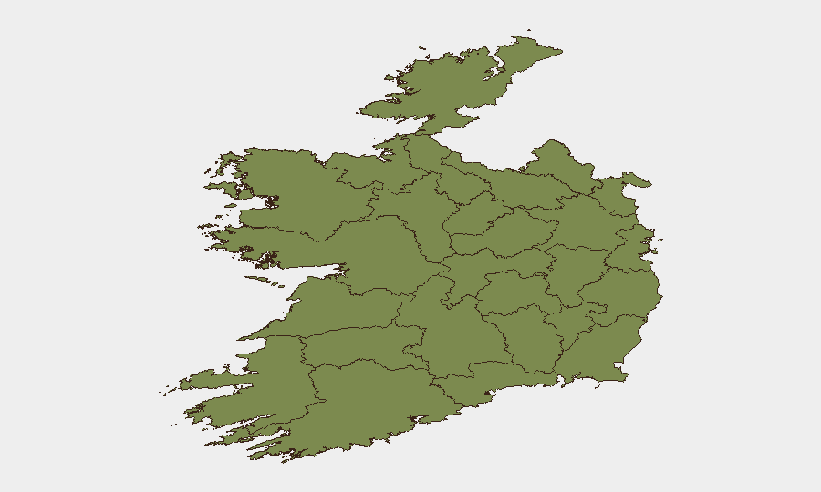
County Tipperary accounts for approximately 80% of Ireland's tracked security event volume, with a composite risk score of 31.5—significantly above all other regions. County Dublin follows distantly (16.8), while all remaining counties score below 5. This concentration suggests ongoing localized tensions or activity in Tipperary, whereas Dublin's secondary risk reflects its status as the capital and demographic hub. The remaining nine counties in the ranking pose minimal incremental risk; operations and personnel in Cork, Galway, and other major centers face threat levels comparable to or lower than the national baseline. Teams with operations or staff in Tipperary should maintain elevated situational awareness and ensure duty-of-care protocols are calibrated to that elevated sub-national context.
How GeoBit Would Assist
For Ireland-focused security monitoring, teams should deploy AOI Monitoring & Early Warning on Tipperary and Dublin postcodes/districts with configured alerting on Garda press releases, transport disruptions, and local news feeds. Intel Sweep and multi-language OSINT fusion capabilities enable continuous scraping of Irish news, social-media accounts of emergency services, and Telegram channels to detect emerging protest activity, crime spikes, or infrastructure incidents. Network & Actor Analysis and entity extraction help teams correlate event signals with known stakeholder statements (government, civil-society, religious organizations) to distinguish coordinated movements from isolated incidents and assess escalation risk.
7-Day Outlook
No indicators suggest imminent large-scale civil unrest, industrial action, or infrastructure disruption in Ireland over the next seven days. Sub-national risk in Tipperary and Dublin should be monitored continuously; any material change in event frequency, violence indicators, or public-authority statements will trigger re-assessment. Routine corporate security protocols remain appropriate for all regions; enhanced vigilance in Tipperary and Dublin is warranted until risk scores decline.
Highest-Risk Areas — Ranked
| # | State / Region | Risk |
|---|---|---|
| 1 | County Tipperary | 31.5 |
| 2 | County Dublin | 16.8 |
| 3 | County Kilkenny | 4.1 |
| 4 | County Cork | 2.8 |
| 5 | County Clare | 2.5 |
| 6 | County Donegal | 1.9 |
| 7 | County Laois | 1.9 |
| 8 | County Louth | 1.9 |
| 9 | County Meath | 1.9 |
| 10 | County Mayo | 1.5 |
| 11 | County Sligo | 1.5 |
| 12 | County Galway | 1.5 |
Sources
Previous Daily Briefs
A new Ireland brief is written every day — each with its own risk map and downloadable CSV. Here's the last week; use the calendar to go further back.
📅 Browse every day by calendar →
Highlighted days have a brief. Tap a day for that day's map & analysis, or “csv” for that day's dataset ($5).
Atlas — our AI intelligence desk — emails them this snapshot personally. Nothing else, no list.