Situation Summary
Mali remains ranked #10 globally for composite security threat, with a score of 100 and 33 tracked events. No independently verified incident-level security events were confirmed in Mali during the last 24–48 hours ending 25 June 2026, though several unconfirmed signals—including reports of aerial weapons activity near Bamako—remain under corroboration. The security environment remains volatile across northern and central regions, with persistent force-posture changes and external military engagement reported but not yet crystallized into discrete tactical incidents.
Key Developments
- Bamako (unconfirmed) — 23 June 2026 — Unconfirmed signals of aerial weapons activity reported near the capital; not independently verified as of 25 June and does not yet establish ground truth on nature, actor, or outcome.
- Kayes/Diéma region — 22 June 2026 — GeoBit reports a planned Russian Africa Corps re-equipment and security deployment, including a drone signal-jamming station at military camps; characterized as force-posture and infrastructure development rather than a tactical incident.
- Mali (countrywide) — 23–25 June 2026 — No independently verified armed clashes, attacks, arrests, or infrastructure damage confirmed in the prior 48-hour window across the country.
- Northern Mali (Timbuktu, Ménaka, Gao, Kidal, Taoudénit) — 23–25 June 2026 — No independently confirmed attacks or insurgent-military clashes reported during the review period, despite historically high activity in these zones.
- Central Mali (Mopti) — 23–25 June 2026 — No independently confirmed security incidents reported in this traditionally volatile region during the last two days.
Highest-Risk Areas
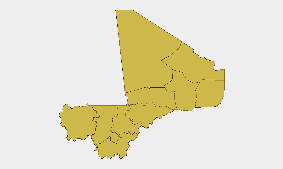
Bamako dominates the sub-national risk profile (score 100), driven by its status as the national capital and concentration of government, economic, and diplomatic assets; unconfirmed signals of aerial activity in this zone underscore its continued volatility. A secondary tier of nine regions—including Timbuktu, Ménaka, Kayes, Kidal, Gao, and Taoudénit—all carry composite scores of 70.3–70, reflecting persistent insurgent presence, cross-border trafficking, and limited state control. The clustering of high-risk zones across Mali's north and center indicates that threat is geographically dispersed rather than localized; organizations with personnel or assets in Bamako face acute risk, while those in northern zones face structural instability and limited emergency services capacity.
How GeoBit Would Assist
Security teams managing personnel or assets in Mali should deploy AOI Monitoring & Early Warning on Bamako, Timbuktu, and Ménaka to generate persistent alerts on emerging threats before they escalate. Intel Sweep and OSINT fusion capabilities (including X/Twitter, Telegram, and multi-language sources) enable real-time corroboration of unconfirmed signals—such as the current aerial-activity reports—to establish ground truth and inform duty-of-care decisions. Alternative route and journey planning via Routing & Network Analysis allows security teams to re-plan travel and supply logistics around confirmed incident zones without reliance on official (often unreliable) advisories.
7-Day Outlook
The absence of verified incidents in the last 48 hours does not signal de-escalation; rather, it reflects a reporting lag typical in remote, conflict-affected zones. Unconfirmed signals and force-posture changes (Russian re-equipment, drone jamming) suggest underlying tension that may materialize into public incidents within 7 days. Organizations should maintain heightened vigilance in Bamako and the northern corridor and continue passive monitoring for incident corroboration before committing to operational changes.
Highest-Risk Areas — Ranked
| # | State / Region | Risk |
|---|---|---|
| 1 | Bamako | 100 |
| 2 | Timbuktu | 70.3 |
| 3 | Ménaka | 70 |
| 4 | Kayes | 70 |
| 5 | Taoudénit Region | 70 |
| 6 | Kidal | 70 |
| 7 | Gao | 70 |
| 8 | Koulikoro | 70 |
| 9 | Ségou Region | 70 |
| 10 | Sikasso Region | 70 |
| 11 | Mopti | 70 |
Previous Daily Briefs
A new Mali brief is written every day — each with its own risk map and downloadable CSV. Here's the last week; use the calendar to go further back.
📅 Browse every day by calendar →
Highlighted days have a brief. Tap a day for that day's map & analysis, or “csv” for that day's dataset ($5).