Situation Summary
Mauritius remains a stable, low-threat jurisdiction with no verifiable security incidents reported in the last 24–48 hours (as of 4 August 2026). The composite national threat score is 4, reflecting routine background risks typical of a developed island economy: petty crime in tourist areas and occasional public demonstrations, but no event-driven disruptions or civil unrest currently active. Sub-national risk is concentrated in Port Louis and surrounding western/central districts, where underlying judicial and law-enforcement activity creates elevated but non-acute tension. The security environment is assessed as steady with no trajectory change indicated in current open-source reporting.
Key Developments
No verifiable, cross-confirmed security, civil-unrest, crime, political-instability, infrastructure, or travel-risk incidents were identified in Mauritius during the 24–48 hours preceding this brief (2–4 August 2026). Live web research, social-media monitoring, and multi-language OSINT did not surface dated event reports, incident confirmations, or situational alerts for this window. Standing travel advisories remain in effect regarding entry restrictions for nationals from DR Congo, Uganda, and Sudan (Ebola-related health controls), but these represent continuing policy rather than newly reported changes. Petty crime (pickpocketing, bag-snatching) and occasional armed robberies targeting tourists remain documented background risks in Port Louis, Grand Baie, and Flic en Flac, consistent with historical patterns; no current incident surge is reported.
Highest-Risk Areas
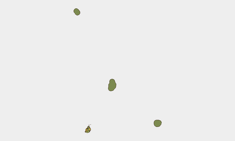
Port Louis dominates sub-national risk (score 92), driven by concentration of commercial activity, transient populations, petty crime, and proximity to judicial/law-enforcement facilities where underlying tension has been flagged in earlier July reporting. Plaines Wilhems (68), Black River (65), and Flacq (62) follow at moderate risk levels, reflecting secondary urban centers and transport corridors where crime and isolated demonstrations remain possible but infrequent. Outer districts (Rodrigues, Saint Brandon, Agaléga) carry minimal risk (<25 score), consistent with low population density and geographic isolation. Corporate teams and duty-of-care managers should prioritize awareness and access controls in Port Louis and Plaines Wilhems; routine precautions (situational awareness, travel planning, emergency contact networks) suffice for lower-risk districts and tourist zones outside active crime clusters.
How GeoBit Would Assist
Security teams should employ AOI Monitoring & Early Warning to track Port Louis and Plaines Wilhems for shifts in law-enforcement activity, public assembly, or media reporting that might signal escalation of underlying tensions. OSINT fusion & corroboration (X/Twitter, Telegram, multi-language web search, event-feed aggregation) provides real-time detection of dated incidents, protest announcements, or crime spikes, enabling faster response to any departure from current stability. Routing & Network Analysis supports duty-of-care travel planning for personnel in Port Louis, offering alternative route options and secure transit corridors if specific areas become unstable. Periodic Risk & Threat Assessment updates (weekly or on-demand) maintain awareness of background crime trends and political signals without operational overhead.
7-Day Outlook
No indicators suggest imminent escalation in Mauritius over the next 7 days. The security environment is expected to remain stable with routine petty crime and no organized disruptions. Continued monitoring of Port Louis and judicial/law-enforcement developments is prudent; corporate teams should maintain standard duty-of-care protocols (emergency contacts, travel advisories to staff, incident-reporting channels) without heightened alert posture.
Highest-Risk Areas — Ranked
| # | State / Region | Risk |
|---|---|---|
| 1 | Port Louis | 92 |
| 2 | Plaines Wilhems | 68 |
| 3 | Black River | 65 |
| 4 | Flacq | 62 |
| 5 | Grand Port | 58 |
| 6 | Moka | 52 |
| 7 | Savanne | 48 |
| 8 | Pamplemousses | 45 |
| 9 | Rivière du Rempart District | 38 |
| 10 | Rodrigues | 22 |
| 11 | Saint Brandon | 8 |
| 12 | Agaléga | 5 |
Sources
Previous Daily Briefs
A new Mauritius brief is written every day — each with its own risk map and downloadable CSV. Here's the last week; use the calendar to go further back.
📅 Browse every day by calendar →
Highlighted days have a brief. Tap a day for that day's map & analysis, or “csv” for that day's dataset ($5).
Atlas — our AI intelligence desk — emails them this snapshot personally. Nothing else, no list.