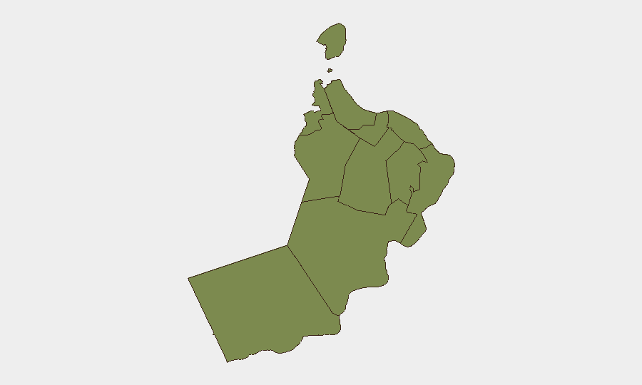
Situation Summary
Oman faces acute maritime and territorial security escalation centered on Iranian military strikes on Omani radar installations and a cluster of projectile attacks on commercial tankers in the Strait of Hormuz and Gulf approaches. Three confirmed incidents involving tanker strikes or direct fire occurred within 48 hours (July 17–19, 2026), with Iranian Revolutionary Guard Corps claiming responsibility for radar-site strikes on Omani soil. International travel warnings, aviation restrictions, and naval blockade operations now constrain movement and commerce through Omani waters and airspace, with risk concentrated in the north (Musandam) and central-east (Al Wusta) governorates.
Key Developments
- Tanker strike east of Khasab, Musandam (Friday, July 18, 2026): Commercial oil tanker struck by unknown projectile ~19 nautical miles east of Khasab; minor structural damage, crew safe; investigation ongoing by Omani authorities.
- Vessel fire northwest of Kumzar, Musandam (Sunday, July 19, 2026): Tanker hit by projectile ~8 nautical miles northwest of Kumzar, caught fire, crew abandoned and recovered safely; vessel remains adrift with fire unextinguished.
- Military incident east of Duqm, Al Wusta (Friday, July 17, 2026): UK Maritime Trade Operations reported security incident involving commercial tanker and military forces ~100 nautical miles east of Duqm; full details and damage assessment remain unclear.
- Iranian strikes on Omani radar sites (Friday, July 18, 2026): Iran's Islamic Revolutionary Guard Corps publicly claimed missile strikes on radar installations in Oman, including US air-control radar, coinciding with tanker attack east of Khasab.
- U.S. and French travel advisories updated (July 18–19, 2026): U.S. Embassy Muscat and French Foreign Ministry issued heightened warnings against non-essential travel to Musandam, Duqm, Salalah, and Yemen-border areas; U.S. government personnel now face official travel restrictions to Musandam and Duqm.
- EASA aviation advisory (July 18–19, 2026): European Union Aviation Safety Agency advised air operators to avoid Gulf airspace, including routes near Oman, through July 29, 2026, due to increased military activity and missile/drone exchanges.
- Naval blockade operations (July 18–19, 2026): U.S. Central Command naval forces redirected and disabled commercial vessels in Gulf shipping lanes near Omani waters as part of expanded Iran blockade, increasing maritime traffic disruption and security checks.
Highest-Risk Areas
Al Wusta Governorate (risk score 31.3) and Musandam Governorate (2.6) drive the national threat profile. Al Wusta's elevated risk reflects the cluster of military incidents and tanker strikes in sea corridors east of Duqm over the past 48 hours, while Musandam faces direct exposure to Strait of Hormuz maritime violence and Iranian strike claims on Omani radar installations. Muscat (10.1) carries secondary risk due to diplomatic and administrative concentration; all other governorates register minimal baseline threat. The geographic concentration of incidents in maritime and northern border zones reflects regional conflict spillover rather than widespread domestic instability.
How GeoBit Would Assist
Security teams should deploy AOI Monitoring & Early Warning on Musandam and Al Wusta sea corridors to detect maritime incidents in real time; Maritime & Aviation tracking to monitor vessel routes and airspace restrictions through EASA advisories; and OSINT fusion (X/Twitter, maritime feeds, UKMTO alerts, official travel warnings) to corroborate incident claims and Iranian statements and maintain situational awareness of blockade operations. Routing & Network Analysis enables identification of alternative maritime and air transit corridors to avoid high-risk zones.
7-Day Outlook
Iranian and regional military activity will likely persist through late July, with further tanker incidents possible in Hormuz approaches and Al Wusta sea lanes. International restrictions (aviation through July 29, maritime blockade operations) should remain in force, constraining commercial and personnel movement. Risk of accidental escalation or secondary strikes on Omani infrastructure remains elevated; monitoring for official Omani military response or coalition repositioning is warranted.
Highest-Risk Areas — Ranked
| # | State / Region | Risk |
|---|---|---|
| 1 | Al Wusta Governorate | 31.3 |
| 2 | Muscat Governorate | 10.1 |
| 3 | Dhofar Governorate | 3.3 |
| 4 | Musandam Governorate | 2.6 |
| 5 | Al Buraymi Governorate | 1.3 |
| 6 | Ad Dhahirah Governorate | 1.3 |
| 7 | Al Batinah North Governorate | 1.3 |
| 8 | Al Batinah South Governorate | 1.3 |
| 9 | Ad Dakhiliyah Governorate | 1.3 |
| 10 | Ash Sharqiyah North Governorate | 1.3 |
| 11 | Ash Sharqiyah South Governorate | 1.3 |
Sources
Previous Daily Briefs
A new Oman brief is written every day — each with its own risk map and downloadable CSV. Here's the last week; use the calendar to go further back.
📅 Browse every day by calendar →
Highlighted days have a brief. Tap a day for that day's map & analysis, or “csv” for that day's dataset ($5).
Atlas — our AI intelligence desk — emails them this snapshot personally. Nothing else, no list.