Situation Summary
Palau remains in a stable security environment with no confirmed incidents, civil unrest, infrastructure disruption, or travel-risk events recorded in the last 24–48 hours. Open-source monitoring across news, social media, and official advisories indicates routine conditions nationwide. The composite threat score of 2 and absence of tracked events reflect a low-risk operating environment, though baseline elevation in Peleliu and Angaur states warrants continued awareness for organizations with presence in those jurisdictions.
Key Developments
- Nationwide, Palau – 4–5 Aug 2026: Multi-source threat monitoring (news aggregation, social media OSINT, and regional advisories) confirms zero verified security incidents, civil unrest, crime spikes, or travel disruptions in the 24–48-hour window.
- Peleliu and Angaur states, Palau – 4–5 Aug 2026: Sub-national risk assessment notes no new incidents in these elevated-risk jurisdictions during the reporting period; baseline composite scores (92 and 88, respectively) reflect standing conditions rather than fresh events.
- Koror infrastructure, Palau – 4–5 Aug 2026: Live infrastructure scanning detects no new utility outages or disruptions (power, ports, airports, telecoms, water/sewage). Note: A sewage pipeline break occurred on 30 July (outside this reporting window) and remains monitored for repair status.
- Health and public safety, Palau – 4–5 Aug 2026: No new health emergencies, disease outbreaks, or public-order disturbances reported; the most recent health event (confirmed whooping cough case, 29 June) falls outside the current assessment window.
- Regional context, Micronesia – 4–5 Aug 2026: Broader regional monitoring confirms no armed conflict, civil unrest, or major disruptions across neighboring island jurisdictions, consistent with Palau's stable profile.
Highest-Risk Areas
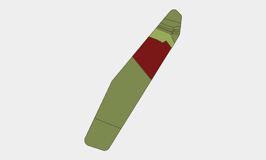
Peleliu and Angaur remain the highest-risk states (composite scores 92 and 88), though no fresh incidents drive this elevation during the 24–48-hour window. The ranking reflects baseline structural factors—historical settlement patterns, infrastructure constraints, or limited service capacity—rather than active threats. Koror (risk 45) carries moderate elevation as the capital and commercial hub, making it relevant for organizations with operational footprint. The remaining nine states present materially lower risk (scores 21–35) and do not require heightened operational focus at present.
How GeoBit Would Assist
Organizations with personnel or assets in Palau should employ AOI Monitoring & Early Warning on Peleliu, Angaur, and Koror to detect emerging civil unrest, infrastructure failure, or crime clusters in real time. Intel Sweep and OSINT fusion (X/Twitter, local news, and regional advisories) provide continuous baseline validation and alert capability if conditions shift. Risk & Threat Assessment linked to GIS & Spatial Analysis enables duty-of-care teams to map exposure by state, route personnel safely, and adjust operational posture if sub-national risk escalates.
7-Day Outlook
No indicators suggest imminent security deterioration in Palau over the next seven days. The operating environment is expected to remain stable, with routine governance, commerce, and tourism continuing. Teams should maintain standard monitoring protocols and flag any changes in baseline activity in Peleliu or Angaur, where structural risk remains elevated despite current quiet.
Highest-Risk Areas — Ranked
| # | State / Region | Risk |
|---|---|---|
| 1 | Peleliu | 92 |
| 2 | Angaur | 88 |
| 3 | Koror | 45 |
| 4 | Melekeok | 35 |
| 5 | Airai | 32 |
| 6 | Ngatpang | 28 |
| 7 | Ngeremlengui | 26 |
| 8 | Ngaraard | 25 |
| 9 | Ngardmau | 24 |
| 10 | Aimeliik | 23 |
| 11 | Ngiwal | 22 |
| 12 | Ngchesar | 21 |
Sources
Previous Daily Briefs
A new Palau brief is written every day — each with its own risk map and downloadable CSV. Here's the last week; use the calendar to go further back.
📅 Browse every day by calendar →
Highlighted days have a brief. Tap a day for that day's map & analysis, or “csv” for that day's dataset ($5).
Atlas — our AI intelligence desk — emails them this snapshot personally. Nothing else, no list.