Situation Summary
Papua New Guinea faces elevated diplomatic tension following late-July statements involving the United States, China, Taiwan, and PNG authorities—centered on unconfirmed geopolitical friction—concurrent with two significant seismic events (M 5.1 and M 4.6) in the New Britain region and an active circulating vaccine-derived poliovirus type 2 (cVDPV2) outbreak. The National Capital District (Port Moresby) remains by far the highest-risk zone, with a composite threat score of 31.3, driven by urban crime, civil unrest, and administrative instability. Bougainville's score (13.3) reflects residual post-conflict fragility and isolation. The overall threat trajectory is moderate but fragmented across diplomatic, seismic, and health domains rather than a single unified crisis.
Key Developments
- 2026-07-25 · Port Moresby / Diplomatic Escalation — Multiple public statements issued by the US, China, Taiwan, PNG government, and PNG ambassador suggest unresolved bilateral disagreements; specific triggers remain opaque in available reporting and require corroboration.
- 2026-07-27 · Papua New Guinea / Government Action — PNG government issued disapproval statement, indicating reactive institutional response to external pressure or internal policy challenge; context unclear from current sources.
- 2026-07-25 · Taiwan / Relations — Taiwan announced reduction in diplomatic relations with PNG, signaling formalization of the preceding week's diplomatic friction.
- Recent · New Britain Region / Seismic Activity — Magnitude 5.1 earthquake recorded 147 km east of Kimbe; Magnitude 4.6 recorded 120 km east of Kokopo. No casualty or infrastructure-impact reports available; aftershock risk present in both zones.
- Circulating · National / Public Health — Vaccine-derived poliovirus type 2 (cVDPV2) detected in PNG; national immunization capacity and surveillance posture require assessment given geographical isolation and healthcare infrastructure constraints.
- Pre-2026-07-27 · East New Britain / Search & Rescue — Two boats carrying 27 people reported missing off Duke of York Islands / near Namatanai (underlying incident date July 18); active SAR operations ongoing; advisory issued for police approval before inter-island travel in affected waters.
Highest-Risk Areas
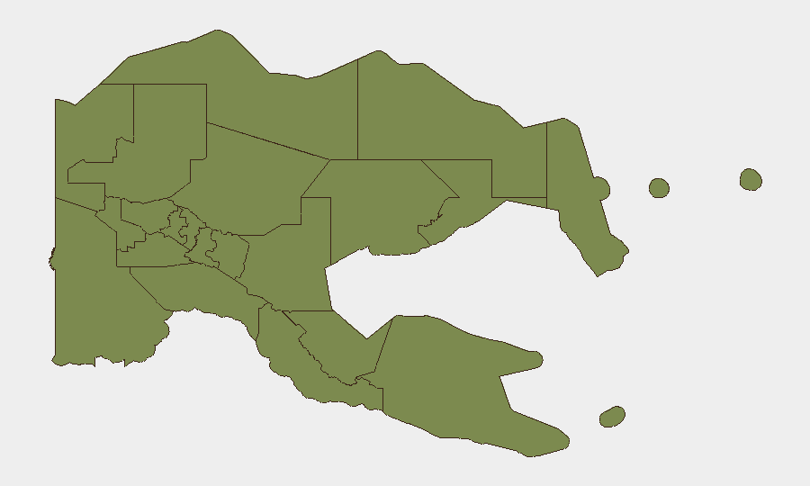
National Capital District dominates the risk landscape with a score more than double Bougainville's, reflecting Port Moresby's chronic gang violence, carjacking, home invasion, and frequent civil disorder. Bougainville's secondary risk stems from limited state capacity, residual weapons proliferation (post-2001 peace accord), and economic fragility. The remaining 10 provinces cluster at identical risk scores (1.3), indicating either genuine equivalence in threat drivers or data collection gaps in remote and maritime regions; Madang, Manus, and Morobe warrant particular attention due to maritime corridor exposure and informal settlement density.
How GeoBit Would Assist
Security teams should deploy AOI Monitoring & Early Warning on Port Moresby's high-crime zones and Bougainville administrative centers to flag escalation signals in real time. Intel Sweep and X/Twitter OSINT will clarify the current diplomatic dispute and track PNG/Taiwan/US/China rhetoric for impact on business and expat safety. Environmental & Health monitoring paired with Maritime & Aviation tracking will support supply-chain resilience during the seismic aftershock window and poliovirus response phase.
7-Day Outlook
Diplomatic temperatures will likely stabilize or formally crystallize within 48–72 hours, reducing acute political risk to corporate operations. Seismic aftershock probability remains elevated in New Britain through early August; infrastructure and supply-chain audits are warranted. Health and maritime travel advisories should remain in place pending SAR operation closure and polio surveillance updates.
Highest-Risk Areas — Ranked
| # | State / Region | Risk |
|---|---|---|
| 1 | National Capital District | 31.3 |
| 2 | Autonomous Region of Bougainville | 13.3 |
| 3 | Eastern Highlands | 1.3 |
| 4 | Gulf | 1.3 |
| 5 | Madang | 1.3 |
| 6 | Manus | 1.3 |
| 7 | West New Britain | 1.3 |
| 8 | New Ireland | 1.3 |
| 9 | East New Britain | 1.3 |
| 10 | Morobe | 1.3 |
| 11 | Central | 1.3 |
| 12 | Oro | 1.3 |
Sources
Previous Daily Briefs
A new Papua New Guinea brief is written every day — each with its own risk map and downloadable CSV. Here's the last week; use the calendar to go further back.
📅 Browse every day by calendar →
Highlighted days have a brief. Tap a day for that day's map & analysis, or “csv” for that day's dataset ($5).
Atlas — our AI intelligence desk — emails them this snapshot personally. Nothing else, no list.