Situation Summary
Peru remains a composite-threat environment with moderate baseline security challenges, currently ranked #57 globally. Risk is concentrated in five northern and central regions—chiefly La Libertad, Loreto, Ancash, and Junín—where trafficking, organized crime, and resource-conflict activity persist under existing states of emergency. The past 24–48 hours have seen routine seismic activity, localized violent crime against transport operators in Lima, and no large-scale civil unrest or terror incidents; however, a spike in extortion-linked bus attacks is prompting potential nationwide transport disruption around Fiestas Patrias.
Key Developments
- Lima Norte bus attacks (22 July 2026). Three separate attacks on interprovincial buses occurred within 24 hours in Lima Norte, including a shooting near Avenida Izaguirre/Universitaria that wounded a woman. Local police attribute the incidents to extortion rings targeting transport operators.
- Zarumilla homicide (c. 22 July). Miguel Enrique Villamisar Mantilla was fatally shot in the Zarumilla zone while preparing to board his motorcycle, under investigation by Depincri (criminal investigation police) as part of broader northern Lima violent-crime patterns.
- Transport sector disruption warning (22 July). Following the cluster of three attacks in 24 hours, interprovincial bus companies announced evaluation of a potential nationwide suspension of services, affecting 450–470 buses and creating short-term overland travel risk around Fiestas Patrias.
- Extortion-attack surge in Lima–Callao (current). The Observatorio de Criminalidad reported 107 transport-sector attacks in Lima Metropolitana and Callao year-to-date—matching the entire 2025 total—with a documented spike in the past 24–48 hours.
- Seismic activity, Samanco and multi-region (22 July). A magnitude 4.5 earthquake struck near Samanco, Áncash; multiple low-to-moderate temblores were recorded across Lima, Junín, Arequipa, and Moquegua with no reported major damage or casualties.
- No new political/security decrees (last 48 hours). Existing states of emergency in Lima–Callao and Trujillo–Virú (La Libertad) remain in effect; no new emergency declarations or rescissions have been issued.
Highest-Risk Areas
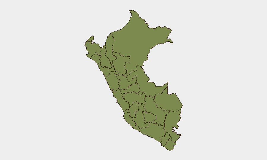
La Libertad (risk 31.4) and Loreto (18.0) drive Peru's sub-national threat profile, followed by Ancash (16.7) and Junín (14.2). These regions remain under states of emergency and experience recurring activity linked to coca cultivation, trafficking routes, armed-group presence, and resource conflicts. Lima's risk score (6.5) reflects dense urban crime and organized extortion against commerce and transport, which has intensified in the past 48 hours. Peripheral northern and southern regions (Tumbes, Piura, Lambayeque, Amazonas) carry minimal current risk signals.
How GeoBit Would Assist
Security teams managing personnel or assets in Peru should leverage GeoBit's AOI Monitoring & Early Warning capability to establish persistent watch on high-risk corridors (Lima–Callao transport routes, La Libertad/Trujillo region) with real-time alerting on armed activity, trafficking choke-points, and security-force operations. Intel Sweep and multi-language OSINT fusion provide consolidated feeds from Peruvian media, local law enforcement reports, and regional intelligence to flag emerging extortion networks or cartel coordination before tactical escalation. Routing & Network Analysis enables secure alternative-journey planning when transport disruptions are announced, while GIS & Spatial Analysis maps crime clusters and seismic risk in relation to office/asset locations.
7-Day Outlook
Transport-sector violence is likely to sustain or intensify around Fiestas Patrias (28–29 July) if bus operators proceed with suspensions, creating supply-chain and mobility friction. Seismic activity in Ancash and surrounding regions is routine; no major destructive events are forecast. Expect continued baseline organized-crime and extortion pressure in Lima and the five northern/central high-risk regions, with no imminent large-scale unrest or political crisis signaled.
Highest-Risk Areas — Ranked
| # | State / Region | Risk |
|---|---|---|
| 1 | La Libertad | 31.4 |
| 2 | Loreto | 18 |
| 3 | Ancash | 16.7 |
| 4 | Junín | 14.2 |
| 5 | Lima | 6.5 |
| 6 | Ayacucho | 6.5 |
| 7 | Ica | 5.2 |
| 8 | Pasco | 2.7 |
| 9 | Tumbes | 1.4 |
| 10 | Piura | 1.4 |
| 11 | Lambayeque | 1.4 |
| 12 | Amazonas | 1.4 |
Previous Daily Briefs
A new Peru brief is written every day — each with its own risk map and downloadable CSV. Here's the last week; use the calendar to go further back.
📅 Browse every day by calendar →
Highlighted days have a brief. Tap a day for that day's map & analysis, or “csv” for that day's dataset ($5).
Atlas — our AI intelligence desk — emails them this snapshot personally. Nothing else, no list.