Situation Summary
Vietnam remains a lower-tier global security concern (rank #126, composite score 6.0) with a highly concentrated risk profile dominated by Hà Nội, which accounts for the overwhelming majority of tracked threat events. Current activity reflects routine infrastructure development, crime enforcement, and wildfire response with no indicators of imminent systemic instability. The sub-national risk concentration and recent event signals involving military and political actors warrant sustained monitoring, particularly around the capital.
Key Developments
- Coastal forest fires, Nghe An and Quang Tri Provinces (2026-08-01 to 2026-08-02): Hundreds of personnel contained a forest fire in Nghe An; ongoing overnight firefighting continues in Quang Tri's coastal zones. Risk to air quality, rural transport corridors, and evacuation logistics in north-central provinces.
- Lien Khuong Airport upgrade acceleration, Lam Dong Province (2026-08-02, current): Workers accelerating construction to meet August reopening target. Medium-term airport access and flight operations disruptions expected.
- Electrical equipment thefts, Tuyen Lam National Tourist Area, Da Lat (2026-08-02, current): Six suspects arrested for theft at major tourist infrastructure site. Signals ongoing supply-chain vulnerability at high-profile locations.
- Foreign worker enforcement sweep, Dong Nai Province (2026-08-02, current): Authorities issued employer warnings following discovery of dozens of immigration and residency violations among foreign nationals in manufacturing and construction sectors. Indicates tightening administrative enforcement that may affect corporate staffing compliance.
- Violent assault on gig-economy worker, Ho Chi Minh City (2026-08-02, current): Delivery worker attacked and injured in dispute. Reflects elevated localized urban crime risk in HCMC affecting supply-chain and service personnel.
- Cyberscam network arrests, nationwide (August 2026, current month): Vietnamese police arrested 300+ nationals repatriated from Cambodia following dismantling of transnational internet fraud ring. Indicates active organized cybercrime targeting Vietnamese and regional networks.
- Hanoi infrastructure groundbreaking (2026-08-02, current): Five metro lines and three rental housing projects broke ground. Major medium-term construction disruption expected across multiple Hanoi zones affecting commute profiles and asset access.
Highest-Risk Areas
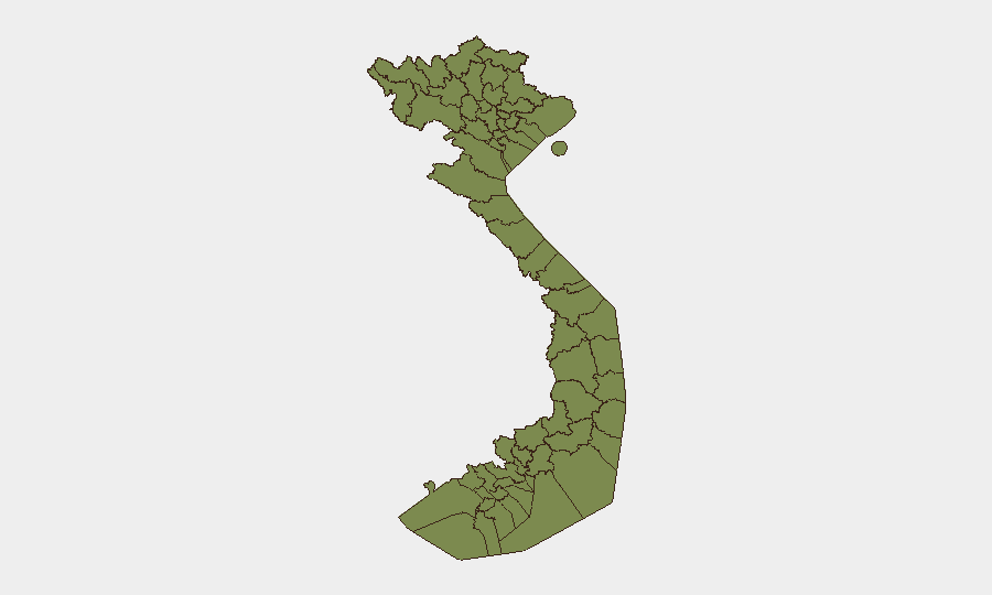
Hà Nội dominates the risk landscape with a composite score of 31.8—roughly 14 times higher than Ho Chi Minh City (2.2). The capital's elevated profile reflects recent event signals involving military and political actors (2026-08-01), public statements, and large-scale infrastructure works now commencing. Northern border provinces (Lào Cai, Hà Giang, Cao Bằng, Điện Biên, and others along the China frontier) all register identical risk scores of 1.8, consistent with historical cross-border sensitivities and limited baseline security reporting. Ho Chi Minh City, despite its size and economic importance, shows significantly lower tracked risk, though recent violent crime and gig-economy vulnerability warrant field-level attention.
How GeoBit Would Assist
Security teams should deploy AOI Monitoring & Early Warning on Hà Nội (persistent watch for further military, political, or public-order signals) and northern border provinces (real-time alerting on cross-border activity or maritime incidents). Intel Sweep, OSINT fusion, and multi-language social/web search enable continuous tracking of emerging labor, crime, and infrastructure disruptions affecting corporate operations in Ho Chi Minh City, Lam Dong, and Dong Nai. Routing & Network Analysis supports alternative commute and supply-chain planning around active Hanoi metro construction zones.
7-Day Outlook
Near-term trajectory remains stable with no indicators of acute destabilization. Wildfire response and infrastructure construction will create localized operational friction; enforcement actions suggest sustained government administrative activity. Sustained monitoring of Hà Nội event signals and northern border zones is warranted as precaution.
Highest-Risk Areas — Ranked
| # | State / Region | Risk |
|---|---|---|
| 1 | Hà Nội | 31.8 |
| 2 | Ho Chi Minh City | 2.2 |
| 3 | Lai Châu Province | 1.8 |
| 4 | Lào Cai Province | 1.8 |
| 5 | Hà Giang Province | 1.8 |
| 6 | Tuyên Quang Province | 1.8 |
| 7 | Cao Bằng Province | 1.8 |
| 8 | Bắc Kạn Province | 1.8 |
| 9 | Điện Biên Province | 1.8 |
| 10 | Yên Bái Province | 1.8 |
| 11 | Sơn La Province | 1.8 |
| 12 | Thái Nguyên Province | 1.8 |
Sources
Previous Daily Briefs
A new Vietnam brief is written every day — each with its own risk map and downloadable CSV. Here's the last week; use the calendar to go further back.
📅 Browse every day by calendar →
Highlighted days have a brief. Tap a day for that day's map & analysis, or “csv” for that day's dataset ($5).
Atlas — our AI intelligence desk — emails them this snapshot personally. Nothing else, no list.