Situation Summary
Bahrain remains under elevated regional threat from Iranian military activity and drone/missile strikes that have persisted since June–July 2026, with air defenses active and periodic airspace disruptions reported. No discrete security incidents, civil unrest, or infrastructure failures have been verified in the last 24–48 hours. The U.S. Embassy maintains a complex-environment travel advisory (Aug. 1) citing flight cancellations and airspace closures as ongoing risks. Overall threat posture is stable but contingent on regional escalation patterns.
Key Developments
- No verified new security incidents in Bahrain for Aug. 4–6, 2026. Live research returned no discrete crime, civil unrest, terrorism, or infrastructure events within the last 24–48 hours; available reporting reflects older July developments or general advisory messaging.
- U.S. Embassy Travel Advisory, Aug. 1 — Manama / Bahrain-wide: Advisory warns of complex regional security environment with potential for flight cancellations, airspace closures, and travel disruption; serves as standing notice of regional volatility rather than indicator of imminent domestic incident.
- Regional Iranian Activity (June–July context) — While not a current 24-hour event, Bahrain's air defenses conducted interception operations against Iranian aerial threats in July; context for persistent elevated alert status but not a fresh development.
Highest-Risk Areas
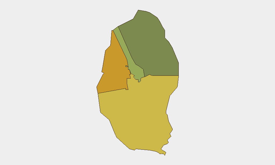
Northern Governorate (risk score 72) and Southern Governorate (risk score 68) are the primary drivers of Bahrain's sub-national risk profile, suggesting geographic concentration in periphery regions away from Manama. Capital Governorate (45), home to government, financial, and diplomatic assets, carries moderate risk. This distribution may reflect underlying sectarian geography, proximity to land borders, or historical patterns of civil unrest; concentrations in north and south imply that central commercial and administrative zones (Muharraq, Manama) face comparatively lower indexed risk, though they remain operational hubs for multinational firms and expat populations.
How GeoBit Would Assist
Security teams with personnel or assets in Bahrain should deploy AOI Monitoring & Early Warning on the Northern and Southern Governorates to detect civil unrest, infrastructure disruption, or security incidents in real time. Multi-language OSINT (X/Twitter, Telegram, local media feeds) and sentiment & temporal analysis provide early signals of emerging tensions or operational security concerns before mainstream reporting. Conflict & Military tracking and aviation/airspace monitoring enable duty-of-care teams to anticipate flight cancellations and alternative routing in response to regional missile or drone activity.
7-Day Outlook
Bahrain's security posture is expected to remain stable over the next 7 days absent new Iranian strikes or regional escalation. Periodic airspace closures and flight disruptions may continue as a regional phenomenon; travel and logistics planning should maintain buffer margins. Monitor for any shift in U.S. Embassy messaging or Iranian military signaling that could trigger rapid changes in air traffic and cross-border movement.
Highest-Risk Areas — Ranked
| # | State / Region | Risk |
|---|---|---|
| 1 | Northern Governorate | 72 |
| 2 | Southern Governorate | 68 |
| 3 | Capital Governorate | 45 |
| 4 | Muharraq Governorate | 38 |
Sources
Previous Daily Briefs
A new Bahrain brief is written every day — each with its own risk map and downloadable CSV. Here's the last week; use the calendar to go further back.
📅 Browse every day by calendar →
Highlighted days have a brief. Tap a day for that day's map & analysis, or “csv” for that day's dataset ($5).
Atlas — our AI intelligence desk — emails them this snapshot personally. Nothing else, no list.