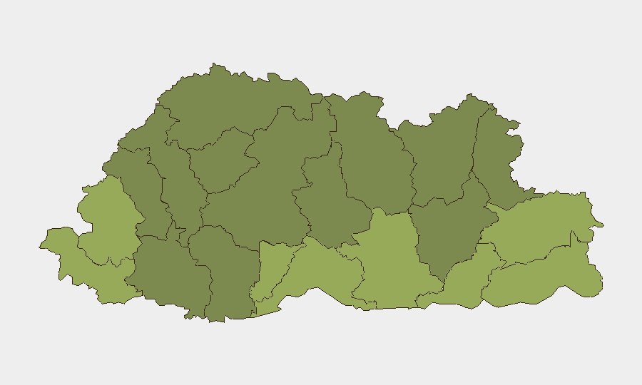
Situation Summary
Bhutan remains a low-threat environment with no confirmed security incidents in the past 24–48 hours. The national composite threat score of 3 (rank #179 globally) reflects a stable baseline characterized by minimal crime, terrorism, or civil unrest. Southern border districts—Samtse, Sarpang, Haa, and Pemagatshel—carry elevated relative risk scores (50–58) but have not generated discrete event reports in the current reporting window. The overall security posture supports routine business and travel operations across the country.
Key Developments
- Bhutan (national) — 17–18 Aug 2026 — No confirmed security, crime, civil unrest, terrorism, or infrastructure incidents reported in the last 24–48 hours.
- Bhutan (national) — 13–14 Aug 2026 — Continued absence of discrete security events; baseline threat posture unchanged.
- Bhutan (national) — 8–15 Aug 2026 — Travel advisory remained at Level 1 (exercise normal precautions); no escalation triggers identified in available reporting.
- Southern border districts (Samtse, Sarpang, Haa, Pemagatshel) — mid-Aug 2026 — These areas retained higher composite risk scores but produced no new incident corroboration in the last 48 hours; relative elevation reflects structural/geographic factors rather than active event dynamics.
- Bhutan (national) — 17–18 Aug 2026 — No social-media or news corroboration of unfolding incidents; no cross-platform escalation signals detected.
Highest-Risk Areas
Samtse, Sarpang, Haa, and Pemagatshel districts constitute the country's highest-risk geography, with composite scores ranging from 50 to 58. These southern border regions face elevated exposure to cross-border dynamics, informal trade flows, and limited state infrastructure relative to central valleys. However, this relative elevation does not translate to active conflict, organized crime, or unrest in the current window. Organizations with personnel or assets in these districts should maintain standard due-diligence protocols; no emergency measures are warranted based on present reporting.
How GeoBit Would Assist
Organizations with ongoing operations in Bhutan or repeated travel to border districts (particularly Samtse and Sarpang) should deploy AOI Monitoring & Early Warning on those districts to capture any emerging incident signals before they escalate. Intel Sweep and OSINT fusion (X/Twitter, Telegram, local-language news) will provide 24–48 hour corroboration of any new events, enabling rapid duty-of-care response. Routing & Network Analysis can identify alternative transport corridors in southern districts should infrastructure disruption occur, supporting business continuity and personnel safety planning.
7-Day Outlook
Bhutan's security environment is forecast to remain stable and low-threat over the next seven days. No indicators point to imminent escalation in crime, civil unrest, or cross-border incident activity. Standard precautions (local liaison, situational awareness in border areas, compliance with Bhutanese regulations) remain sufficient for corporate operations and travel.
Highest-Risk Areas — Ranked
| # | State / Region | Risk |
|---|---|---|
| 1 | Samtse District | 58 |
| 2 | Sarpang District | 55 |
| 3 | Haa District | 52 |
| 4 | Pemagatshel District | 50 |
| 5 | Samdrup Jongkhar District | 48 |
| 6 | Tsirang District | 45 |
| 7 | Zhemgang District | 42 |
| 8 | Trashigang District | 40 |
| 9 | Mongar District | 38 |
| 10 | Gasa District | 35 |
| 11 | Lhuntse District | 32 |
| 12 | Wangdue Phodrang District | 30 |
Sources
Previous Daily Briefs
A new Bhutan brief is written every day — each with its own risk map and downloadable CSV. Here's the last week; use the calendar to go further back.
- August 16, 2026
- August 14, 2026
- August 12, 2026
- August 10, 2026
- August 8, 2026
- August 6, 2026
- August 5, 2026
📅 Browse every day by calendar →
Highlighted days have a brief. Tap a day for that day's map & analysis, or “csv” for that day's dataset ($5).
Atlas — our AI intelligence desk — emails them this snapshot personally. Nothing else, no list.