Situation Summary
Brazil remains at composite threat level #45 globally, with 727 tracked events and a composite score of 40. The security environment is characterized by persistent urban violence concentrated in São Paulo and Rio de Janeiro, active law-enforcement operations against organized crime and trafficking networks, and infrastructure vulnerabilities affecting cargo and passenger movement. Current trajectory shows sustained operational tempo by federal and state police, with recent coordinated arrests exceeding 18,000 individuals, though tactical confrontations and gang-driven disruptions continue to pose acute risks to movement and facility operations.
Key Developments
- Rio de Janeiro (Avenida Brasil, Zona Norte) – 30 July 2026: A high-speed police pursuit ended in armed confrontation, resulting in 5 deaths (including 1 officer) and 4 injured. Major arterial road disrupted with traffic diversions; incident underscores rapid escalation potential on primary commute corridors.
- Goiás (BR-153 near Goiânia) – late July, reported 30 July 2026: Federal highway police (PRF) intercepted postal service truck during cargo inspection; one individual arrested hidden in cargo box. Incident reflects ongoing cargo-theft activity targeting interstate freight logistics in Goiás corridor.
- Brazil (nationwide) – operations concluded late July, reported 30 July 2026: Coordinated security operations arrested 18,855 individuals across 17,175 deployed agents. Scale suggests sustained federal-state coordination against organized-crime networks and resource-gap remediation in police capacity.
- Rio de Janeiro (Zona Norte, multiple favela complexes) – ongoing through 30 July 2026: Recurring armed clashes between police and criminal factions reported in Complexo da Penha, Complexo da Maré, and along arterials (Linha Vermelha, Linha Amarela). Risk of sudden road closures and stray-fire exposure for transiting personnel remains elevated.
- Brasília satellite cities (Ceilândia, Santa Maria, São Sebastião, Paranoá) – reaffirmed July 2026: U.S. government travel restrictions between 18:00–06:00 in effect; areas classified as "Do Not Travel" at night. Night-time movement restrictions affect business continuity and personnel logistics.
Highest-Risk Areas
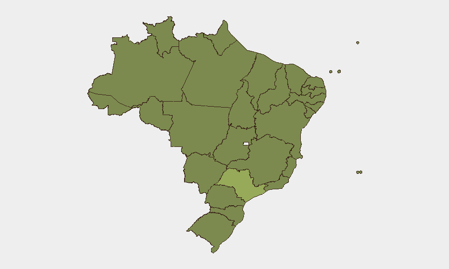
São Paulo dominates sub-national risk (54.3), driven by scale of organized-crime presence, gang territorial disputes, and express-kidnapping/carjacking incidents. Rio de Janeiro (28.5) follows, with acute violence concentrated in favela complexes and major arterials, compounded by police-faction confrontations creating unpredictable disruption. Northern and northeastern states (Pará, Amazonas, Pernambuco, Bahia) cluster around 24–25 risk scores, primarily reflecting drug-trafficking corridor activity and gang presence. Paraná, Rio Grande do Sul, and Minas Gerais (26–26.4) show moderate elevation linked to interstate cargo theft and trafficking networks.
How GeoBit Would Assist
Security teams would deploy AOI Monitoring & Early Warning on high-risk corridors (Avenida Brasil, BR-153, Linha Vermelha) to detect police operations, gang activity, and traffic disruptions in real time. Routing & Network Analysis tools enable alternative-route and journey-planning assessment to avoid active conflict zones and timing restrictions. Entity & Network Analysis paired with OSINT fusion (X/Twitter, Telegram, local news feeds) provide continuous tactical intelligence on criminal-faction movements, police operations, and infrastructure vulnerabilities affecting logistics and personnel mobility.
7-Day Outlook
Coordinated federal-state operations are likely to continue at current intensity, with arrests and enforcement actions sustaining disruption risk in São Paulo and Rio. Gang-driven violence and police confrontations in Rio's Zona Norte and favela complexes will remain episodic but frequent; personnel and asset movements should anticipate sudden road closures and heightened threat windows. No significant de-escalation is expected in the near term; risk profile remains stable but operationally volatile.
Highest-Risk Areas — Ranked
| # | State / Region | Risk |
|---|---|---|
| 1 | São Paulo | 54.3 |
| 2 | Rio de Janeiro | 28.5 |
| 3 | Paraná | 26.4 |
| 4 | Rio Grande do Sul | 26.4 |
| 5 | Minas Gerais | 26.2 |
| 6 | Pernambuco | 25.6 |
| 7 | Goiás | 25.3 |
| 8 | Mato Grosso | 24.8 |
| 9 | Paraíba | 24.8 |
| 10 | Bahia | 24.8 |
| 11 | Amazonas | 24.5 |
| 12 | Pará | 24.5 |
Sources
Previous Daily Briefs
A new Brazil brief is written every day — each with its own risk map and downloadable CSV. Here's the last week; use the calendar to go further back.
📅 Browse every day by calendar →
Highlighted days have a brief. Tap a day for that day's map & analysis, or “csv” for that day's dataset ($5).
Atlas — our AI intelligence desk — emails them this snapshot personally. Nothing else, no list.