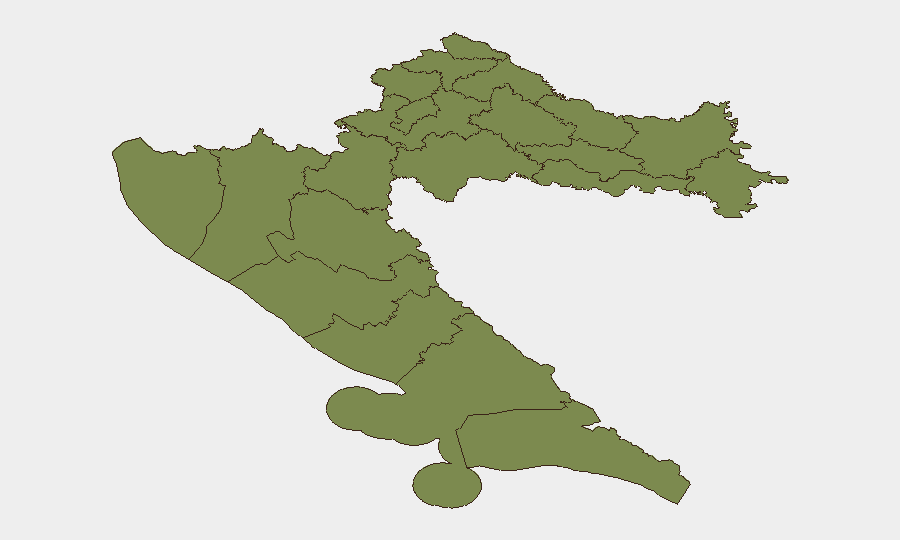
Situation Summary
Croatia remains a low-threat environment globally (composite score 28), with security incidents concentrated in coastal and border regions rather than affecting the national baseline. The past 24–48 hours have seen isolated incidents—a fatal aircraft accident in Istria, an armed suspect manhunt spanning Croatia and Slovenia, infrastructure collapse at a derelict military site, and routine law-enforcement arrests—with no indicators of systemic instability or widening civil unrest. Šibenik-Knin County carries elevated sub-national risk (31.3), while Zagreb and Vukovar-Srijem register moderate concern; most other regions remain low-risk. The security posture remains stable absent fresh escalation signals.
Key Developments
- Medulin, Istria (2026-07-29/30): Small aircraft crashed near Pula with four confirmed fatalities; classed as accident, not conflict-related. Local emergency response ongoing; temporary airspace and road constraints possible near crash site.
- Pula and Črnomelj cross-border incident (2026-07-29/30): 41-year-old Croatian national (Srđan Aleksić) shot a 60-year-old man in Pula on Thursday, then robbed a petrol station near Črnomelj (Slovenia) on Friday. Suspect found dead in Uršna sela (Slovenia) after >24-hour manhunt. Heightened police presence in Pula and wider Istria during operation.
- Štinjan, Pula (2026-07-30, ~14:00 local): Roof of abandoned military bunker collapsed, injuring six foreign youths. Localized infrastructure hazard; underscores risks of unauthorized entry to derelict coastal military structures.
- Vis Island wildfire (2026-07-28/29): Major forest fire broke out late Sunday evening, triggering large-scale firefighting operation through the night. Potential temporary road closures and smoke hazards for travelers in wooded areas.
- Zadar drug and firearms arrest (2026-07-29/30): Croatian national (45) arrested after multi-day police investigation. Seized: 58 g cocaine, 462 g marijuana, 146 g psilocybin mushrooms, MDMA, LSD, and illegal pistol with ammunition. No wider public-order disruption reported.
- Dramalj, Primorje-Gorski Kotar (2026-07-29/30): German national (36) arrested on three European warrants for aggravated theft and false statements. Routine cross-border law-enforcement action; no broader unrest indicated.
- Istria County accidents and fire (2026-07-28/29): Multiple road accidents during extended weekend period, including one fatality; separate fire incident noted. Routine traffic and emergency incidents in coastal tourist region.
Highest-Risk Areas
Šibenik-Knin County dominates the sub-national risk profile (31.3), driven by the 7-event cluster flagged in the platform's threat tracking; the specific nature of these events (uprising demand signals, military force events, arrests, prison investigation) suggests localized law-enforcement activity or civil tensions warranting closer monitoring. Zagreb and Vukovar-Srijem County (both 6.3) reflect capital-city and border-region baseline vulnerabilities typical of administrative hubs and historically sensitive areas. All remaining counties score 1.3–2.5, indicating low residual risk; the coastal tourist zones (Istria, Dubrovnik-Neretva) experience routine accidents and crime but no systemic threat elevation.
How GeoBit Would Assist
Security teams should employ AOI Monitoring & Early Warning to track Šibenik-Knin County, Pula/Istria, and Zadar in real time, with alerting thresholds for law-enforcement operations, public statements, and civil unrest signals. OSINT fusion (X/Telegram, multi-language feeds, sentiment analysis) would disambiguate event severity and cross-border implications, particularly for incidents spanning Croatia and Slovenia. Risk & Threat Assessment capabilities should reassess sub-national rankings weekly, especially if Šibenik-Knin event density escalates.
7-Day Outlook
No escalation trajectory is evident. Incident rates remain within normal seasonal parameters for a mid-summer coastal tourism and enforcement cycle. Monitoring should focus on whether Šibenik-Knin event clustering reflects isolated administrative activity or early signs of wider unrest; absent new signals, Croatia is expected to remain a low-threat operating environment for corporate assets and personnel.
Highest-Risk Areas — Ranked
| # | State / Region | Risk |
|---|---|---|
| 1 | Šibenik-Knin County | 31.3 |
| 2 | City of Zagreb | 6.3 |
| 3 | Vukovar-Srijem County | 6.3 |
| 4 | Dubrovnik-Neretva County | 2.5 |
| 5 | Krapina-Zagorje County | 1.3 |
| 6 | Međimurje County | 1.3 |
| 7 | Varaždin County | 1.3 |
| 8 | Koprivnica-Križevci County | 1.3 |
| 9 | Zagreb County | 1.3 |
| 10 | Karlovac County | 1.3 |
| 11 | Sisak-Moslavina County | 1.3 |
| 12 | Istria | 1.3 |
Sources
Previous Daily Briefs
A new Croatia brief is written every day — each with its own risk map and downloadable CSV. Here's the last week; use the calendar to go further back.
📅 Browse every day by calendar →
Highlighted days have a brief. Tap a day for that day's map & analysis, or “csv” for that day's dataset ($5).
Atlas — our AI intelligence desk — emails them this snapshot personally. Nothing else, no list.