Situation Summary
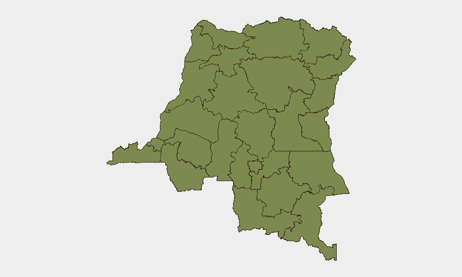
DR Congo remains at composite threat rank #32 globally, with 3,888 tracked security events; the country's risk profile is heavily concentrated in eastern provinces, particularly South Kivu (risk 34.8), which dwarfs all other regions. Recent activity signals military-force incidents involving FARDC, ongoing telecom infrastructure disruption in rebel-controlled eastern cities, and renewed high-level diplomatic pressure to enforce a US-brokered ceasefire in the Minembwe area. The security picture reflects persistent armed-group control in the east combined with fragile state capacity and widening humanitarian impact.
Key Developments
- South Kivu Province (25 June 2026): A conventional military force incident involving FARDC and a civilian worker was recorded; details on circumstances and casualty status remain unreported, but the event underscores sustained FARDC operational tempo in the province.
- Goma, North Kivu (23–25 June 2026): Vodacom RDC lost access to multiple technical sites, degrading mobile and data services for over 48 hours. The operator cited circumstances "beyond its control" in a city confirmed under AFC/M23 rebel control, raising concerns over infrastructure vulnerability and service restoration timelines.
- Bukavu, South Kivu (23–25 June 2026): Parallel Vodacom service disruptions affected the provincial capital during the same window, with access to technical sites severed. Local reporting notes a "particularly fragile security and administrative situation" under AFC/M23 control.
- London JOC Meeting (24 June 2026): The 6th Joint Oversight Committee session on the DR Congo–Rwanda peace agreement concluded with reaffirmed commitment to de-escalation but explicitly registered "serious concern" over recent drone strikes and escalating fighting in Minembwe (South Kivu).
- Minembwe Area, South Kivu (24–25 June 2026): The JOC communiqué documented escalating fighting and drone-strike impacts on civilians, flagging urgent need to enforce the ceasefire and prevent further security deterioration in this contested zone.
- Sudanese Force Activity (26 June 2026): A conventional military force event involving Sudanese actors was recorded; no geographic specificity or casualty detail is yet available.
Highest-Risk Areas
South Kivu Province dominates the risk landscape with a composite score more than 4× that of Kinshasa; the province's exposure to drone strikes, armed-group control of key towns (Bukavu, Minembwe), ongoing conventional military operations, and critical infrastructure vulnerabilities (telecom, logistics) creates a uniquely acute operational environment. Kinshasa, Tshopo, and Maniema follow at significantly lower risk but remain relevant for capital-city political volatility, riverine movement, and supply-chain continuity. All other tracked provinces cluster below 5.0, indicating that eastern DRC—particularly South Kivu—is the primary driver of national threat elevation.
How GeoBit Would Assist
Corporate teams operating in DR Congo should prioritize AOI Monitoring & Early Warning on Goma, Bukavu, and Minembwe to detect military movement, civilian displacement, and infrastructure changes in real time. Routing & Network Analysis is critical for duty-of-care planning, given telecom outages and rebel-controlled checkpoints; alternative supply and evacuation routes must account for dynamic control-line shifts. Conflict & Military force-structure and weapons-capability tracking, combined with multi-language OSINT fusion (Swahili, French, Lingala feeds), enables rapid detection of ceasefire violations, drone deployment, and FARDC/M23 operational changes that may trigger workforce evacuation triggers.
7-Day Outlook
The diplomatic de-escalation push from London (24 June) will likely face immediate pressure from continued drone strikes and fighting in Minembwe; no rapid ceasefire consolidation is expected in the next week. Telecom infrastructure in eastern cities will remain at risk of further disruption given the fragile security situation and rebel administrative control. Conventional military incidents involving FARDC, armed groups, and external actors (including Sudanese forces) are expected to persist, sustaining elevated alertness for personnel and asset-protection teams.
Highest-Risk Areas — Ranked
| # | State / Region | Risk |
|---|---|---|
| 1 | South Kivu | 34.8 |
| 2 | Kinshasa | 8.1 |
| 3 | Tshopo | 6.7 |
| 4 | Maniema | 4.8 |
| 5 | Sud-Ubangi | 4.8 |
| 6 | Équateur | 4.8 |
| 7 | Nord-Ubangi | 4.8 |
| 8 | Mongala | 4.8 |
| 9 | Lower Uele | 4.8 |
| 10 | Tshuapa | 4.8 |
| 11 | Upper Uele | 4.8 |
| 12 | Ituri | 4.8 |
Sources
Previous Daily Briefs
A new DR Congo brief is written every day — each with its own risk map and downloadable CSV. Here's the last week; use the calendar to go further back.
📅 Browse every day by calendar →
Highlighted days have a brief. Tap a day for that day's map & analysis, or “csv” for that day's dataset ($5).