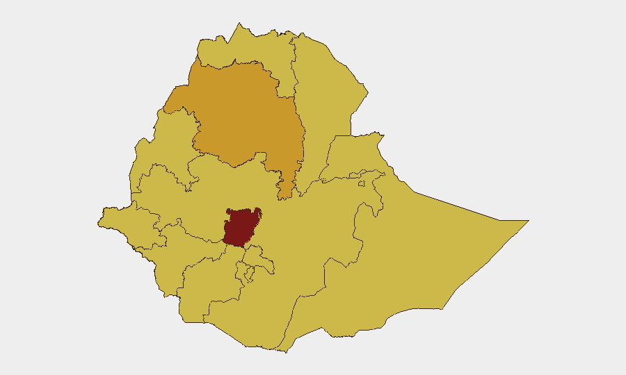
Situation Summary
Ethiopia remains at elevated risk (global rank #6, composite threat score 100) driven primarily by active civil conflict, with 27 tracked events in the current reporting cycle. The security landscape spans multiple regions simultaneously, with Central Ethiopia Regional State presenting the highest composite risk (100), followed by Amhara, Tigray, Afar, and six additional regions each scoring 70. Recent event signals include armed-group physical assaults, cross-border tensions with Somalia, and localized protester violence, though no major verified conflict escalation has been reported in the past 24 hours.
Key Developments
- 2026-07-11 · Armed Group Physical Assault — Location not geo-specified in available data; signals continued armed-group activity independent of major faction engagement.
- 2026-07-11 · Protester Physical Assault (2026-07-10) — Indicates localized civil unrest; specific location pending clarification from source correlation.
- 2026-07-11 · Ethiopian State Disapproval Event — Government signaling or opposition statement; context requires cross-referencing with concurrent diplomatic signals.
- 2026-07-11 · Australian Rejection (bilateral and vs. US) — Diplomatic or policy statement by Australia regarding Ethiopia or US–Ethiopia relations; monitor for sanctions, aid suspension, or travel advisory escalation.
- 2026-07-09 · Ethiopia–Somalia Bilateral Demand — Cross-border tension signal; consistent with periodic Somali–Ethiopian border disputes in Somali, Afar, and Oromia Regions.
- 2026-07-11 · Kenya Physical Assault Report — Signals spillover or cross-border violence affecting Kenya–Ethiopia frontier (likely Somali or Afar Region).
- Health Alerts (recent) — Marburg virus disease cases confirmed in Ethiopia (location/cluster data pending); malaria activity ongoing. Recommend liaison with MOH and partner health agencies for case geography and containment status.
Highest-Risk Areas
Central Ethiopia Regional State (risk 100) dominates the threat landscape, suggesting either active factional conflict or administrative/security-force activity concentrated in or near the capital zone. Amhara Region (71.2) remains volatile following years of conflict; Tigray (70) continues post-war instability and humanitarian strain. A cohort of six peripheral regions—Afar, Benishangul-Gumuz, Somali, Gambela, South West Ethiopia Peoples, and South Ethiopia Regional State—each score 70, indicating either cross-border spillover (Kenya, Somalia, Sudan/South Sudan) or localized ethnic/communal tension. Addis Ababa's inclusion at risk level 70 reflects urban security fragility and the concentration of government, diaspora, and international presence.
How GeoBit Would Assist
Security teams should leverage AOI Monitoring & Early Warning on Central Ethiopia Regional State, Amhara, and Somali Region to detect event clusters and escalation patterns in real time. Intel Sweep and X/Telegram OSINT fusion will isolate factional communications, armed-group signaling, and cross-border actor movements ahead of major incidents. Network & Actor Analysis applied to armed groups and state security forces, combined with GIS & Spatial Analysis of reported assault and demand events, will pinpoint flash-point locations and enable risk-informed routing for personnel and asset movements via Routing & Network Analysis capabilities.
7-Day Outlook
No immediate major escalation is forecast based on current event density and signal tone, but localized armed-group and protester activity is expected to persist in peripheral regions and Addis Ababa. Health alerts (Marburg, malaria) will likely drive secondary compliance and movement restrictions for international staff. Diplomatic friction (Australian statement) may presage aid conditionality or advisory shifts; monitor for downstream visa, banking, or logistics impacts within 72–96 hours.
Highest-Risk Areas — Ranked
| # | State / Region | Risk |
|---|---|---|
| 1 | Central Ethiopia Regional State | 100 |
| 2 | Amhara Region | 71.2 |
| 3 | Tigray | 70 |
| 4 | Afar Region | 70 |
| 5 | Benishangul-Gumuz Region | 70 |
| 6 | Somali Region | 70 |
| 7 | Gambela Region | 70 |
| 8 | South West Ethiopia Peoples | 70 |
| 9 | Addis Ababa | 70 |
| 10 | South Ethiopia Regional State | 70 |
| 11 | Oromia Region | 70 |
| 12 | Sidama | 70 |
Previous Daily Briefs
A new Ethiopia brief is written every day — each with its own risk map and downloadable CSV. Here's the last week; use the calendar to go further back.
📅 Browse every day by calendar →
Highlighted days have a brief. Tap a day for that day's map & analysis, or “csv” for that day's dataset ($5).
Atlas — our AI intelligence desk — emails them this snapshot personally. Nothing else, no list.