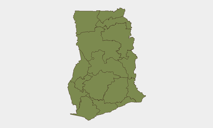
Situation Summary
Ghana remains at composite threat level 9 (rank 102 globally), with 27 tracked security events concentrated heavily in Greater Accra Region and the north. Recent days show elevated police and military activity, inter-agency tensions, and localized civilian harm incidents across multiple regions. The security posture is volatile but not yet showing signs of systemic breakdown; however, concentrated risk in the capital and Northern Region warrants active corporate monitoring.
Key Developments
- Sefwi Sayerano, Western North Region | 11–12 July — Police shooting during a civilian confrontation left at least three dead; roads were subsequently blocked and police posts burned by residents in apparent retaliation.
- Nkwanta South, Oti Region | 8–9 July — Armed attackers killed three civilians and wounded nine in a direct assault on the community; secondary reports on 14 July indicate a journalist was hospitalized following an alleged military assault in the same area.
- Dome-Kwabenya, Greater Accra | 10 July — Six private security guards arrested by police following a shooting incident near a former MP's residence; incident type and motive remain under investigation.
- Bantama Constituency, Ashanti Region | 10 July — Violence disrupted NPP constituency primary elections; three detentions and one injury reported.
- National | 13–14 July — Multiple government and counsel public statements released; a Director General statement appears to contradict official Ghana position; police investigation initiated (date 14 July).
- Accra / Greater Accra Region | 14 July — Conventional military force activity reported in relation to Nigerian counterpart; context and scope remain unclear from available signals.
Highest-Risk Areas
Greater Accra Region (32.4 composite risk) dominates the threat landscape by a factor of two, driven by urban crime, political tension, and security-force incidents in and around the capital. Northern Region (16.1) remains significantly elevated due to recurring armed-group activity and civilian casualties, while Bono East Region (11) shows emerging concern. The remaining nine regions cluster at 2.4–3.2 risk, suggesting either lower incident density or effective localization of threats. Corporate assets and personnel in Accra face the highest daily exposure; Northern Region travel and operations require enhanced due diligence.
How GeoBit Would Assist
Intel Sweep and OSINT fusion would isolate verified recent incidents from rumor and consolidate fragmented official statements into actionable timeline. AOI (Area-of-Interest) Monitoring with alerting on Greater Accra, Northern Region, and Oti Region would provide early warning of escalation in police/military activity or civilian harm. Network & Actor Analysis would clarify the relationships between government entities, security forces, and armed groups, helping corporate teams anticipate secondary impacts on supply chains and staff safety. Election monitoring capabilities would flag political-violence risk ahead of any scheduled electoral activity.
7-Day Outlook
The next 48–72 hours will clarify intent behind recent military signaling and the outcome of the police investigation announced 14 July. Absent rapid de-escalation in Sefwi Sayerano and Nkwanta South, repeat civilian–security-force clashes and community retaliation are probable. Personnel in Greater Accra should assume elevated baseline vigilance; Northern and Western North Region operations should activate contingency routing and communication protocols.
Highest-Risk Areas — Ranked
| # | State / Region | Risk |
|---|---|---|
| 1 | Greater Accra Region | 32.4 |
| 2 | Northern Region | 16.1 |
| 3 | Bono East Region | 11 |
| 4 | Volta Region | 3.2 |
| 5 | Upper East Region | 2.4 |
| 6 | Upper West Region | 2.4 |
| 7 | Savannah Region | 2.4 |
| 8 | North East Region | 2.4 |
| 9 | Eastern Region | 2.4 |
| 10 | Oti Region | 2.4 |
| 11 | Bono Region | 2.4 |
| 12 | Ahafo Region | 2.4 |
Sources
Previous Daily Briefs
A new Ghana brief is written every day — each with its own risk map and downloadable CSV. Here's the last week; use the calendar to go further back.
📅 Browse every day by calendar →
Highlighted days have a brief. Tap a day for that day's map & analysis, or “csv” for that day's dataset ($5).
Atlas — our AI intelligence desk — emails them this snapshot personally. Nothing else, no list.