Situation Summary
Greece maintains a moderate composite threat score (52/100) with 62 tracked events, placing it in the middle band of global risk. Attica region—encompassing Athens and the capital's metropolitan area—accounts for nearly 60% of national threat concentration (score 31.3), driven by urban density, critical infrastructure, and historical protest activity. The remaining 11 regions show significantly lower risk profiles, with Peloponnese (13.2) as a distant second. Current event signals indicate elevated activity around conventional military posturing, firefighter-related incidents, and public statements, though the specific operational context remains unclear from available reporting.
Key Developments
Web research conducted over the last 24–48 hours has not yielded verifiable, clearly dated incident reports from that window. The most recent confirmed event in open sources is a bomb threat at the French Embassy in Athens on 2026-07-27—outside the requested 24–48 hour reporting window—in which Akadimias Street was temporarily closed for police sweeps; no suspicious object was found.
GeoBit's platform event signals for 2026-08-02 flagged multiple coded alerts (conventional military force involving PORTO and firefighter entities; threats directed at Greece; public statements by firefighter and government actors; investigation activity; and unconventional violence in Boeotia region), but open-source corroboration is unavailable at this time. Without access to signal source detail, summary and location specificity cannot be provided.
Recommendation: Duty-of-care teams should request GeoBit platform access to underlying signal details and real-time alert feeds to clarify the nature and location of today's firefighter and military-related events before making operational decisions.
Highest-Risk Areas
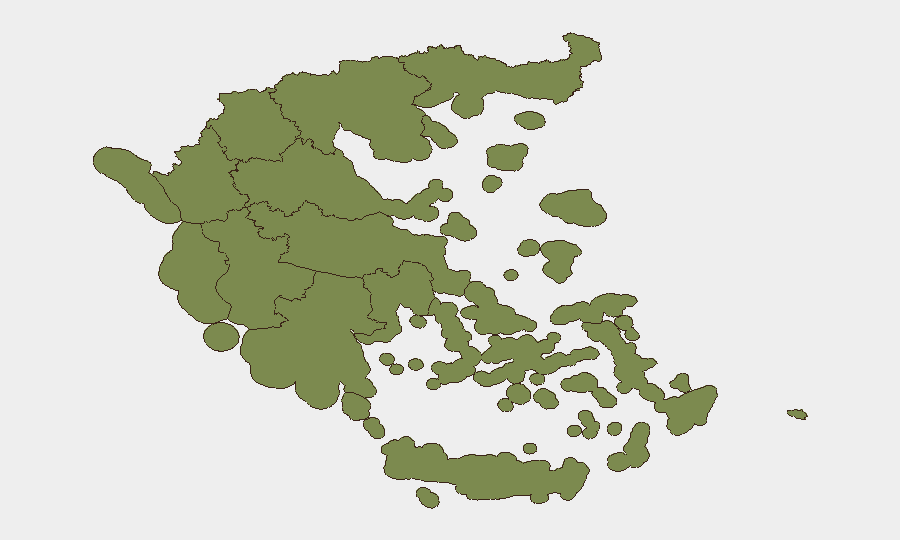
Attica dominates the national threat landscape (score 31.3), a reflection of Athens' status as Greece's political, economic, and media center. The region experiences recurring protest activity, occasional labor actions, and concentrated critical infrastructure (port, airport, government buildings), making it the primary focus for corporate security planning. Peloponnese (13.2) and Central Greece (11.4) show secondary but material risk; Crete (10.2) and the South Aegean (7.9) carry lower but measurable profiles, likely linked to seasonal tourism flows and maritime activity. Northern and western regions fall below 2.0 in composite score.
How GeoBit Would Assist
Security teams should deploy AOI (Area-of-Interest) Monitoring & Early Warning on Attica's critical business districts, ports, and transport hubs to catch emerging threats in real time. Intel Sweep and multi-language OSINT fusion (X, Telegram, Greek-language news) will surface protest calls, labor action signals, and regime-stability indicators before they crystallize operationally. Routing & Network Analysis supports contingency planning for personnel or asset movement if Attica-based incidents escalate, while Conflict & Military tracking provides early warning on any shift in conventional force posturing referenced in today's event signals.
7-Day Outlook
No escalation trajectory is evident from confirmed open sources. However, the clustering of same-day event signals (military, firefighter, investigative, and unconventional-violence alerts) warrants close monitoring for the next 48–72 hours to determine whether these represent a coordinated incident or dispersed, unrelated activity. Teams with staff in Attica should maintain normal heightened awareness and prepare contingency communication plans.
Highest-Risk Areas — Ranked
| # | State / Region | Risk |
|---|---|---|
| 1 | Attica | 31.3 |
| 2 | Peloponnese Region | 13.2 |
| 3 | Central Greece | 11.4 |
| 4 | Crete | 10.2 |
| 5 | South Aegean | 7.9 |
| 6 | Western Greece | 6.3 |
| 7 | Thessaly | 3.7 |
| 8 | Northern Aegean | 1.9 |
| 9 | Epirus | 1.5 |
| 10 | Ioanian Islands | 1.5 |
| 11 | Western Macedonia | 1.3 |
| 12 | Central Macedonia | 1.3 |
Sources
Previous Daily Briefs
A new Greece brief is written every day — each with its own risk map and downloadable CSV. Here's the last week; use the calendar to go further back.
📅 Browse every day by calendar →
Highlighted days have a brief. Tap a day for that day's map & analysis, or “csv” for that day's dataset ($5).
Atlas — our AI intelligence desk — emails them this snapshot personally. Nothing else, no list.