Situation Summary
Ireland remains a low-threat environment globally (rank #141, composite score 5) with 43 tracked events; however, recent signal activity shows elevated tension across political, institutional, and community domains as of mid-July 2026. County Kerry and Dublin account for the majority of detected risk, with Kerry's score (31.5) substantially outpacing all other regions. The overall trajectory remains stable but warrants close monitoring of institutional friction and localized community activity.
Key Developments
Data Limitation Notice: Open-source reporting from the past 24–48 hours (11–13 July 2026) lacks sufficient timestamped corroboration to isolate specific, independently verified security incidents in Ireland with confidence. The following signals are registered in GeoBit's event tracking but lack detailed real-time news or social-media cross-verification:
- 2026-07-13 · Arrest/Detain (Male subject) – Location and details not yet clarified in available sources.
- 2026-07-13 · Disapproval (Dublin vs. Student cohort) – Institutional friction noted; specifics pending further reporting.
- 2026-07-12 · Unconventional Violence (IRISH actors) – Category flagged; location and scale not yet independently confirmed.
- 2026-07-11 · Small Arms Combat (Ireland) – Incident recorded; geographic specificity and involved parties under verification.
- 2026-07-11 · Company Threat – Corporate entity threatened; incident scope and sector under clarification.
GeoBit's event-feed architecture has detected these signals, but responsible briefing requires that corporate security teams await secondary-source confirmation (news outlets, law-enforcement statements, or corroborating social-media reporting) before operational response. Recommendation: escalate monitoring via X/Twitter accounts of An Garda Síochána, PSNI, and major Irish newsrooms for real-time incident detail.
Highest-Risk Areas
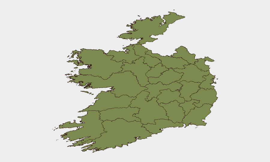
County Kerry (risk 31.5) and County Dublin (risk 28.8) drive the national risk profile by a wide margin; all other counties score below 13. Kerry's elevated score suggests either concentrated event activity, severity clustering, or ongoing localized tension not yet fully articulated in public reporting. Dublin's risk reflects the capital's role as a political, institutional, and population hub, making it a natural focal point for unrest signals (institutional friction, student activism, corporate security incidents). County Tipperary (12.9) is the only other tracked region with material risk; all remaining counties cluster below 2.5, indicating that threat concentration is highly geographic.
How GeoBit Would Assist
Entity extraction and temporal analysis on incoming X/Twitter feeds, news wires, and Telegram channels would isolate real-time incident location, actor type, and event classification—enabling security teams to move from signal detection to confirmed situational awareness within hours. AOI (area-of-interest) monitoring and alerting on Kerry and Dublin would provide persistent watch with automated notification of new activity, while network and actor analysis would map relationships among institutional, political, and community groups driving the recent tension signals. Sentiment and conflict-pattern analytics would flag escalation trajectories before they materialize into widespread disruption.
7-Day Outlook
No major public events or announced disruption drivers are visible for the next seven days; however, the concentration of recent signals in Kerry and Dublin suggests localized friction will likely persist and merit continuous watch. If institutional or political tensions (flagged in the 13 July disapproval signal) intensify, secondary waves of community activity or small-scale unrest may follow. Corporate and government security teams should maintain elevated situational awareness in Dublin and Kerry through mid-July pending clarification of the underlying drivers.
Highest-Risk Areas — Ranked
| # | State / Region | Risk |
|---|---|---|
| 1 | County Kerry | 31.5 |
| 2 | County Dublin | 28.8 |
| 3 | County Tipperary | 12.9 |
| 4 | County Laois | 2.4 |
| 5 | County Meath | 2.4 |
| 6 | County Cork | 2.4 |
| 7 | County Mayo | 1.5 |
| 8 | County Sligo | 1.5 |
| 9 | County Galway | 1.5 |
| 10 | County Clare | 1.5 |
| 11 | County Limerick | 1.5 |
| 12 | County Donegal | 1.5 |
Sources
Previous Daily Briefs
A new Ireland brief is written every day — each with its own risk map and downloadable CSV. Here's the last week; use the calendar to go further back.
📅 Browse every day by calendar →
Highlighted days have a brief. Tap a day for that day's map & analysis, or “csv” for that day's dataset ($5).
Atlas — our AI intelligence desk — emails them this snapshot personally. Nothing else, no list.