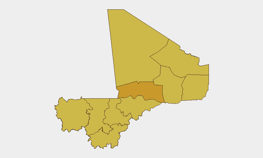
Situation Summary
Mali's overall security environment remains fragmented and elevated, with Bamako emerging as the single highest-risk node (97.8) while armed-group activity persists across the Sahel belt and northern regions. No independently verified armed clashes, attacks, or infrastructure damage were confirmed in the last 48 hours ending 25 June 2026, though unconfirmed aerial weapons signals near the capital on 23 June warrant monitoring. The security posture reflects ongoing military presence and force-posture adjustments by external actors, coupled with persistent Islamist and criminal networks across the north and east. Risk trajectory remains stable but fragile, dependent on seasonal escalation patterns and external force deployments.
Key Developments
- Bamako area, 23 June 2026 — Unconfirmed signals of aerial weapons activity detected near the capital; GeoBit has not independently verified these reports and recommends treating as unconfirmed pending further corroboration.
- Kayes/Diéma region, 22 June 2026 — Russian Africa Corps security-force infrastructure development ongoing, including deployment of drone signal-jamming station at military camps; classified as force-posture adjustment rather than active incident.
- Countrywide, 23–25 June 2026 — No independently verified armed clashes, arrests, or tactical incidents reported across Mali's territory in the 48-hour window.
- Journalist disapproval incident, 26 June 2026 — Signal of press-freedom tension logged in GeoBit event feeds; context and severity remain under assessment.
- Somalia-Mali linkage, multiple dates 23–26 June — Cross-border threat and diplomatic-tension signals involving Somali actors detected in public statements; relevance to Mali ground security requires further analysis.
Highest-Risk Areas
Bamako dominates the risk calculus at 97.8, reflecting the capital's concentration of government, foreign mission, and economic activity alongside demonstrated vulnerability to security incidents. The tier-two cluster—Timbuktu (72.8), Ménaka, Kayes, Taoudénit, Kidal, Gao, and Mopti—reflects sustained armed-group presence, smuggling networks, and recurring intercommunal tension across the Sahel and northern zones. Timbuktu's specific elevation reflects historical ISIS-linked activity and tourism/heritage-site targeting. Ménaka, Kidal, and Gao represent ungoverned-space risk where JNIM and splinter groups maintain operational capacity. Kayes reflects transnational criminal and militant infiltration from Mauritania and Senegal. Corporate assets and personnel in Bamako face the highest absolute incident probability; northern and eastern operations face lower-frequency but higher-severity kidnap, armed robbery, and intercommunal-violence risks.
How GeoBit Would Assist
A security team with people or assets in Mali would prioritize AOI (Area-of-Interest) Monitoring & Early Warning for Bamako and key northern nodes (Gao, Timbuktu, Ménaka) to detect tactical movement, checkpoint establishment, or unusual military activity in real time. Intel Sweep and multi-language OSINT fusion would track JNIM, ISGS, and armed-group communications on Telegram and local radio to anticipate recruitment drives, taxation operations, or planned operations. Conflict & Military mapping and force-structure analysis would monitor Russian Africa Corps and Malian military repositioning to assess protection capacity and potential spillover risk. Network & Actor Analysis would map local intermediaries, fixers, and power brokers whose allegiances or security status may shift with force changes.
7-Day Outlook
No major escalation is anticipated in the next seven days absent new external shocks (e.g., cross-border Mauritanian incursion or Bamako political crisis). Rainy-season logistics constraints may reduce northern armed-group mobility but increase localized flooding and intercommunal resource competition. Monitoring of Somali-Mali threat signals and Russian force-posture updates should continue to detect any indirect spillover or pressure on Mali's sovereignty.
Highest-Risk Areas — Ranked
| # | State / Region | Risk |
|---|---|---|
| 1 | Bamako | 97.8 |
| 2 | Timbuktu | 72.8 |
| 3 | Ménaka | 67.8 |
| 4 | Kayes | 67.8 |
| 5 | Taoudénit Region | 67.8 |
| 6 | Kidal | 67.8 |
| 7 | Gao | 67.8 |
| 8 | Koulikoro | 67.8 |
| 9 | Ségou Region | 67.8 |
| 10 | Sikasso Region | 67.8 |
| 11 | Mopti | 67.8 |
Sources
Previous Daily Briefs
A new Mali brief is written every day — each with its own risk map and downloadable CSV. Here's the last week; use the calendar to go further back.
📅 Browse every day by calendar →
Highlighted days have a brief. Tap a day for that day's map & analysis, or “csv” for that day's dataset ($5).