Situation Summary
Oman's security environment has deteriorated sharply over the past 72 hours due to escalating maritime incidents in the Strait of Hormuz and surrounding waters. Multiple vessels have been struck by unidentified projectiles near Kumzar, Khasab, and Duqm, with at least one fire resulting and crew evacuations reported. Western governments—including the U.S., France, and Australia—have issued or updated travel restrictions and airspace warnings affecting Oman's northern and eastern regions and commercial aviation through at least 29 July. The concentrated cluster of July 17–20 events signals a material shift in threat posture, with Al Wusta and Musandam governorates now bearing the highest operational risk.
Key Developments
- Strait of Hormuz, northwest of Kumzar (Musandam), 23 Jul (reported 20 Jul): UKMTO confirmed a vessel struck by unknown projectile approximately 8 nm northwest of Kumzar; crew abandoned vessel; fire remains active and vessel adrift.
- Tanker incident, 19 nm east of Khasab (Musandam), 18 Jul: UKMTO reported unidentified projectile strike on commercial tanker with minor damage; crew reported safe. Incident occurred during broader regional military activity.
- Commercial tanker strike, ~100 nm east of Duqm (Al Wusta), 18 Jul: UKMTO logged tanker incident in vicinity of active military operations; vessel details and damage status limited in available reporting.
- U.S. Embassy Muscat travel restrictions, 17 Jul: Embassy issued security alert restricting U.S. government employee travel to Musandam and Duqm due to proximity to maritime incidents and geographic isolation complicating emergency response.
- French foreign ministry advisory upgrade, 17 Jul: France advised maximum caution and avoidance of nonessential travel to Salalah, Duqm, Musandam, and Yemen border regions following regional escalation.
- EASA airspace advisory, 20 Jul: European and international air operators directed to avoid Gulf airspace until at least 29 July 2026; Australian Smartraveller confirmed advisory affecting commercial aviation routes serving Oman.
Highest-Risk Areas
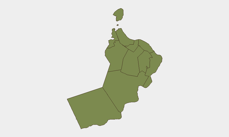
Al Wusta Governorate (risk score 31.3) dominates the threat landscape due to its position along major tanker routes and proximity to contested waters 80–100 nm offshore; ongoing military activity and three confirmed incidents in the region since 17 July warrant this elevated rating. Musandam Governorate (4.3) ranks second, reflecting its strategic location at the Strait of Hormuz chokepoint and two confirmed projectile strikes near Kumzar and Khasab within the same 72-hour window. Muscat Governorate (2.8) carries residual risk as the capital and diplomatic/commercial hub, though incidents remain concentrated in northern and eastern waters. All other governorates remain at baseline (1.3), indicating risk is geographically compartmented to maritime zones and border regions.
How GeoBit Would Assist
Teams with personnel or assets in Oman should leverage Maritime & Aviation tracking to monitor vessel movements and AIS anomalies in high-risk waters around Duqm and Musandam, and AOI Monitoring & Early Warning to detect and alert on fresh incidents near designated corporate chokepoints. Intel Sweep and OSINT fusion (X/Twitter, Telegram, UKMTO feeds, multi-language sources) enable real-time corroboration of incident reports and distinguish operational military activity from criminal or accidental events. Routing & Network Analysis can identify alternative transit corridors and assess feasibility of air/sea operations outside current advisory zones.
7-Day Outlook
Maritime incidents are likely to persist through 29 July given stated airspace restrictions and ongoing military operations. Corporate presence in Musandam and Al Wusta should assume heightened standby protocols; supply-chain and personnel routing through Gulf waters or northern Oman will require day-to-day reassessment. A stabilization or de-escalation signal (e.g., formal military stand-down, UKMTO all-clear) is not yet evident in available reporting.
Highest-Risk Areas — Ranked
| # | State / Region | Risk |
|---|---|---|
| 1 | Al Wusta Governorate | 31.3 |
| 2 | Musandam Governorate | 4.3 |
| 3 | Muscat Governorate | 2.8 |
| 4 | Al Buraymi Governorate | 1.3 |
| 5 | Ad Dhahirah Governorate | 1.3 |
| 6 | Al Batinah North Governorate | 1.3 |
| 7 | Al Batinah South Governorate | 1.3 |
| 8 | Ad Dakhiliyah Governorate | 1.3 |
| 9 | Ash Sharqiyah North Governorate | 1.3 |
| 10 | Ash Sharqiyah South Governorate | 1.3 |
| 11 | Dhofar Governorate | 1.3 |
Sources
Previous Daily Briefs
A new Oman brief is written every day — each with its own risk map and downloadable CSV. Here's the last week; use the calendar to go further back.
📅 Browse every day by calendar →
Highlighted days have a brief. Tap a day for that day's map & analysis, or “csv” for that day's dataset ($5).
Atlas — our AI intelligence desk — emails them this snapshot personally. Nothing else, no list.