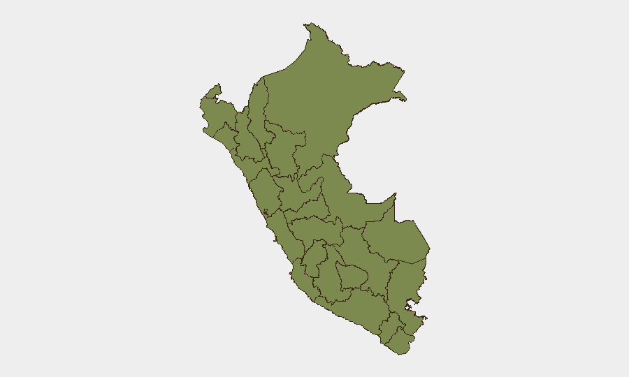
Situation Summary
Peru faces a composite threat score of 22 (41 tracked events), with security deteriorating most acutely in Lima due to a surge in extortion-related violence targeting interprovincial transport operators. Over 24–48 hours, Lima has recorded at least nine violent incidents—including multiple armed attacks on buses, targeted homicides, and gang-related shootings—concentrated in northern and southern districts (San Martín de Porres, Villa María del Triunfo, Chorrillos, Puente Piedra). Police operations have yielded 21 arrests in Lima Norte linked to extortion gangs, but operational tempo suggests criminal networks remain active and organized. La Libertad, Piura, and Ucayali remain elevated regional risks, though current event density is highest in the capital.
Key Developments
- Lima Norte megaoperación (July 26–27, 2026): National Police arrested 21 suspects across five districts in Lima Norte, mostly foreign nationals allegedly part of extortion gangs targeting bus companies; at least one detainee reportedly confessed to multiple armed attacks on transport.
- Repeated attacks on Emmanuel buses (July 27, 2026): Emmanuel interprovincial bus company suffered a second armed attack within 24 hours near Óvalo Tomás Valle, San Martín de Porres, with driver gravely injured; pattern strongly suggests organized extortion.
- Shooting at Pachacútec Avenue, Villa María del Triunfo (July 27, 2026): Armed attack killed two people and injured two others, including a private security guard; classified as part of ongoing southern Lima urban violence.
- Nor Lima bus attack, San Martín de Porres (July 27, 2026): Minibus driver shot and injured in armed assault; authorities link to extortion campaigns against transport operators in Lima Norte.
- Transport extortionists arrested, Santa Anita (July 27, 2026): Police captured four suspected extortionists believed responsible for threats and armed attacks on bus companies.
- Targeted homicide, Chorrillos (July 27, 2026): Man shot dead inside his vehicle; investigators treat case as "ajuste de cuentas" linked to organized crime.
- Homicide after social gathering, Puente Piedra (July 27, 2026): Man shot twice and killed in Zapallal; suspected criminal or personal vendetta.
- Minor seismic activity, Caylloma, Arequipa (night of July 27, 2026): Magnitude 3.5 earthquake; no major damage reported but relevant for infrastructure and travel risk in the highlands.
Highest-Risk Areas
La Libertad (31.3), Piura (22.8), and Lima (22.2) dominate the national risk profile. Lima's risk is driven by acute, concentrated violence in the last 48 hours—extortion-linked shootings against transport, gang arrests, and targeted homicides across northern and coastal districts. La Libertad and Piura, historically associated with drug trafficking and gang activity, continue to exhibit sustained underlying threat levels. Ucayali (20.6) and Tacna (15.3) remain moderately elevated; southern regions (Cusco, Lambayeque) and Amazonian departments (Loreto, Amazonas, Huánuco) show lower current event intensity.
How GeoBit Would Assist
Corporate security teams should employ AOI Monitoring & Early Warning on Lima's high-crime districts (San Martín de Porres, Villa María del Triunfo, Callao) to track emerging extortion patterns and transport attacks in real time. Intel Sweep and X/Twitter OSINT can monitor criminal communications, gang claims, and transport-sector warnings posted by affected companies or authorities. Routing & Network Analysis enables security teams to calculate alternative travel routes for personnel and assets avoiding identified incident clusters, particularly around interprovincial transit corridors.
7-Day Outlook
Extortion violence in Lima is likely to persist short-term despite police arrests; criminal networks typically adapt operational tactics rather than cease immediately following enforcement sweeps. Transport companies and logistics providers face continued elevated risk in Lima Norte and coastal zones over the next week. Regional tensions cited in recent diplomatic statements (Ecuador–Peru, government rejections) warrant monitoring for secondary security spillover, though no direct operational impact on Lima crime is evident as of 28 July.
Highest-Risk Areas — Ranked
| # | State / Region | Risk |
|---|---|---|
| 1 | La Libertad | 31.3 |
| 2 | Piura | 22.8 |
| 3 | Lima | 22.2 |
| 4 | Ucayali | 20.6 |
| 5 | Tacna | 15.3 |
| 6 | Cusco | 14.2 |
| 7 | Lambayeque | 8.8 |
| 8 | Junín | 3.5 |
| 9 | Loreto | 2.4 |
| 10 | Amazonas | 2.4 |
| 11 | Huánuco | 2.4 |
| 12 | Apurímac | 2.4 |
Sources
Previous Daily Briefs
A new Peru brief is written every day — each with its own risk map and downloadable CSV. Here's the last week; use the calendar to go further back.
📅 Browse every day by calendar →
Highlighted days have a brief. Tap a day for that day's map & analysis, or “csv” for that day's dataset ($5).
Atlas — our AI intelligence desk — emails them this snapshot personally. Nothing else, no list.