Situation Summary
The Philippines faces a composite threat environment dominated by West Philippine Sea tensions with China, coordinated militant attacks in the Bangsamoro region, and ongoing communist insurgency in northern Luzon. A violent confrontation between Philippine Navy and Chinese forces on 20 July near Second Thomas Shoal has escalated diplomatic rhetoric, while four coordinated attacks on AFP units across Maguindanao provinces over 18–19 July—attributed to BIFF and Dawlah Islamiya—suggest organized retaliation against military operations and the new election gun ban. The national threat ranking remains moderate (51st globally), but risk concentrates sharply in Metro Manila and the Mindanao corridor.
Key Developments
- Second Thomas Shoal, West Philippine Sea (20 Jul): Violent close-quarters altercation between Philippine Navy personnel and Chinese Coast Guard near contested shoal; at least one Filipino sailor sustained a head injury. Both governments issued formal accusations; incident raises risk of further maritime escalation in disputed waters.
- Maguindanao del Norte & Maguindanao del Sur (18–19 Jul, reported 20–21 Jul): Four coordinated attacks on AFP units attributed to BIFF (Bungos faction) and Dawlah Islamiya–Hassan group: gunfire on 12th Mechanized Company (Talitay), IED near armored vehicle (Barangay Linantangan), hand grenade on convoy in Shariff Aguak (2 soldiers, 3 civilians wounded), and grenade attack on 7th IB detachment (Barangay Macaguiling, Sultan Kudarat). Military assesses attacks as retaliation for recent operations and the 16 July election gun ban.
- Tineg, Abra province (20 Jul): Second armed clash within 48 hours between 50th Infantry Battalion and approximately 10 alleged New People's Army fighters in Barangay Apao; no confirmed casualties reported; clearance and community security operations ongoing.
- Presidential Security Relocation (Bangsamoro, 21–22 Jul): President Marcos Jr.'s 22 July engagement relocated from Cotabato City to Camp Siongco in Datu Odin Sinsuat due to heightened threat posture; heightened security measures and route protection implemented across Maguindanao corridor.
- BARMM Election Gun Ban Enforcement (16 Jul ongoing): Weapon seizures and checkpoint operations across Bangsamoro region in advance of 14 September regional elections; four militant attacks in first 48–72 hours suggest organized pushback and continued armed-group activity despite ban.
Highest-Risk Areas
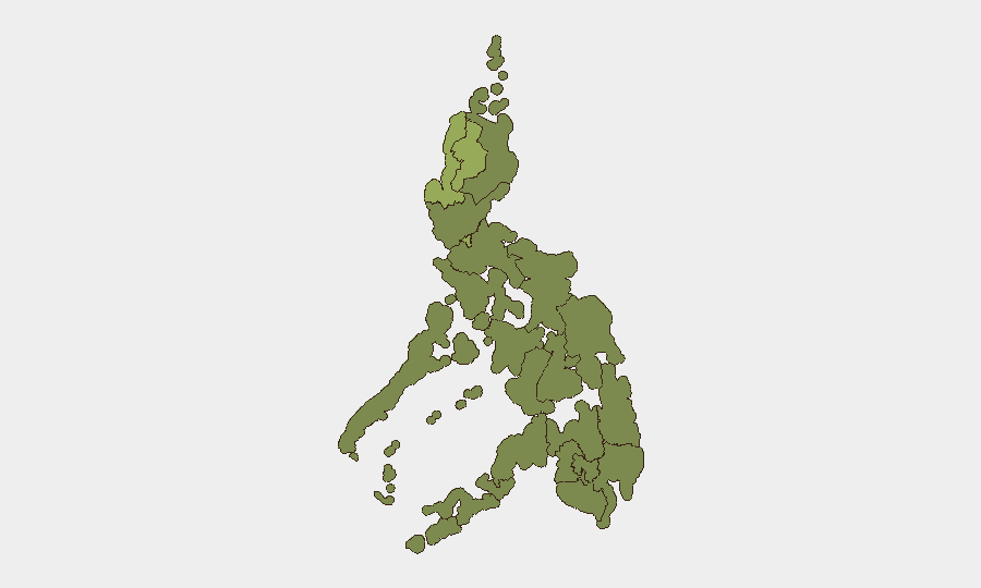
Metro Manila (53.1) and Ilocos Region (45.4) drive national risk, but the Mindanao corridor—particularly Maguindanao del Norte, Maguindanao del Sur, and the broader Bangsamoro region—presents acute tactical threat. The coordinated militant attacks, election-related gun ban enforcement, and ongoing AFP-BIFF/Dawlah Islamiya confrontation create a sustained operational environment with IED, ambush, and grenade-attack risk. Abra's communist insurgency activity represents a secondary but persistent northern threat. West Philippine Sea incidents add cross-cutting diplomatic and potential kinetic escalation risk affecting national stability.
How GeoBit Would Assist
Security teams should employ AOI Monitoring & Early Warning on Maguindanao municipalities and the Second Thomas Shoal approaches to detect militant activity and maritime incidents in real time; Network & Actor Analysis to map BIFF, Dawlah Islamiya, and NPA command structures and likely next targets; and Conflict & Military battle mapping and force-structure tracking to anticipate AFP redeployments and intercept patterns. Election Monitoring capabilities should track Bangsamoro gun-ban enforcement and armed-group responses to assess risk to corporate travel and operations through the polling period.
7-Day Outlook
Militant retaliation in Maguindanao is expected to persist through the election gun-ban period (through 14 September), with further grenade and ambush attacks likely targeting isolated AFP units. West Philippine Sea tensions remain elevated and unpredictable. Personnel and asset movement in Metro Manila, Ilocos, and the Maguindanao corridor should assume heightened checkpoint, delay, and incident risk.
Highest-Risk Areas — Ranked
| # | State / Region | Risk |
|---|---|---|
| 1 | Metro Manila | 53.1 |
| 2 | Ilocos Region | 45.4 |
| 3 | Cordillera Administrative Region | 40 |
| 4 | Mimaropa | 35.7 |
| 5 | Cagayan Valley | 35.2 |
| 6 | Calabarzon | 24.6 |
| 7 | Zamboanga Peninsula | 23.6 |
| 8 | Western Visayas | 23.6 |
| 9 | Bangsamoro | 23.1 |
| 10 | Caraga | 23.1 |
| 11 | Northern Mindanao | 23.1 |
| 12 | Soccsksargen | 23.1 |
Sources
Previous Daily Briefs
A new Philippines brief is written every day — each with its own risk map and downloadable CSV. Here's the last week; use the calendar to go further back.
📅 Browse every day by calendar →
Highlighted days have a brief. Tap a day for that day's map & analysis, or “csv” for that day's dataset ($5).
Atlas — our AI intelligence desk — emails them this snapshot personally. Nothing else, no list.