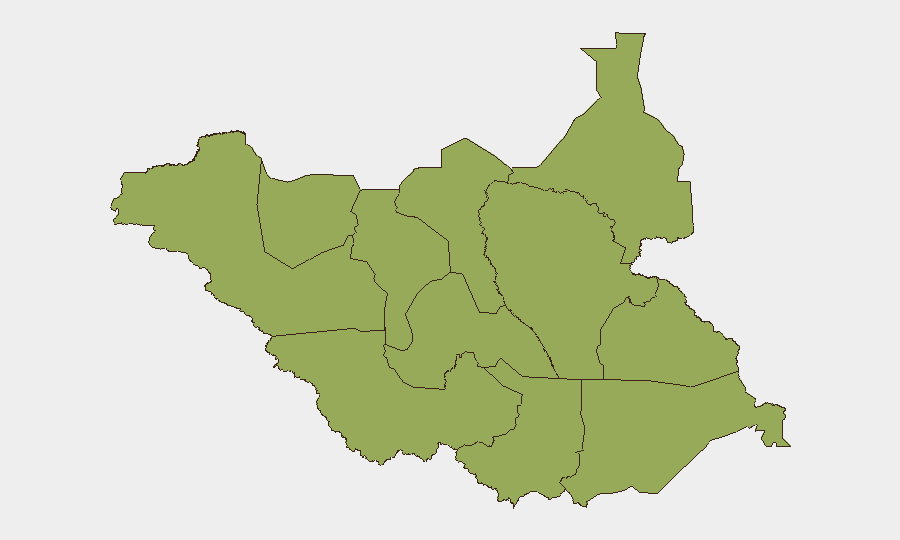
Situation Summary
South Sudan remains at composite threat rank #30 globally (score 67), driven primarily by civil violence. No discrete security incidents have been verified in the last 24–48 hours across open-source reporting; however, baseline risk in conflict-affected states (Unity, Jonglei, Upper Nile, Greater Pibor) remains elevated. A passenger bus attack on the Juba–Bor highway was reported on 22 July, signalling continued threat to road movement, though outside the current reporting window. The country's fragile conflict equilibrium persists ahead of December 2026 national elections.
Key Developments
- No verified discrete incidents in the last 24–48 hours. Multiple monitoring sources confirm absence of newly documented attacks, clashes, or criminal incidents in this narrow window, though limited open-source reporting coverage may mask lower-level activity.
- Juba–Bor highway remains high-risk. A passenger bus attack near Juba (Central Equatoria State) on 22 July signals active threat to civilians using major transport corridors, even where no incidents are reported in the immediate past 48 hours.
- Electoral calendar advances political risk. President Salva Kiir signed the 2026 Amendment to the Revitalized Peace Agreement (earlier in week of 22 July), clearing the legal pathway for December 2026 national elections; potential for renewed factional tension or administrative violence as campaign period approaches.
- County-level administrative targeting ongoing. A county commissioner was killed in Jonglei State on 7 July 2026, reflecting a pattern of political violence and targeting of state officials in conflict-affected areas.
- Border security dialogue with Uganda. South Sudan and Uganda have reactivated joint border security committees and agreed to re-mark their shared border, signalling attempted stabilisation of a historically contested frontier, though without time-stamped corroboration in the last 48 hours.
Highest-Risk Areas
All twelve tracked sub-national regions carry equivalent composite risk scores (46.7), with particular operational concern in Unity, Jonglei, Upper Nile, and Greater Pibor Administrative Area. These zones have seen documented violence (including administrative targeting) and remain active for intercommunal conflict and armed-group activity. Central Equatoria, hosting the capital Juba and the Juba–Bor highway, carries elevated risk for banditry and armed movement despite lower absolute conflict density. Risk is distributed across the country rather than geographically concentrated, requiring blanket operational caution for personnel and supply chains nationwide.
How GeoBit Would Assist
Security teams should employ AOI (Area-of-Interest) Monitoring & Early Warning to track Jonglei, Unity, and Upper Nile in real-time for emerging clashes or population movement. Conflict & Military battle mapping and force-structure tracking will support assessment of armed-group posture and factional alignment ahead of the electoral period. Multi-language radio SIGINT and local news intelligence feeds (Eye Radio, SSBC, ACLED fusion) are essential to close the gap between official reporting and ground-level incidents, particularly for road-security assessments on routes like Juba–Bor.
7-Day Outlook
No major escalation is signalled for the next 7 days; however, the absence of reported incidents should not be read as de-escalation. Road movement in Central Equatoria and cross-border trade remain operationally constrained. Monitor electoral preparations and factional positioning closely, as December polling may trigger renewed administrative targeting and localized violence by mid-to-late August.
Highest-Risk Areas — Ranked
| # | State / Region | Risk |
|---|---|---|
| 1 | Upper Nile | 46.7 |
| 2 | Northern Bahr el Ghazal | 46.7 |
| 3 | Western Bahr el Ghazal State | 46.7 |
| 4 | Ruweng Administrative Area | 46.7 |
| 5 | Unity | 46.7 |
| 6 | Warrap | 46.7 |
| 7 | Lakes | 46.7 |
| 8 | Jonglei | 46.7 |
| 9 | Greater Pibor Administrative Area | 46.7 |
| 10 | Western Equatoria | 46.7 |
| 11 | Central Equatoria | 46.7 |
| 12 | Eastern Equatoria | 46.7 |
Sources
Previous Daily Briefs
A new South Sudan brief is written every day — each with its own risk map and downloadable CSV. Here's the last week; use the calendar to go further back.
📅 Browse every day by calendar →
Highlighted days have a brief. Tap a day for that day's map & analysis, or “csv” for that day's dataset ($5).
Atlas — our AI intelligence desk — emails them this snapshot personally. Nothing else, no list.