Situation Summary
Yemen remains in a state of active civil conflict with persistent cross-border military escalation between Houthi-controlled areas and Saudi Arabia. Over the past 48 hours, maritime threats and air strikes have intensified, signaling a renewed cycle of tit-for-tat retaliation. Amanat Al Asimah (Sana'a) remains the highest-risk zone, with 37 tracked events nationwide placing Yemen at #18 globally on GeoBit's composite threat ranking.
Key Developments
- Maritime blockade threat (21 Jul 2026). Houthis issued direct warnings to shipping companies via email prohibiting cargo operations at Saudi Arabian ports and signaling closure of Bab el-Mandeb strait. This constitutes an active threat to Red Sea maritime commerce and vessels transiting the region.
- Red Sea shipping lanes targeted (21 Jul 2026). Houthi spokesman Nasruddin Amer announced renewed interdiction posture toward southern Red Sea, explicitly prohibiting Saudi vessels and reinforcing blockade signaling.
- Cross-border air strikes (19–21 Jul 2026). AP and CGTN report renewed exchange of strikes: Saudi forces struck Sana'a International Airport; Houthis retaliated with missiles and drones targeting Abha International Airport in Saudi Arabia. Both runway and airfield operations remain degraded.
- Regional diplomatic engagement (mid-July, ongoing). UN Special Envoy Hans Grundberg held talks in Muscat with Omani officials and Houthi negotiators; status of de-escalation progress remains unclear but indicates active UN mediation efforts.
- Multi-actor rejection signals (20–21 Jul 2026). Event signals capture rejections and threats spanning Yemen, Saudi Arabia (Riyadh), Iran (Tehran), and international parties (Athens investigation), indicating fragmented diplomatic posture and elevated international concern.
- Civilian-security community tensions (21 Jul 2026). Threat signals between community actors and Sana'a, plus worker disapproval noted on 20 Jul, suggest underlying civilian friction and potential labor/services disruption in high-risk zones.
Highest-Risk Areas
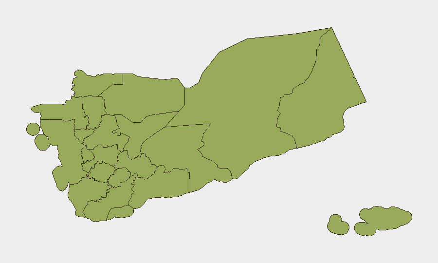
Amanat Al Asimah (Sana'a city and surrounding governorate) dominates the risk landscape at 78.5, driven by active military operations, competing governance claims, and international diplomatic activity. Shabwah Governorate ranks second (54.7), reflecting southeastern insurgency and tribal conflict dynamics. The remaining ten governorates cluster at 48.5, reflecting the nationwide distribution of conflict; however, northern zones (Sa'dah, Hajjah, 'Amran, Sana'a Governorate) and Red Sea coastal areas (Al Hudaydah) remain consistent flashpoints due to Houthi concentration and Saudi proximity.
How GeoBit Would Assist
Organizations with personnel or assets in Yemen should employ AOI Monitoring & Early Warning on Amanat Al Asimah, Red Sea ports, and Sanaa/Abha airports to capture strike and blockade developments in real time. Maritime & Aviation tracking combined with Intel Sweep and multi-language OSINT enables rapid detection of shipping interdictions, port closures, and airspace restrictions before they impact supply chains or movement. Network & Actor Analysis on Houthi, Saudi, and Iranian messaging channels (X, Telegram, direct communications) provides early signal of escalation intent or de-escalation openings, informing duty-of-care decisions.
7-Day Outlook
Expect continued tit-for-tat military exchanges and maritime interdiction rhetoric over the next 7 days, with shipping disruption likely to intensify. UN mediation efforts may produce minor ceasefires or localized pauses, but absent breakthrough political agreement, cycle of retaliation will persist. Risk to air operations, Red Sea transit, and Sana'a-area personnel remains elevated.
Highest-Risk Areas — Ranked
| # | State / Region | Risk |
|---|---|---|
| 1 | Amanat Al Asimah | 78.5 |
| 2 | Shabwah Governorate | 54.7 |
| 3 | Sa'dah Governorate | 48.5 |
| 4 | Hajjah Governorate | 48.5 |
| 5 | Al Mahwit Governorate | 48.5 |
| 6 | Al Hudaydah Governorate | 48.5 |
| 7 | 'Amran Governorate | 48.5 |
| 8 | Sana'a Governorate | 48.5 |
| 9 | Raymah Governorate | 48.5 |
| 10 | Dhamar Governorate | 48.5 |
| 11 | Ibb Governorate | 48.5 |
| 12 | Ta'izz Governorate | 48.5 |
Sources
Previous Daily Briefs
A new Yemen brief is written every day — each with its own risk map and downloadable CSV. Here's the last week; use the calendar to go further back.
📅 Browse every day by calendar →
Highlighted days have a brief. Tap a day for that day's map & analysis, or “csv” for that day's dataset ($5).
Atlas — our AI intelligence desk — emails them this snapshot personally. Nothing else, no list.