Situation Summary
Central African Republic remains a fragmented, medium-tier security environment (global rank #26, composite threat score 89) with no active armed conflict or mass casualty events reported in the last 48 hours. A cholera outbreak declared 28 June in Bimbo and Mbaïki health districts southwest of Bangui—197 confirmed cases, 24 deaths—represents the primary operational risk to personnel and supply chains in the capital region and affected southwestern districts. Regional diplomatic tension involving Congo, Democratic Republic of Congo, Ghana, Nigeria, and Uganda reflects broader Central African geopolitical stress but has not yet triggered direct CAR instability.
Key Developments
- Cholera outbreak declared, Bimbo and Mbaïki districts, 28 June 2026. Health Minister Pierre Somse confirmed 197 cases and 24 deaths; authorities initiated investigations into source and launched preventive hygiene measures. Proximity to Bangui creates potential exposure and movement-related transmission risk for corporate personnel and supply-chain operations.
- Regional diplomatic friction. Between 28–30 June, Ghana, Nigeria, and Uganda each reduced diplomatic relations with Democratic Republic of Congo; Congo engaged in conventional military force incidents with Uzbekistan (28 June). No direct CAR military involvement reported, but neighboring instability may constrain cross-border transport and fuel supply routes.
- Domestic banking/administrative tension. Between 28–30 June, CAR's Central Bank faced administrative sanctions and reduction of relations with a governor; separately issued demands to a bank. No evidence of systemic financial disruption, but regulatory unpredictability merits monitoring of payment systems and cash-flow reliability.
- No new armed-group, crime, or civil-unrest incidents. Web research across major news outlets and verified social sources for 29–30 June yielded no corroborated reports of new clashes, rebel activity, urban crime spikes, or protests in CAR beyond the cholera declaration.
Highest-Risk Areas
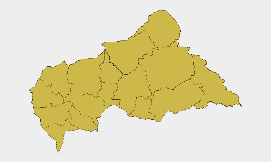
All twelve provinces currently register identical risk scores (62.2), indicating either evenly distributed threat conditions or limited granular recent intelligence. Bamingui-Bangoran, Vakaga, and Haute-Kotto—geographically remote, sparsely governed northeastern and eastern provinces—typically host transient armed groups and smuggling networks; however, no activity surge is documented this reporting cycle. Southwestern regions (Mambéré-Kadéï, Sangha-Mbaéré) now carry elevated public-health risk due to cholera concentration near Bangui's supply and personnel corridors. Urban Bangui itself remains operationally viable but subject to localized crime and occasional political volatility.
How GeoBit Would Assist
Security teams should deploy AOI Monitoring & Early Warning (persistent watch on Bimbo, Mbaïki, and Bangui districts) coupled with Environmental & Health intelligence to track cholera progression, hospital capacity, and water/sanitation status—critical for duty-of-care decisions. Intel Sweep and multi-language OSINT across regional news, NGO health alerts, and local social channels will detect any escalation in outbreak severity or secondary civil unrest triggered by health-system strain. Routing & Network Analysis can identify alternative supply and personnel movement corridors to bypass affected zones if outbreak worsens.
7-Day Outlook
The cholera outbreak is expected to remain the dominant operational risk factor over the next week; case counts and mortality will determine whether movement restrictions or evacuation contingencies are triggered. Regional diplomatic cooling (DRC-focused) poses no immediate direct threat to CAR but may disrupt cross-border trade and fuel supply if it deepens. Armed-group and crime activity in peripheral provinces is expected to remain at baseline absent external shocks.
Highest-Risk Areas — Ranked
| # | State / Region | Risk |
|---|---|---|
| 1 | Bamingui-Bangoran | 62.2 |
| 2 | Vakaga | 62.2 |
| 3 | Haute-Kotto | 62.2 |
| 4 | Haut-Mbomou | 62.2 |
| 5 | Mbomou | 62.2 |
| 6 | Nana-Mambéré | 62.2 |
| 7 | Ouham-Pendé | 62.2 |
| 8 | Mambéré-Kadéï | 62.2 |
| 9 | Sangha-Mbaéré | 62.2 |
| 10 | Ouham | 62.2 |
| 11 | Nana-Grébizi | 62.2 |
| 12 | Kémo | 62.2 |
Sources
Previous Daily Briefs
A new Central African Republic brief is written every day — each with its own risk map and downloadable CSV. Here's the last week; use the calendar to go further back.
📅 Browse every day by calendar →
Highlighted days have a brief. Tap a day for that day's map & analysis, or “csv” for that day's dataset ($5).