Situation Summary
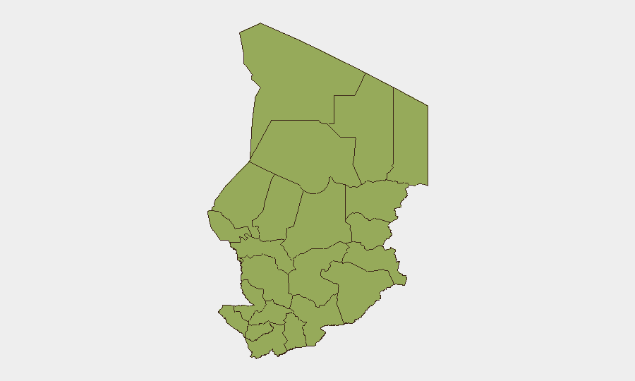
Chad remains a composite-threat environment (global rank #25, score 73) characterized by persistent regional fragmentation, weak state capacity in peripheral zones, and sustained cross-border pressure from militant and criminal actors. The country's security footprint is distributed across twelve sub-national regions, each carrying elevated risk (51.2 composite score). No verified new security incidents have been documented in the last 24–48 hours; however, institutional instability and resource constraints continue to constrain governance and duty-of-care delivery, particularly in the Sahel periphery.
Key Developments
- No verified security incidents reported in the last 24–48 hours. Available open-source signals do not confirm a specific, dated, and localized attack, protest, kidnapping, curfew, or conflict event occurring since 2026-07-06 evening UTC.
- Police/government communication signal (2026-07-06). Two public statements attributed to Chad authorities and police were indexed on 2026-07-06; content and context are not detailed in available feeds and require further corroboration.
- Unconfirmed border-closure claim vs. Nigeria. Social media reports mention alleged Chad border closure with Nigeria tied to militant movement concerns; source credibility and incident date remain unverified and should not be treated as confirmed.
- Diplomatic water-security engagement. A Chadian foreign minister visit on water-security matters (early July) reflects regional diplomatic activity but does not constitute a security or conflict development.
- Ongoing humanitarian and refugee-border dynamics. Long-standing Chad–Sudan border instability and refugee pressures persist as a baseline context; no fresh incident location or date is available.
Highest-Risk Areas
All twelve of Chad's administrative regions carry identical composite risk scores (51.2), indicating either systemic, country-wide threat distribution or assessment-model saturation. In operational terms, Ennedi-Ouest, Wadi Fira, Ouaddaï, and the Lake Chad basin states (Lac, Kanem, Hadjer-Lamis) have historically concentrated militant activity, cross-border trafficking, and humanitarian displacement. N'Djamena, while scored equally, remains the capital and thus the focal point for regime-stability dynamics and potential civil unrest. The flatness of the risk ranking suggests that geospatial and actor-specific intelligence is needed to isolate genuine hot spots from background threat noise.
How GeoBit Would Assist
Security teams with personnel or assets in Chad should deploy AOI (Area of Interest) Monitoring & Early Warning on key nodes—N'Djamena, Abeche, Tiné, and Lake Chad crossing points—to detect protest, roadblock, military movement, or supply-chain disruption in real time. Multi-language OSINT and Telegram/X intelligence feeds would capture early signals of armed-group activity, checkpoint harassment, or regime announcements before they reach mainstream reporting. Conflict mapping and force-structure tracking can clarify which actors (national military, national guard, militia, terrorist groups) control specific zones and how their presence affects staff routing and asset security.
7-Day Outlook
No imminent escalation is flagged in available intelligence. However, the absence of verified 24–48-hour incident reporting does not indicate reduced risk; rather, it suggests that emerging threats may not yet be visible in open sources or that institutional reporting gaps mask on-ground volatility. Security teams should assume baseline elevated risk across the Sahel periphery and maintain heightened situational awareness around N'Djamena, fuel and supply logistics, and cross-border movement.
Highest-Risk Areas — Ranked
| # | State / Region | Risk |
|---|---|---|
| 1 | Ennedi-Ouest | 51.2 |
| 2 | Wadi Fira | 51.2 |
| 3 | Ouaddaï | 51.2 |
| 4 | Sila | 51.2 |
| 5 | Salamat | 51.2 |
| 6 | East Ennedi | 51.2 |
| 7 | Kanem | 51.2 |
| 8 | Lac | 51.2 |
| 9 | N'Djamena | 51.2 |
| 10 | Hadjer-Lamis | 51.2 |
| 11 | Chari-Baguirmi | 51.2 |
| 12 | Tibesti | 51.2 |
Sources
Previous Daily Briefs
A new Chad brief is written every day — each with its own risk map and downloadable CSV. Here's the last week; use the calendar to go further back.
📅 Browse every day by calendar →
Highlighted days have a brief. Tap a day for that day's map & analysis, or “csv” for that day's dataset ($5).
Atlas — our AI intelligence desk — emails them this snapshot personally. Nothing else, no list.