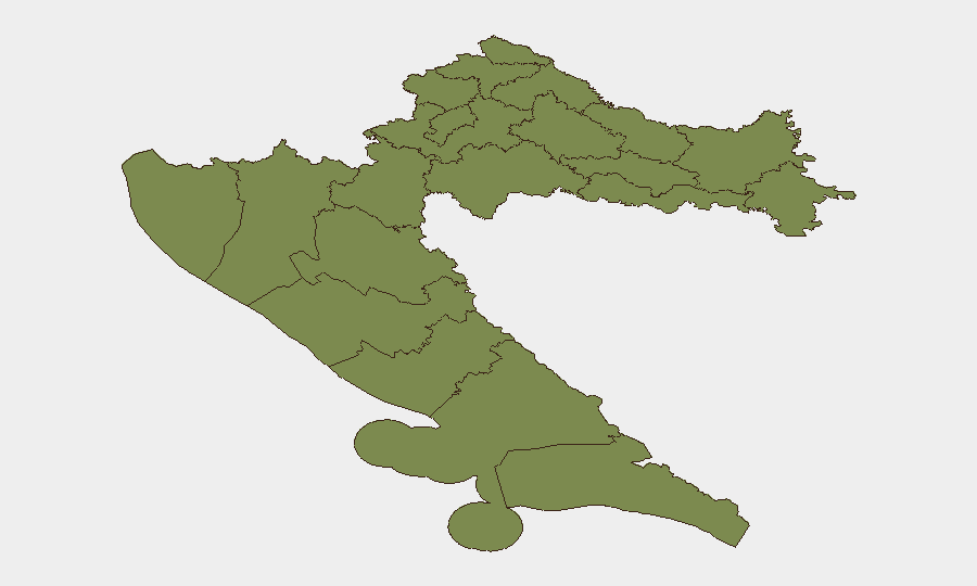
Situation Summary
Croatia remains at low overall threat (composite score 21, rank #null globally), with security conditions characterized by scattered localized incidents rather than systemic instability. The past 48 hours have produced six distinct events spanning occupational safety, environmental contamination, wildfire, aviation, religious-property vandalism, and cross-border irregular migration—none yet indicating coordinated instability or escalating conflict. Šibenik-Knin County continues as the highest-risk sub-national zone (31.3), though the drivers of that elevation are not yet clear from current event data; remaining regions carry minimal to very low residual risk.
Key Developments
- Kukuljanovo industrial zone (Rijeka), 2026-07-30/31: Croatian Public Health Institute confirmed dangerous hydrogen sulphide concentrations in sewers adjacent to Orada Adriatic plant following citizen reports; police investigation opened into localized environmental and infrastructure-safety incident.
- Pazdigrad (Split), 2026-07-31 (~10:15): Construction-site crane collapse resulted in one fatality; incident highlights occupational and infrastructure-safety risk in expanding Split residential zone.
- Podhumlje area (Vis), late 2026-07-30–2026-07-31: Large open-air wildfire across island required 70 firefighters, four helicopters, and mainland reinforcements; short-term travel disruption and infrastructure risk for Komiža and Vis.
- Cvjetni trg (Zagreb), morning 2026-07-31: Vandalism reported at Orthodox Church of the Transfiguration; damage to signage and surfaces; treated as offence against religious property; minor civil-unrest and inter-community tension indicator in central Zagreb.
- Medulin area (Pula, Istria), 2026-07-31: Small aircraft crashed with four confirmed fatalities; emergency services secured site and opened investigation; localized coastal and road-access disruption.
- Croatia–Slovenia border (Novo Mesto and Koper sectors), night 2026-07-30–2026-07-31: Slovenian police intercepted 66 irregular-entry attempts (44 near Novo Mesto, 22 near Koper) originating from Croatia; migrants primarily from Bangladesh, Egypt, Sudan; indicates sustained irregular-migration pressure and intensified border enforcement affecting cross-border road travel.
Highest-Risk Areas
Šibenik-Knin County's elevated composite risk (31.3) substantially outpaces all other regions; underlying drivers require further investigation but warrant focused duty-of-care attention for personnel and assets in that zone. Vukovar-Srijem County (6.3) remains secondary concern, historically reflective of post-conflict legacy sensitivities and border proximity. Zagreb city (2.6) and Dubrovnik-Neretva (2.6) show minor elevated exposure, likely driven by population density and tourism infrastructure; remaining counties fall to baseline minimal risk (1.3). Organizations with operations or personnel in Šibenik-Knin should prioritize targeted area-of-interest monitoring and incident alerting.
How GeoBit Would Assist
Security teams can deploy AOI Monitoring & Early Warning on Šibenik-Knin County and Zagreb to receive real-time alerts on emerging incidents and civil unrest; Intel Sweep and global event feeds to track cross-border irregular-migration patterns and their nexus to Croatia; and GIS & Spatial Analysis plus Routing & Network Analysis to model safe corridors and identify infrastructure-vulnerability hot spots (industrial zones, construction sites, border crossings) for duty-of-care route planning. Environmental & Health data feeds would flag pollution and occupational-safety hazards similar to the Kukuljanovo H₂S incident before they escalate.
7-Day Outlook
Near-term trajectory remains stable with low escalation probability; however, the convergence of wildfire containment needs, migration-enforcement intensity, and isolated civil-unrest indicators (vandalism, occupational incidents) suggests sustained elevated incident frequency rather than strategic threat. Continued monitoring of Šibenik-Knin for emerging patterns and cross-border enforcement activity is warranted through early August.
Highest-Risk Areas — Ranked
| # | State / Region | Risk |
|---|---|---|
| 1 | Šibenik-Knin County | 31.3 |
| 2 | Vukovar-Srijem County | 6.3 |
| 3 | City of Zagreb | 2.6 |
| 4 | Dubrovnik-Neretva County | 2.6 |
| 5 | Krapina-Zagorje County | 1.3 |
| 6 | Međimurje County | 1.3 |
| 7 | Varaždin County | 1.3 |
| 8 | Koprivnica-Križevci County | 1.3 |
| 9 | Zagreb County | 1.3 |
| 10 | Karlovac County | 1.3 |
| 11 | Sisak-Moslavina County | 1.3 |
| 12 | Istria | 1.3 |
Sources
Previous Daily Briefs
A new Croatia brief is written every day — each with its own risk map and downloadable CSV. Here's the last week; use the calendar to go further back.
📅 Browse every day by calendar →
Highlighted days have a brief. Tap a day for that day's map & analysis, or “csv” for that day's dataset ($5).
Atlas — our AI intelligence desk — emails them this snapshot personally. Nothing else, no list.