Situation Summary
DR Congo remains the #32 global security threat (composite score 61), with 1,144 tracked events reflecting persistent armed conflict, health emergency, and state fragmentation. South Kivu is the dominant driver of risk (33.6), with Tshopo a distant second (4.5), indicating highly concentrated instability in the eastern borderlands. The security environment has deteriorated noticeably in the past 48 hours, with escalating M23 activity, cross-border military incursions, telecom infrastructure collapse in rebel-held areas, and direct threats to Ebola containment operations.
Key Developments
- Minembwe, South Kivu – 24–25 June. Armed clashes and drone strikes between M23-aligned forces and FARDC/pro-government coalition intensified around Minembwe town, with documented civilian impact and urgent ceasefire enforcement calls from the 6th Joint Oversight Committee.
- South Kivu Province – 25 June. A conventional military-force incident involving FARDC and a civilian worker was recorded; limited tactical detail available, but confirms ongoing army operations in the province.
- Goma, North Kivu – 23–25 June. Vodacom RDC lost access to multiple technical sites under M23/AFC control, resulting in over 48 hours of mobile and data service disruption—critical for corporate operations and humanitarian coordination.
- Kisangani, Tshopo (Bangoka International Airport vicinity) – 25–26 June. Multiple drone attacks reported near the airport; travel advisories updated to warn against all but essential travel to the area.
- Bunia, Mungwalu (Ituri); Butembo, Beni (North Kivu) – late June, incidents ongoing. Documented attacks and intimidation targeting Ebola treatment centers and response teams are directly disrupting outbreak containment; WHO briefings confirm link between armed activity and outbreak acceleration.
- Lubero territory, North Kivu – 25–26 June. Intensified M23-linked insecurity drove mass civilian displacement; thousands lack food, shelter, and healthcare access.
- Eastern DR Congo (unspecified, involving Sudanese forces) – 26 June. Conventional military-force event involving Sudanese actors confirmed on Congolese soil; precise location and casualty data pending.
- Goma, Bukavu and adjacent areas – confirmed in updated late-June advisories. M23 rebels and Rwanda Defence Forces confirmed holding major urban centers; foreign travel guidance characterizes environment as "highly unstable and unpredictable."
Highest-Risk Areas
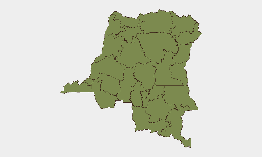
South Kivu's risk score of 33.6 is nearly eight times that of the second-ranked province (Tshopo, 4.5), indicating extreme concentration of threat. The Minembwe escalation, drone activity, and mass displacement in adjacent Lubero territory reflect the persistence of M23/Rwanda-backed insurgency and state incapacity. Tshopo's elevated ranking correlates with drone activity around Kisangani's main international airport, creating critical vulnerability for evacuation and supply routes. All other tracked provinces cluster at 3.6, suggesting a long tail of lower-intensity instability across the north and northwest.
How GeoBit Would Assist
Teams with personnel or assets in DR Congo should deploy AOI Monitoring & Early Warning on South Kivu and Tshopo to detect escalation signals before they impact operations. Conflict & Military battle mapping and force-structure tracking would clarify M23/FARDC/Sudanese disposition and predict flashpoint movement. Intel Sweep and OSINT fusion on telecom and Ebola-response disruptions can identify secondary risks to supply chains and staff safety in real time.
7-Day Outlook
Escalation pressure will remain highest in South Kivu and around Kisangani. Expect continued drone and artillery activity, further telecom disruption in M23-held zones, and worsening Ebola response security—likely forcing more NGO/humanitarian staff relocations. Cross-border Sudanese and Rwandan military involvement may complicate FARDC operations and increase ceasefire violation risk.
Highest-Risk Areas — Ranked
| # | State / Region | Risk |
|---|---|---|
| 1 | South Kivu | 33.6 |
| 2 | Tshopo | 4.5 |
| 3 | Maniema | 3.6 |
| 4 | Sud-Ubangi | 3.6 |
| 5 | Équateur | 3.6 |
| 6 | Nord-Ubangi | 3.6 |
| 7 | Mongala | 3.6 |
| 8 | Lower Uele | 3.6 |
| 9 | Tshuapa | 3.6 |
| 10 | Upper Uele | 3.6 |
| 11 | Ituri | 3.6 |
| 12 | North Kivu | 3.6 |
Sources
Previous Daily Briefs
A new DR Congo brief is written every day — each with its own risk map and downloadable CSV. Here's the last week; use the calendar to go further back.
📅 Browse every day by calendar →
Highlighted days have a brief. Tap a day for that day's map & analysis, or “csv” for that day's dataset ($5).