Situation Summary
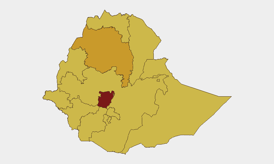
Ethiopia remains in the 10th-highest threat position globally, driven by ongoing civil conflict, armed-group violence, and urban terrorism. The past 48 hours show a continuation of multi-actor tensions—including unverified reports of clashes involving foreign nationals, alleged infrastructure attacks, and documented incidents of urban crime—against a backdrop of Prime Minister Abiy Ahmed's public statements linking Tigray conscription activity, OLA attacks in Oromia, and recent bombings in major cities. Central Ethiopia Regional State carries the highest sub-national risk score (100), reflecting the scale and frequency of armed incidents. The security environment remains volatile with no near-term de-escalation indicators.
Key Developments
- Addis Ababa, Summit Condominium area (12–13 July): Early-morning robbery surge targeting residents reported by diaspora media; police criticized for weak response. Risk type: urban crime with perceived enforcement gaps.
- National (11–12 July): Multiple arrest/detention incidents involving Ethiopian authorities and Nigerian nationals, alongside reported unconventional violence between Nigerian and Ethiopian actors. Specifics remain sparse; independent corroboration pending.
- Tigray region (statement 8 July, current discourse): PM Abiy Ahmed cited intensified Tigray conscription and daily provocations as escalation risks; framed as ongoing concern in parliamentary debate and current diplomatic assessments.
- Addis Ababa, Bahir Dar, Gondar, and Arsi Zone (referenced in recent PM address, exact incident dates unspecified): PM referenced recent bombings in Addis Ababa, Bahir Dar, and Gondar (including student casualties in latter); confirmed attack in Arsi Zone (Oromia) causing 11 deaths (8 police/militia). Urban IED and rural armed-group violence pattern.
- Arsi Zone, Oromia (ongoing since late 2025, cited in current reporting): Ethiopian Human Rights Commission reports persistent OLA attacks across Shirka, Aseko, Merti, Guna, and Honkolo Wabe districts; civilian deaths, destruction, and displacement documented.
- Amhara region near Gondar (claims 8–9 July, unverified): Social media claims of fatal armed attack on UK telecom-linked field personnel circulating in security forums; no corroboration by Reuters, AP, AFP, UN/OCHA, or major NGOs. Should not be treated as established.
- National travel advisory (ongoing): Australian Smartraveller maintains "reconsider your need to travel" rating; recent Marburg virus disease alerts also noted in health-risk channels.
Highest-Risk Areas
Central Ethiopia Regional State (score 100) dominates the threat landscape, reflecting concentrated armed-group and civil-conflict activity. Amhara, Tigray, and six other regions (Afar, Benishangul-Gumuz, Somali, Gambela, South West, and Oromia) all score 70, indicating endemic armed clashes, OLA operations, and inter-communal violence. Addis Ababa (score 70) faces both urban terrorism/IED risk and street crime. The concentration of risk in border and regional-conflict zones underscores the civil-war driver; northern Tigray and eastern Oromia represent both immediate flashpoints and areas of ongoing conscription and armed-group recruitment.
How GeoBit Would Assist
Corporate security teams should employ AOI Monitoring & Early Warning on Central Ethiopia, Amhara, and Tigray to track incident frequency and timing; Intel Sweep and X/Twitter OSINT to rapidly triage unverified claims (e.g., the Gondar telecom report) against authoritative sources; and Conflict & Military battle mapping to understand force positioning and OLA/Tigray movement patterns. Routing & Network Analysis supports alternative journey planning for field teams; Sentiment & Temporal Analysis on social media and diaspora channels flags emerging unrest narratives before mainstream media adoption.
7-Day Outlook
No significant de-escalation is expected in the next week. Arsi Zone and northern Amhara will likely see continued OLA activity and state counter-operations. Urban terrorism risk in Addis Ababa, Bahir Dar, and Gondar remains elevated. Tigray rhetoric may intensify if conscription accusations are met with federal pushback, raising conflict-renewal risk in the north.
Highest-Risk Areas — Ranked
| # | State / Region | Risk |
|---|---|---|
| 1 | Central Ethiopia Regional State | 100 |
| 2 | Amhara Region | 71 |
| 3 | Tigray | 70 |
| 4 | Afar Region | 70 |
| 5 | Benishangul-Gumuz Region | 70 |
| 6 | Somali Region | 70 |
| 7 | Gambela Region | 70 |
| 8 | South West Ethiopia Peoples | 70 |
| 9 | Addis Ababa | 70 |
| 10 | South Ethiopia Regional State | 70 |
| 11 | Oromia Region | 70 |
| 12 | Sidama | 70 |
Sources
Previous Daily Briefs
A new Ethiopia brief is written every day — each with its own risk map and downloadable CSV. Here's the last week; use the calendar to go further back.
📅 Browse every day by calendar →
Highlighted days have a brief. Tap a day for that day's map & analysis, or “csv” for that day's dataset ($5).
Atlas — our AI intelligence desk — emails them this snapshot personally. Nothing else, no list.