Situation Summary
Ghana remains a stable, lower-risk operating environment globally (rank #96, composite score 10), but is experiencing acute localized instability in rural northwestern regions and heightened political tension in Accra. Police-civilian confrontations in Sefwi Sayerano (Western North Region) and armed robbery on major inter-regional roads have triggered community unrest and formal investigations. Concurrent political detention of opposition figures and unconfirmed reports of party-affiliated security formations have elevated concerns about election-cycle polarization and potential violence ahead of scheduled balloting.
Key Developments
- Sefwi Sayerano, Western North Region (11–12 July): Ghana Police Service opened fire during a resident confrontation, killing at least three people; community response included arson at two police posts and road blockades with burning tyres. Eight police officers have been interdicted pending investigation; security presence in the area remains elevated and an ongoing manhunt is active.
- Sunyani–Mim Road, Bono Region (10 July): Armed assailants (suspected Fulani herdsmen) attacked a Toyota Land Cruiser with approximately 15 rounds of ammunition, robbed bystanders of mobile phones, and stole GH¢25,000. Incident video circulated widely on social media, prompting public calls for increased patrols on the route.
- Accra, national level (11–13 July): Economic and Organized Crime Office (EOCO) arrested opposition NPP communications officer Denis "Miracles" Aboagye on suspicion of theft, state financial loss, and money laundering tied to a decentralization committee. NPP supporters mobilized at EOCO offices demanding his release while authorities indicated bail proceedings would continue.
- Accra, national level (11–12 July): NPP Russia Branch chairman publicly denied that "Lions of NPP" formations constitute vigilante groups, following mounting public debate on the risks posed by party-aligned informal security outfits and election-related violence.
- National diplomatic level (9–10 July, ongoing impact): Ghanaian government postponed bilateral talks with South Africa and signaled legal action in response to anti-migrant violence targeting Ghanaians in South Africa and announced repatriations, creating consular and travel risk for affected nationals.
Highest-Risk Areas
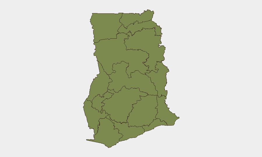
Greater Accra Region dominates the national threat profile (risk score 32.8), reflecting concentrated political volatility, security-force presence, and media attention around arrests and party-aligned formations. Bono East Region (11.9) and Northern Region (8.9) rank second and third due to armed robbery, communal land disputes, and the cascading effects of the Sefwi Sayerano police shootings and road banditry on regional stability and freedom of movement. All other regions remain substantially lower-risk (scores ≤3.2), indicating that acute threats are geographically concentrated in the northwest and the capital.
How GeoBit Would Assist
Security teams with personnel or assets in Ghana should employ AOI Monitoring & Early Warning on Accra (political/detention risk), Sefwi Sayerano and Bono East (road safety and police operations), and key inter-regional routes; Routing & Network Analysis to identify safe transit corridors and avoid high-incident zones; and OSINT fusion (X/Twitter, Telegram, local radio SIGINT) to track police investigations, community sentiment shifts, and party-formation activity that could signal escalation or de-escalation in the coming days.
7-Day Outlook
Sefwi Sayerano is likely to remain under elevated police activity and community tension for 7–14 days as investigations proceed and interdicted officers' status becomes clearer; road banditry on Sunyani–Mim and similar routes will probable persist. In Accra, the Aboagye detention and ongoing debate over party-linked security formations carry risk of further arrests or public mobilization if political temperature rises ahead of scheduled elections; diplomatic friction with South Africa may generate ad-hoc consular disruptions for affected travelers.
Highest-Risk Areas — Ranked
| # | State / Region | Risk |
|---|---|---|
| 1 | Greater Accra Region | 32.8 |
| 2 | Bono East Region | 11.9 |
| 3 | Northern Region | 8.9 |
| 4 | Volta Region | 3.2 |
| 5 | Central Region | 3.2 |
| 6 | Upper East Region | 2.8 |
| 7 | Upper West Region | 2.8 |
| 8 | Savannah Region | 2.8 |
| 9 | North East Region | 2.8 |
| 10 | Eastern Region | 2.8 |
| 11 | Oti Region | 2.8 |
| 12 | Bono Region | 2.8 |
Previous Daily Briefs
A new Ghana brief is written every day — each with its own risk map and downloadable CSV. Here's the last week; use the calendar to go further back.
📅 Browse every day by calendar →
Highlighted days have a brief. Tap a day for that day's map & analysis, or “csv” for that day's dataset ($5).
Atlas — our AI intelligence desk — emails them this snapshot personally. Nothing else, no list.