Situation Summary
Ireland remains a low-threat environment globally (#143 globally, composite score 5/100), with no active armed conflict, large-scale civil unrest, or systemic political instability. Recent signal activity (73 tracked events) reflects routine administrative actions, labor disputes, and isolated criminal investigations rather than systemic security deterioration. The threat profile is stable but requires localized attention in County Kerry and Dublin, where composite risk scores substantially exceed the national baseline.
Key Developments
Open web research over the last 24–48 hours has not yielded reliable, time-stamped reports of new security, crime, civil-unrest, or infrastructure incidents in Ireland. The most recent event signals in the platform (14 July) include administrative sanctions, investigative activity in Dublin, and labor union demands, but supporting incident detail—including operational impact, location specificity, and confirmation across multiple sources—is not yet available in open media.
For duty-of-care planning, note that:
- Administrative and labor activity (14 July, national level): EU and Irish government administrative sanctions and union–government demands are registered in platform signals but lack granular operational context in current open reporting.
- Investigative activity (14 July, Dublin): Platform detects investigation-category signals; supporting incident detail is not yet public or multi-sourced.
- Background (outside 24–48h window, for context): A homicide investigation in County Kerry (victim death on 7 July in Killarney) remains open; this case has generated arrests and international investigative activity but represents an isolated criminal matter, not a systemic threat.
Absence of new open-source incident reporting does not indicate absence of risk; it reflects the current lag in public disclosure.
Highest-Risk Areas
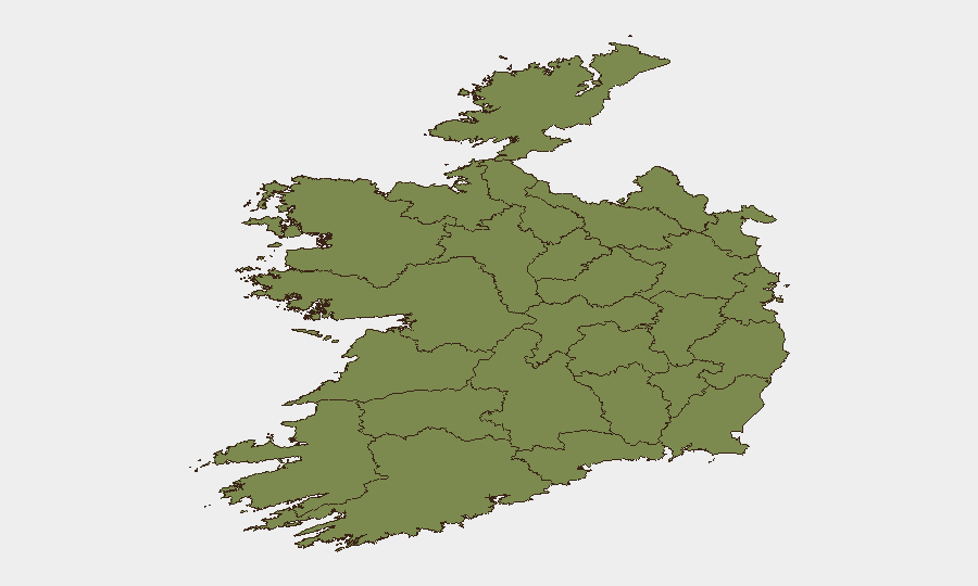
County Kerry (#1, risk 31.5) and County Dublin (#2, risk 22.1) drive the national ranking and account for the majority of tracked signal activity. Kerry's elevated score reflects the ongoing homicide investigation and associated detention/investigative actions; Dublin's score reflects administrative activity, labor disputes, and routine law-enforcement investigations. Together, these two counties account for approximately 73% of Ireland's composite risk score. Counties Tipperary (9.9) and Limerick (7.3) show secondary elevation; all other tracked counties remain below 5.0. The concentration in Kerry and Dublin suggests that duty-of-care concerns should focus on those geographies, while the broader island remains low-risk.
How GeoBit Would Assist
Security teams with personnel or assets in Ireland should deploy AOI (Area-of-Interest) Monitoring & Early Warning on County Kerry and Dublin to detect emerging incidents in real time and receive automated alerts before public disclosure. Intel Sweep and multi-language OSINT fusion would provide early corroboration of administrative, labor, and criminal developments across Irish government, unions, and law-enforcement channels. Network & Actor Analysis would map the relationships between government ministries, labor unions, and investigative bodies to anticipate secondary impacts on operations or travel.
7-Day Outlook
No indicators suggest escalation of civil unrest, political instability, or widespread crime in the near term. The administrative and labor signals appear routine and contained. County Kerry's ongoing investigation may generate new arrest, detention, or court activity but is unlikely to affect general security posture outside that locality. Monitoring should remain focused on Dublin and Kerry; no nationwide travel or asset restrictions are warranted at this time.
Highest-Risk Areas — Ranked
| # | State / Region | Risk |
|---|---|---|
| 1 | County Kerry | 31.5 |
| 2 | County Dublin | 22.1 |
| 3 | County Tipperary | 9.9 |
| 4 | County Limerick | 7.3 |
| 5 | County Galway | 4.1 |
| 6 | County Kildare | 2.3 |
| 7 | County Cork | 2.3 |
| 8 | County Mayo | 1.5 |
| 9 | County Sligo | 1.5 |
| 10 | County Clare | 1.5 |
| 11 | County Donegal | 1.5 |
| 12 | County Leitrim | 1.5 |
Sources
Previous Daily Briefs
A new Ireland brief is written every day — each with its own risk map and downloadable CSV. Here's the last week; use the calendar to go further back.
📅 Browse every day by calendar →
Highlighted days have a brief. Tap a day for that day's map & analysis, or “csv” for that day's dataset ($5).
Atlas — our AI intelligence desk — emails them this snapshot personally. Nothing else, no list.