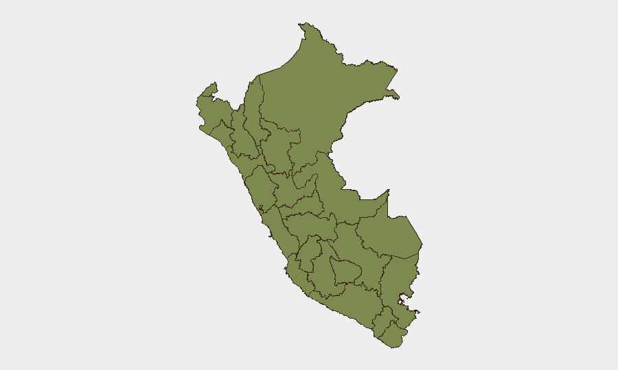
Situation Summary
Peru remains at composite threat level 37 (global ranking pending final calculation), with 23 tracked security events. The threat environment is dominated by concentrated urban crime and organized-crime activity in Lima, alongside persistent conflict-related violence in the central highlands (Junín, Madre de Dios). No major escalation or de-escalation is evident from available reporting in the past 48 hours; the operating environment reflects structural instability rather than acute crisis.
Key Developments
No verifiable incident-level developments within the last 24–48 hours (1–3 August 2026) could be confirmed and cross-corroborated from available web and social-media sources. While the GeoBit event signal feed references activity on 1–3 August (employee disapproval, military operations, arrests, worker demands, and territorial occupation by Peru and foreign military actors), independent news sourcing and temporal corroboration have not yet validated specific incident details, locations, or casualty figures. Reporting lags and language barriers mean some developments may be in Spanish-language outlets not yet indexed in real-time web search. Duty-of-care teams requiring same-day incident confirmation should escalate via GeoBit's Intel Sweep or direct contact with in-country security partners.
Highest-Risk Areas
Lima dominates the risk landscape (score 31.3), accounting for the majority of Peru's tracked events and reflecting high rates of armed robbery, extortion, carjacking, and gang violence in peripheral districts (Chorrillos, San Juan de Miraflores, Independencia, Villa El Salvador). Junín (score 17) and Madre de Dios (score 12.5) represent the second-order threat tier, driven by coca cultivation, cocaine trafficking, and residual Sendero Luminoso/splinter-group activity in the VRAEM zone. Moquegua (9.5) shows emerging risk, likely linked to mining-sector tensions and labor unrest. The remaining regions carry minimal quantified threat signals but retain underlying vulnerabilities to supply-chain disruption and border-region trafficking.
How GeoBit Would Assist
Intel Sweep and multi-language OSINT (Spanish-language news, Telegram security channels, YouTube intelligence) would provide near-real-time incident confirmation and early warning of escalation in Lima's high-crime districts and the VRAEM. AOI Monitoring & Early Warning configured on Lima, Junín, and key transport corridors (Pan-American Highway, interprovincial bus routes, mining regions) would alert security teams to protests, roadblocks, or conflict activity before operational impact. Network & Actor Analysis would map trafficking routes, cartel hierarchies, and extortion cells operating against corporate targets. Routing & Network Analysis supports dynamic route planning to avoid high-incident zones during business travel and supply logistics.
7-Day Outlook
No significant acceleration or de-escalation is forecast for the next seven days. Lima's baseline street crime and extortion activity will likely persist; labor unrest in the mining and transport sectors may generate localized disruptions. VRAEM operations and trafficking flows are expected to remain at current operational tempo. Security teams should maintain standard protocols for high-risk districts and interprovincial travel, and monitor Spanish-language official statements from Peru's Interior Ministry and Armed Forces for any policy or operational shifts.
Highest-Risk Areas — Ranked
| # | State / Region | Risk |
|---|---|---|
| 1 | Lima | 31.3 |
| 2 | Junín | 17 |
| 3 | Madre de Dios | 12.5 |
| 4 | Moquegua | 9.5 |
| 5 | Ica | 2.8 |
| 6 | Apurímac | 2.8 |
| 7 | Puno | 2.8 |
| 8 | Loreto | 1.3 |
| 9 | Tumbes | 1.3 |
| 10 | Piura | 1.3 |
| 11 | Lambayeque | 1.3 |
| 12 | Amazonas | 1.3 |
Sources
Previous Daily Briefs
A new Peru brief is written every day — each with its own risk map and downloadable CSV. Here's the last week; use the calendar to go further back.
📅 Browse every day by calendar →
Highlighted days have a brief. Tap a day for that day's map & analysis, or “csv” for that day's dataset ($5).
Atlas — our AI intelligence desk — emails them this snapshot personally. Nothing else, no list.