Situation Summary
The Philippines remains a mid-tier global security concern (rank #43, composite score 38) with heightened volatility driven by overlapping maritime disputes, domestic insurgent activity, and urban crime. The past 48 hours have surfaced elevated diplomatic friction across Southeast Asia—with seven "Disapprove" signals logged on 23 July involving Philippines, Vietnam, Indonesia, and Malaysia—alongside continued military incidents in Mindanao and ongoing volcanic and seismic hazards. Risk is heavily concentrated in Metro Manila and peripheral conflict zones; trajectory remains unstable.
Key Developments
- Shariff Saydona Mustapha, Maguindanao del Sur – 19 July 2026 (1900 hrs)
Armed individuals hurled an explosive device at Linantangan Patrol Base (34th Infantry Battalion, Philippine Army), triggering a 20-minute firefight; no casualties reported. Incident linked to ongoing grenade attacks on military targets in BARMM.
- Shariff Aguak, Maguindanao del Sur – 18 July 2026 (0630 hrs)
Motorcycle-mounted suspects detonated a grenade at an Army convoy, wounding two soldiers and three civilians; suspects fled; heightened checkpoints and manhunt operations remain active under BARMM gun ban.
- Metro Manila – mid-July, investigation ongoing
PNP and Napolcom are investigating alleged harassment of two photojournalists by Pasay City police at an ASEAN-related rally; press-freedom concerns remain active in current executive-security reporting.
- Caloocan City, Metro Manila – mid-July, active manhunt
Vlogger Alicia Lipata was shot dead; partner wounded; PNP chief reports ongoing hot-pursuit operations and investigation into potential links to organized crime syndicate.
- Balut Island area, Sarangani – recent days
Phivolcs recorded two aftershocks near Balut Island; PAGASA warnings for habagat-driven heavy rains affecting Mindanao, raising localized flooding and landslide risks.
- Mayon Volcano, Albay – ongoing as of latest bulletin
Alert Level 3 status maintained; 6-km permanent danger zone enforced; continued lava collapses and incandescent flows restrict travel and infrastructure access.
- Regional diplomatic escalation – 23 July 2026
Seven high-level "Disapprove" signals recorded in 24 hours involving Philippines, Vietnam, Indonesia, and Malaysia; reflects acute South China Sea tension and potential impact on Philippine maritime operations.
Highest-Risk Areas
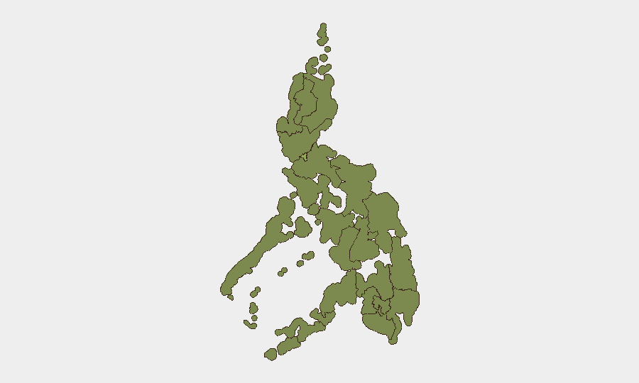
Metro Manila dominates the national risk profile (56.3), driven by urban crime, police accountability gaps, and press-freedom concerns now under official investigation. Cordillera, Cagayan Valley, and Calabarzon regions (32.1–27.6) remain elevated due to persistent insurgent activity and military operations. Bangsamoro (26.3) and surrounding Mindanao regions sustain military-grade asymmetric threats, evidenced by the two grenade attacks in Maguindanao del Sur within 24 hours; these zones remain the primary locus of conventional armed conflict risk. Natural hazards (volcanic and seismic) add secondary risk in Albay and Sarangani.
How GeoBit Would Assist
Security teams should deploy AOI Monitoring & Early Warning on Mindanao conflict zones (particularly Maguindanao del Sur) to detect emerging patterns in grenade attacks and military operations before impact. Intel Sweep and OSINT fusion across social media and official channels (X, Telegram, police statements) enable real-time tracking of Manila organized-crime activity and press-freedom incidents. Conflict & Military force-structure monitoring combined with Network & Actor Analysis would map emerging insurgent cells and their operational rhythms, supporting duty-of-care briefings for personnel in high-risk areas.
7-Day Outlook
Mindanao-based insurgent activity is likely to persist at current tempo; diplomatic friction across the South China Sea may amplify nationalist rhetoric and military posturing, indirectly elevating security-force tensions. Metro Manila remains exposed to opportunistic urban crime and law-enforcement misconduct. Volcanic and seismic hazards will continue to disrupt transport and critical infrastructure in affected zones.
Highest-Risk Areas — Ranked
| # | State / Region | Risk |
|---|---|---|
| 1 | Metro Manila | 56.3 |
| 2 | Cordillera Administrative Region | 32.1 |
| 3 | Cagayan Valley | 31 |
| 4 | Calabarzon | 27.6 |
| 5 | Ilocos Region | 27.3 |
| 6 | Davao Region | 26.5 |
| 7 | Central Luzon | 26.5 |
| 8 | Bangsamoro | 26.3 |
| 9 | Caraga | 26.3 |
| 10 | Northern Mindanao | 26.3 |
| 11 | Soccsksargen | 26.3 |
| 12 | Bicol Region | 26.3 |
Sources
Previous Daily Briefs
A new Philippines brief is written every day — each with its own risk map and downloadable CSV. Here's the last week; use the calendar to go further back.
📅 Browse every day by calendar →
Highlighted days have a brief. Tap a day for that day's map & analysis, or “csv” for that day's dataset ($5).
Atlas — our AI intelligence desk — emails them this snapshot personally. Nothing else, no list.