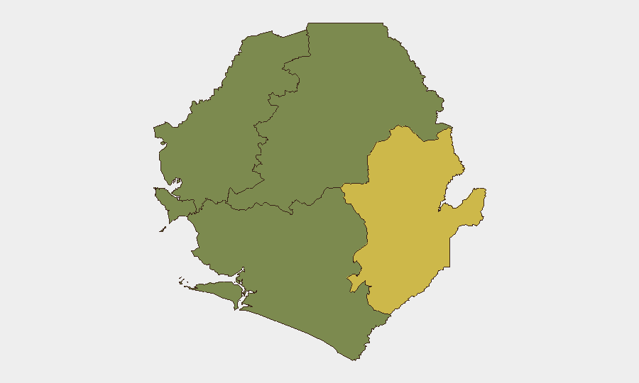
Situation Summary
Sierra Leone remains a high-caution environment characterized by persistent violent crime, sporadic civil unrest, and fragile institutional capacity, with an overall composite threat score placing it at #104 globally. No discrete security incidents have been reliably confirmed in open sources for the 24–48 hour window ending 2026-07-12. The security picture is defined by ongoing patterns—armed robbery and carjacking concentrated in urban centers, particularly Freetown—rather than acute escalation. Trajectory remains stable but dependent on political dynamics and rainy-season movement constraints.
Key Developments
No time-stamped, independently corroborated security incidents (armed conflict, protest, major crime event, or infrastructure failure) affecting corporate personnel or operations have been confirmed in Sierra Leone for 2026-07-10 through 2026-07-12 via official advisories, major news feeds, or social media monitoring.
Background context (for duty-of-care planning): General travel advisories continue to flag elevated risk of armed robbery, carjacking, and burglary in Freetown, particularly Eastern Freetown, the Lumley roundabout, and Lumley Beach after dark. Occasional demonstrations occur and have historically turned violent, though no specific protest is currently reported. These represent structural rather than acute threats.
Highest-Risk Areas
Eastern Province dominates the sub-national risk profile with a composite score of 68, substantially higher than Western Area (35) and other regions. Within Western Area, Freetown and its surroundings (particularly the eastern districts) account for the majority of reported violent crime and civil unrest risk. Northern, Southern, and North West Provinces register minimal tracked threat activity. Corporate presence and critical infrastructure concentration in Freetown and surrounding Western Area mean that crime, protest disruption, and occasional armed incidents in those zones pose the primary operational threat to personnel movement, supply chains, and facility security.
How GeoBit Would Assist
Teams should employ AOI Monitoring & Early Warning with persistent watch on Freetown's high-crime and protest-prone neighborhoods to trigger alerts before escalation affects operations. OSINT fusion across social media, local news, and police announcements (Intel Sweep, X/Twitter & Telegram OSINT, multi-language search) enables real-time detection of demonstrations, roadblocks, or security operations that disrupt movement. Routing & Network Analysis allows security teams to model safe alternative routes around Freetown and identify checkpoint locations before personnel transit, while GIS & Spatial Analysis maps crime and unrest density to inform site hardening and curfew decisions.
7-Day Outlook
No acute threat escalation is forecast for the next seven days; however, rainy season conditions may increase movement friction and access difficulty. Risk remains concentrated in Freetown and remains driven by underlying crime and periodic political tension rather than organized conflict. Duty-of-care teams should maintain standard heightened protocols for urban movement and monitor local police/government channels for any sudden demonstration or security operation announcements.
Highest-Risk Areas — Ranked
| # | State / Region | Risk |
|---|---|---|
| 1 | Eastern Province | 68 |
| 2 | Western Area | 35 |
| 3 | North West Province, Sierra Leone | 0 |
| 4 | Northern Province, Sierra Leone | 0 |
| 5 | Southern Province, Sierra Leone | 0 |
Sources
Previous Daily Briefs
A new Sierra Leone brief is written every day — each with its own risk map and downloadable CSV. Here's the last week; use the calendar to go further back.
📅 Browse every day by calendar →
Highlighted days have a brief. Tap a day for that day's map & analysis, or “csv” for that day's dataset ($5).
Atlas — our AI intelligence desk — emails them this snapshot personally. Nothing else, no list.