Situation Summary
Yemen remains mired in active civil conflict with escalating cross-border military engagement as of 26 July 2026. The past 48 hours have witnessed a sharp uptick in coalition airstrikes targeting Houthi-held areas and coordinated Houthi ballistic and cruise missile attacks on Saudi Arabian infrastructure, signaling renewed intensity in the Iran–Saudi proxy confrontation. The national composite threat score of 72 reflects persistent fragmentation of state authority, competing militant factions, and the sustained risk of collateral impact on civilian infrastructure and international shipping lanes.
Key Developments
- Marib & Al-Jawf governorates (25 July): Saudi-led coalition warplanes conducted airstrikes on Houthi missile launchers, Katyusha rocket bases, and weapons depots across Al-Jubah, Majzar, and Al-Safra districts; multiple Houthi combatants, including missile specialists, reported killed.
- Hodeidah governorate (24–25 July): Coalition forces carried out sequential airstrikes on Houthi military installations and service infrastructure in and around the western port city of Hodeidah, explicitly framed as retaliation for Red Sea shipping attacks.
- Kamaran Island, Red Sea (24–25 July): Saudi airstrikes targeted telecommunications and other facilities on the Houthi-held island off Hodeidah; at least one civilian injury reported.
- Jizan, Saudi Arabia (25 July): Houthi forces claimed ballistic and cruise missile attacks on Saudi Aramco facilities in Jizan; Saudi air defense reported interception of multiple ballistic missiles originating from Yemen.
- Yanbu, western Saudi Arabia (25 July): Houthi military spokesmen announced coordinated ballistic missile, cruise missile, and drone strikes against Saudi Aramco facilities; Saudi authorities acknowledged interception operations but did not confirm damage.
- Northern Yemen reinforcements (25 July): Coalition airstrikes intensified against Houthi force concentrations and supply lines in Marib and Al-Jawf, coinciding with announced escalation in Yemeni government combat readiness.
- Cross-border escalation pattern: The 24–48 hour cycle shows synchronized Houthi attacks on Saudi infrastructure followed by coalition response strikes, indicating sustained operational tempo and willingness to expand targeting beyond Yemen's borders.
Highest-Risk Areas
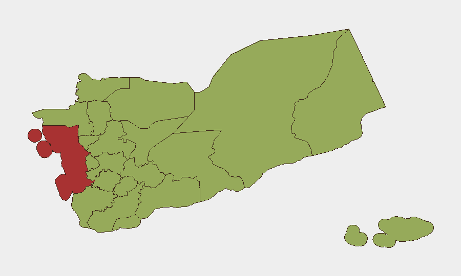
Amanat Al Asimah (Sana'a city, risk 80.5) and Al Hudaydah Governorate (78.3) dominate the risk ranking due to concentration of Houthi military and administrative infrastructure, ongoing coalition targeting, and density of civilian populations. Marib Governorate (55.5) remains a secondary flashpoint, with active coalition operations against missile and weapons facilities reported within the past 48 hours. The clustering of northern and western governorates at 50.5 reflects diffuse conflict dynamics, fragile local security architectures, and vulnerability to cross-border spillover; the recent Kamaran Island strike and Hodeidah airstrikes reinforce that coastal and port areas face elevated targeting risk linked to Red Sea shipping tensions.
How GeoBit Would Assist
Teams with Yemen operations should employ Battle Mapping and Force Structure tracking to monitor coalition and Houthi position shifts in real time, coupled with Satellite & Imagery Analysis to assess damage patterns and infrastructure viability post-strike. AOI Monitoring & Early Warning on Amanat Al Asimah, Al Hudaydah, and Marib, with multi-language OSINT and social-media intelligence (X/Telegram feeds, Yemeni Armed Forces statements), enables rapid detection of attack claims and coalition responses before secondary escalation. Maritime tracking complements situational awareness for Red Sea and port operations.
7-Day Outlook
The oscillating pattern of Houthi strikes and coalition responses is likely to persist through early August absent significant diplomatic intervention. Risk of further infrastructure damage in Hodeidah, Jizan, and Yanbu remains elevated. Personnel and asset security teams should anticipate continued air operations, potential supply-chain disruption, and elevated volatility in contested northern and coastal zones.
Highest-Risk Areas — Ranked
| # | State / Region | Risk |
|---|---|---|
| 1 | Amanat Al Asimah | 80.5 |
| 2 | Al Hudaydah Governorate | 78.3 |
| 3 | Marib Governorate | 55.5 |
| 4 | Abyan Governorate | 50.9 |
| 5 | Sa'dah Governorate | 50.5 |
| 6 | Hajjah Governorate | 50.5 |
| 7 | Al Mahwit Governorate | 50.5 |
| 8 | 'Amran Governorate | 50.5 |
| 9 | Sana'a Governorate | 50.5 |
| 10 | Raymah Governorate | 50.5 |
| 11 | Dhamar Governorate | 50.5 |
| 12 | Ibb Governorate | 50.5 |
Sources
Previous Daily Briefs
A new Yemen brief is written every day — each with its own risk map and downloadable CSV. Here's the last week; use the calendar to go further back.
📅 Browse every day by calendar →
Highlighted days have a brief. Tap a day for that day's map & analysis, or “csv” for that day's dataset ($5).
Atlas — our AI intelligence desk — emails them this snapshot personally. Nothing else, no list.