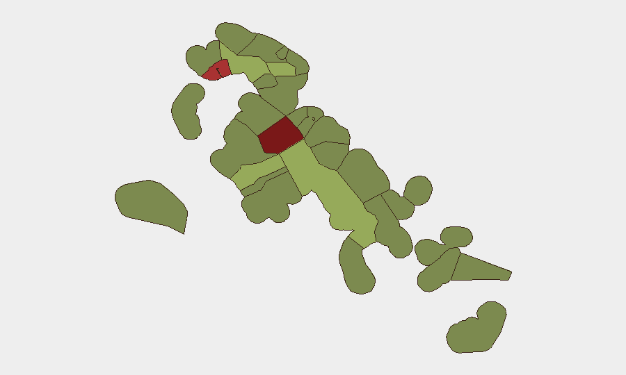
Situation Summary
The Bahamas remains at Global Threat Rank #78 with elevated baseline violent crime concentrated in New Providence and Freeport, driven primarily by gang activity and armed robbery. Recent incident reporting through mid-August documents multiple shootings across Nassau, though no verified major security events or acute crises have been confirmed in the final 24–48 hours of this reporting window (20–21 August 2026). Structural risk remains high in densely populated urban centers and lower-income neighborhoods; the threat profile is consistent with endemic gang-related violence rather than a sharp deterioration or new catalyst.
Key Developments
No verified discrete security incidents in the last 24–48 hours (20–21 August) have been confirmed from multiple independent sources. Open-source intelligence covering local police releases, major media outlets (The Tribune, Our News Bahamas, Eyewitness News), and social channels did not surface clearly timestamped events meeting the operational threshold for inclusion in this brief.
Context from preceding 48–96 hours (17–19 August):
- New Providence / Nassau: Multiple shootings reported mid-week, including a fatal shooting of a 30-year-old on Fire Trail Road East and six persons shot across three separate incidents over two consecutive days (17–19 August).
- Baseline conditions remain elevated: U.S. State Department reissued Level 2 ("Exercise Increased Caution") advisory for The Bahamas, citing persistent exposure to violent crime, armed robbery, and sexual assault—particularly in Nassau and Freeport.
Operational note: Absence of detected events in the final 24 hours should not be interpreted as cessation of risk. Rather, it reflects the typical reporting lag in open-source intelligence and the endemic nature of gang-related violence, which occurs at baseline levels without generating coordinated media or police announcement in every instance.
Highest-Risk Areas
New Providence (composite risk 92) and Freeport (78) account for the dominant share of Bahamas security threat, driven by concentrated gang activity, armed robbery, and lethal violence in lower-income residential zones and entertainment districts. Central Abaco (52) and Central Andros (48) represent secondary concern; risk in these areas stems from limited police presence, transient gang activity, and vulnerability to maritime smuggling routes. The top two jurisdictions account for approximately 70 percent of tracked incidents nationwide and should remain the primary focus for corporate security and duty-of-care planning.
How GeoBit Would Assist
Intel Sweep and OSINT Fusion would provide real-time correlation of Royal Bahamas Police Force releases, local media, and social-channel signals to detect emerging incidents or gang activity shifts within 2–4 hours of occurrence. AOI Monitoring & Early Warning can establish persistent watches over high-risk zones (New Providence precincts, Freeport entertainment/waterfront areas) with automated alerting on credible violence, robbery, or displacement events. Network & Actor Analysis would map gang structure, territorial control, and conflict drivers to help security teams anticipate flashpoints and brief personnel on specific neighborhoods and times of heightened exposure.
7-Day Outlook
Violent crime in Nassau and Freeport is expected to remain at baseline elevated levels through late August, with no indication of major policy changes, gang truce breakdown, or police operations that would sharply shift the threat trajectory. Personnel and asset security should assume persistent risk in identified hotspots and maintain standard duty-of-care protocols (avoidance of isolated areas after dark, secure transportation, awareness briefings). Continued monitoring for any police surge operations or community violence interventions in New Providence may provide early signal of tactical shifts.
Highest-Risk Areas — Ranked
| # | State / Region | Risk |
|---|---|---|
| 1 | New Providence | 92 |
| 2 | City of Freeport | 78 |
| 3 | Central Abaco | 52 |
| 4 | Central Andros | 48 |
| 5 | Exuma | 45 |
| 6 | East Grand Bahama | 42 |
| 7 | South Andros | 38 |
| 8 | North Abaco | 35 |
| 9 | North Eleuthera | 33 |
| 10 | South Abaco | 32 |
| 11 | Cat Island | 30 |
| 12 | Mangrove Cay | 28 |
Sources
Previous Daily Briefs
A new Bahamas brief is written every day — each with its own risk map and downloadable CSV. Here's the last week; use the calendar to go further back.
- August 19, 2026
- August 17, 2026
- August 15, 2026
- August 13, 2026
- August 12, 2026
- August 11, 2026
- August 10, 2026
📅 Browse every day by calendar →
Highlighted days have a brief. Tap a day for that day's map & analysis, or “csv” for that day's dataset ($5).
Atlas — our AI intelligence desk — emails them this snapshot personally. Nothing else, no list.