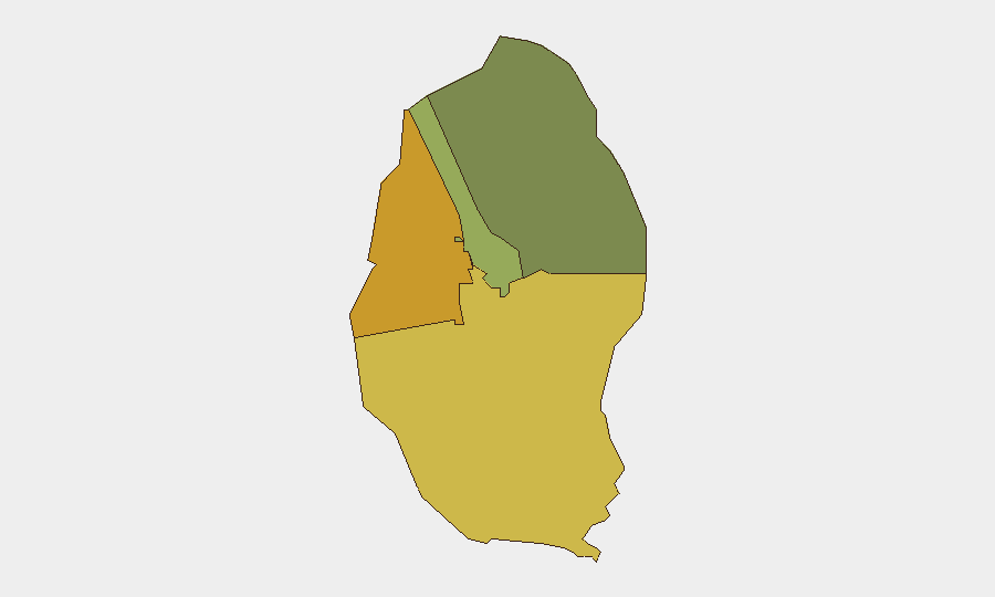
Situation Summary
Bahrain remains a low-threat environment globally (ranked #99) but sits within a volatile regional security corridor defined by Iran–Gulf state tensions. Two significant developments on 8 August—an aerial interception by Bahrain Defence Force and a citizenship-stripping action against 69 individuals—signal elevated state concern over Iranian regional activity and domestic messaging aligned with Iranian positions. The Northern and Southern Governorates carry substantially elevated internal risk (72 and 68 respectively), suggesting concentration of security concerns outside the capital. No tracked security incidents have occurred in Bahrain proper in the assessment period.
Key Developments
- 8 August 2026 · Aerial Interception · Manama. Bahrain Defence Force reported successful interception of aerial threats originating from Iran. No casualties or damage assessments disclosed; incident reflects active air-defence posture in response to regional missile/drone activity.
- 8 August 2026 · Citizenship Revocation · Nationwide. Bahrain authorities stripped 69 individuals of citizenship for allegedly glorifying Iranian attacks. Action indicates security-service focus on domestic pro-Iran sentiment and domestic-messaging control during heightened regional tensions.
- 7 August 2026 · Foreign Policy Statement · Manama. Bahrain's foreign ministry condemned Houthi attacks on Saudi civilian targets. Statement reaffirms Bahrain's alignment with Gulf Cooperation Council members and reinforces regional coalition posture, but does not constitute a direct incident on Bahraini soil.
Note: Web research conducted 10–11 August identified no additional discrete incidents in the 24–48 hours prior to this brief. The regional security environment (July–August 2026) has been marked by Iranian aerial operations and Houthi maritime/air activity affecting the broader Gulf; Bahrain's response has remained defensive and administrative rather than responsive to direct attack.
Highest-Risk Areas
Northern Governorate (composite risk 72) and Southern Governorate (risk 68) represent the primary internal risk concentrations—more than 50% higher than the Capital Governorate (45). These areas have historically experienced sectarian tensions, protest activity, and alleged Iranian influence networks; their elevation in current rankings suggests either intensified monitoring, recent intelligence assessment, or structural vulnerability to spillover from regional escalation. Capital Governorate, home to Manama and critical infrastructure (ports, financial center, government), ranks third—reflecting protective security posture rather than imminent incident risk. Muharraq, the northern island hub, carries the lowest sub-national score (38) but remains above national baseline.
How GeoBit Would Assist
Persistent monitoring via AOI (Area-of-Interest) Monitoring & Early Warning capability would enable continuous watch on Northern and Southern Governorates with alert thresholds for protest activity, security-force deployments, or incident clustering. OSINT fusion—combining X/Twitter, Telegram, and local news feeds with multi-language analysis—would provide real-time early warning of domestic sentiment shifts, planned demonstrations, or cross-border activity signaling escalation. Entity extraction and network analysis would map pro-Iran messaging networks flagged by citizenship actions, supporting duty-of-care risk assessment for corporate personnel.
7-Day Outlook
Bahrain's security posture will likely remain elevated but stable through mid-August. Regional tensions (Iran–Saudi, Houthi–coalition) create persistent low-level spillover risk to Bahraini airspace and maritime zones, but no indicators suggest direct Iranian or proxy attack on Bahraini territory. Monitoring of citizenship-revocation follow-up actions and any further air-defence exercises will clarify whether current measures reflect temporary escalation or sustained threat perception.
Highest-Risk Areas — Ranked
| # | State / Region | Risk |
|---|---|---|
| 1 | Northern Governorate | 72 |
| 2 | Southern Governorate | 68 |
| 3 | Capital Governorate | 45 |
| 4 | Muharraq Governorate | 38 |
Sources
Previous Daily Briefs
A new Bahrain brief is written every day — each with its own risk map and downloadable CSV. Here's the last week; use the calendar to go further back.
📅 Browse every day by calendar →
Highlighted days have a brief. Tap a day for that day's map & analysis, or “csv” for that day's dataset ($5).
Atlas — our AI intelligence desk — emails them this snapshot personally. Nothing else, no list.