Situation Summary
Central African Republic remains at composite threat rank #24 globally with a 90-point composite score and no tracked security events in the past 24–48 hours according to available open-source corroboration. The country exhibits endemic insecurity across all major prefectures—all 12 highest-risk administrative divisions carry identical composite scores of 62.9—driven by persistent armed-group activity, humanitarian access constraints, and weak state capacity. Recent institutional friction (central-bank disputes, election-commission tensions) signals potential governance volatility, but no acute conflict escalation or mass-casualty incidents have been documented in the immediate reporting window.
Key Developments
- No reliably dated CAR-specific security incidents in the past 24–48 hours have been corroborated across accessible open sources, social media, and humanitarian situation reports. Available event signals are either institutional disputes (bank/election-commission friction) with no direct security implication, or regional developments (DRC tensions with Nigeria, Uganda, Mozambique, Ghana) that do not currently map to CAR operations.
- Humanitarian access constraints persist in Haut-Mbomou prefecture, particularly around Zémio and main road corridors; as of 23 June 2026, aid organizations suspended field operations due to route insecurity. This reflects ongoing armed-group control of transit zones and should be factored into duty-of-care movement planning, though no new deterioration in the past 48 hours has been documented.
- Cholera health alert near Bangui with reported 24 deaths and 197 confirmed cases; exact date unavailable in open sources, but represents an indirect security and evacuation risk for personnel with pre-existing health vulnerabilities.
- MINUSCA disarmament operations in June 2026 resulted in disarming 97 ex-combatants and collecting 76 weapons, indicating ongoing low-level peace-process activity, though specific dates and locations are unavailable.
- Regional diplomatic deterioration: Multiple African states (Nigeria, Uganda, Mozambique, Ghana) have reduced relations with the Democratic Republic of Congo as of 30 June 2026. While CAR is not a direct party, DRC instability and cross-border arms flows create secondary pressure on CAR's eastern and southern borders and can fuel refugee movements and militia recruitment.
Highest-Risk Areas
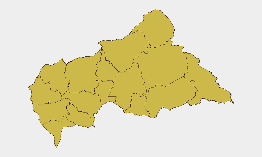
All 12 prefectures carry identical risk scores (62.9), indicating geographically dispersed threat. The eastern tier—Bamingui-Bangoran, Vakaga, Haute-Kotto, Haut-Mbomou, and Mbomou—borders DRC and Sudan, where transnational armed groups, mineral-trafficking networks, and refugee movements create sustained pressure. Western and northwestern prefectures (Nana-Mambéré, Ouham-Pendé, Mambéré-Kadéï, Ouham) experience similar levels of armed-group fragmentation and banditry. Humanitarian organizations have flagged southeastern routes (Zémio area) as particularly constrained. Absence of geographic variation in risk scores suggests systemic, nationwide insecurity rather than localized hotspots.
How GeoBit Would Assist
Security teams should employ Area-of-Interest Monitoring & Early Warning on key CAR routes (Zémio corridors, Bangui-Bouar highway) and prefecture administrative centers to detect armed-group movement and checkpoint establishment before they affect operations. Multi-language OSINT fusion across French-language local media, Telegram militia channels, and humanitarian-coordination feeds will surface access warnings and security incidents with finer temporal resolution than English-language open sources. Routing & Network Analysis can establish real-time alternative movement corridors when main roads become impassable.
7-Day Outlook
No escalation beyond current endemic insecurity is signaled for the next seven days. Regional DRC tensions may indirectly increase eastern-border instability and militia recruitment, but no major tactical shift in CAR armed groups has been reported. Humanitarian access constraints in the southeast are likely to persist; organizations and corporate teams should assume Zémio-area operations remain restricted through at least mid-July unless secondary sources indicate corridor reopening.
Highest-Risk Areas — Ranked
| # | State / Region | Risk |
|---|---|---|
| 1 | Bamingui-Bangoran | 62.9 |
| 2 | Vakaga | 62.9 |
| 3 | Haute-Kotto | 62.9 |
| 4 | Haut-Mbomou | 62.9 |
| 5 | Mbomou | 62.9 |
| 6 | Nana-Mambéré | 62.9 |
| 7 | Ouham-Pendé | 62.9 |
| 8 | Mambéré-Kadéï | 62.9 |
| 9 | Sangha-Mbaéré | 62.9 |
| 10 | Ouham | 62.9 |
| 11 | Nana-Grébizi | 62.9 |
| 12 | Kémo | 62.9 |
Sources
Previous Daily Briefs
A new Central African Republic brief is written every day — each with its own risk map and downloadable CSV. Here's the last week; use the calendar to go further back.
📅 Browse every day by calendar →
Highlighted days have a brief. Tap a day for that day's map & analysis, or “csv” for that day's dataset ($5).