Situation Summary
DR Congo remains in acute instability across its eastern provinces, with heavy fighting between M23/AFC forces (backed by Rwanda) and FARDC-led coalitions continuing to drive mass displacement and civilian harm. The security picture has deteriorated materially in the past 48 hours, with intensified clashes, drone strikes, and communications disruption concentrated in North Kivu and South Kivu. Ceasefire enforcement mechanisms are failing; the Joint Oversight Committee has flagged Minembwe and surrounding areas as flashpoints where violence is actively undermining agreed frameworks. Risk is heavily concentrated in Ituri and South Kivu, with secondary concern across northern provinces.
Key Developments
- Minembwe, South Kivu (24–26 June): Intensified armed clashes and drone strikes between M23-aligned forces and FARDC/pro-government coalition documented with civilian impact; Joint Oversight Committee statement highlights escalation and ceasefire violations.
- Lubero territory, North Kivu (25–26 June): M23-linked violence driving mass civilian displacement; thousands of displaced persons lack food, shelter, and healthcare access; aid agencies flag situation as critical.
- Bangoka International Airport area, Kisangani, Tshopo (25–26 June): Multiple drone attacks reported near airport; updated travel advisories issued warning against all but essential travel to airport vicinity due to aerial threat.
- Goma area, North Kivu (23–25 June): Vodacom RDC lost access to multiple technical sites under M23/AFC control, resulting in 48+ hours of mobile and data service disruption affecting corporate, humanitarian, and security communications.
- Rubaya and Rutshuru, North Kivu (late June): Ongoing clashes centered on Rubaya (key mining hub) and Rutshuru; active front lines elevated risk to mining operations and road travel in North Kivu.
- South Kivu Province (25 June): Conventional military incident involving FARDC and civilian worker recorded; confirms continued army operations and civilian interface amid wider M23/RDF conflict.
- Eastern DR Congo broadly (up to 26–27 June): UN assessment notes heavy fighting continues between AFC/M23 and FARDC-Wazalendo coalitions across North and South Kivu, with civilians sustaining "heavy toll"; security described as "highly unstable."
Highest-Risk Areas
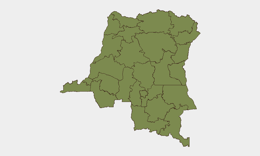
Ituri province dominates the threat landscape with a composite risk score of 34.8—more than four times higher than the second-ranked region—driven by persistent armed-group activity and militia operations. South Kivu follows at 7.3, with Minembwe and surrounding areas now the epicenter of active M23/FARDC clashes and drone strikes. The remaining nine provinces (Maniema, Nord- and Sud-Ubangi, Équateur, Mongala, Lower and Upper Uele, Tshopo, Tshuapa, and North Kivu) cluster at 4.8, indicating baseline insecurity but lower immediate intensity. Corporate and duty-of-care risk concentrates sharply in Ituri and South Kivu; North Kivu's inclusion reflects recent escalation around Goma, Lubero, and mining zones.
How GeoBit Would Assist
Security teams protecting personnel or assets in DR Congo should employ AOI Monitoring & Early Warning to track real-time developments in Ituri, South Kivu, and North Kivu mining corridors, with persistent alerting on clashes, displacement, and access disruption. Routing & Network Analysis is critical for journey planning around active conflict lines (Minembwe, Rubaya, Lubero) and communication-infrastructure failures (Goma telecom outages). Conflict & Military mapping combined with satellite and imagery analysis provides current force-position and displacement data to inform evacuation or relocation decisions.
7-Day Outlook
Ceasefire mechanics remain non-functional; fighting is expected to persist in Minembwe, Lubero, and Rubaya zones through early July unless diplomatic intervention materializes. Drone strikes, displacement, and communications disruption are likely to continue as M23/FARDC contest control of mining and strategic terrain. Risk to road travel, airport operations, and telecommunications infrastructure remains elevated; organizations should assume communications delays and route unpredictability in North and South Kivu.
Highest-Risk Areas — Ranked
| # | State / Region | Risk |
|---|---|---|
| 1 | Ituri | 34.8 |
| 2 | South Kivu | 7.3 |
| 3 | Maniema | 4.8 |
| 4 | Sud-Ubangi | 4.8 |
| 5 | Équateur | 4.8 |
| 6 | Nord-Ubangi | 4.8 |
| 7 | Mongala | 4.8 |
| 8 | Lower Uele | 4.8 |
| 9 | Tshopo | 4.8 |
| 10 | Tshuapa | 4.8 |
| 11 | Upper Uele | 4.8 |
| 12 | North Kivu | 4.8 |
Sources
Previous Daily Briefs
A new DR Congo brief is written every day — each with its own risk map and downloadable CSV. Here's the last week; use the calendar to go further back.
📅 Browse every day by calendar →
Highlighted days have a brief. Tap a day for that day's map & analysis, or “csv” for that day's dataset ($5).