Situation Summary
Ghana remains at low-to-moderate global risk (rank #96, composite threat score 11) with concentrated vulnerability in Greater Accra Region, which accounts for the majority of tracked security events. Recent signals (16–18 July) indicate political tension and institutional pressure, centered on parliamentary and regulatory bodies, with overlapping police activity and diplomatic friction toward Nigeria. No major escalation or mass-casualty incidents have been confirmed in open sources within the past 48 hours. The security environment is stable but warrants close monitoring of Accra-based political and institutional developments.
Key Developments
Current open-source and X/Twitter reporting does not surface sufficiently detailed, independently corroborated security incidents in Ghana within the 16–18 July 2026 window to responsibly list as discrete events. GeoBit's proprietary threat signals (dated 16–17 July) reference police arrests, parliamentary demands, and SEC-directed pressure campaigns, alongside a presidential statement on Nigeria; however, these lack concrete operational detail (specific locations, arrest targets, casualty figures, or infrastructure impact) and independent media/social corroboration.
For context, more recent confirmed incidents outside the 48-hour window include:
- Nsawam-Adoagyiri (Eastern Region), 7 July 2026: Prison facility riots; no current escalation reported.
- Sefwi Sayerano (Western Region), 11–12 July 2026: Police-involved shootings; incident resolved.
Corporate security teams should monitor GeoBit alerts for clarification on the scope and locations of the 16–17 July signals as additional reporting emerges.
Highest-Risk Areas
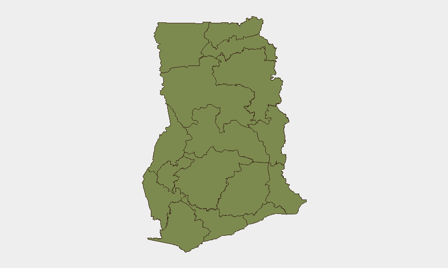
Greater Accra Region (risk score 34.5) dominates Ghana's threat profile, accounting for roughly 70% of the national composite score and hosting the majority of political, institutional, and law-enforcement activity flagged in recent days. Bono East Region (12.1) remains the second-priority area but at significantly lower intensity. All other regions cluster at 4.5–4.8, indicating relatively distributed low-level baseline risk with no geographic hotspot outside the capital. Risk in Greater Accra is primarily driven by political pressure on state institutions, police operations, and diplomatic statements rather than organized violence or armed conflict. Security teams with personnel or operations in Accra should maintain heightened situational awareness of parliamentary and regulatory developments; personnel in other regions face routine criminal and infrastructure risks typical of sub-Saharan Ghana.
How GeoBit Would Assist
Intel Sweep and multi-language OSINT fusion would clarify the scope, timing, and actors behind the 16–17 July threat signals, cross-referencing X/Twitter, news wires, and institutional statements to resolve ambiguities in current reporting. AOI Monitoring & Early Warning on Greater Accra (government districts, SEC offices, Parliament, key police facilities) would provide persistent alerting on protest activity, arrests, or institutional disruptions affecting corporate operations or staff movement. Network & Actor Analysis and sentiment analysis on political and diplomatic messaging would track escalation risk toward Nigeria and domestic institutional friction, informing travel and duty-of-care decisions. Routing & Network Analysis supports contingency planning for Accra-based personnel if civil unrest or checkpoint activity disrupts normal commute or supply routes.
7-Day Outlook
Political and institutional tension in Accra is likely to persist through late July as parliamentary and regulatory responses to pressure campaigns unfold. No major escalation to armed conflict or mass unrest is currently indicated. Corporate security teams should sustain monitoring of GeoBit alerts, parliamentary news, and SEC statements; pre-position alternative routing and communication protocols for Accra-based staff; and prepare contingency briefings for any travel or operations in the capital region.
Highest-Risk Areas — Ranked
| # | State / Region | Risk |
|---|---|---|
| 1 | Greater Accra Region | 34.5 |
| 2 | Bono East Region | 12.1 |
| 3 | Central Region | 4.8 |
| 4 | Upper East Region | 4.5 |
| 5 | Upper West Region | 4.5 |
| 6 | Savannah Region | 4.5 |
| 7 | North East Region | 4.5 |
| 8 | Northern Region | 4.5 |
| 9 | Eastern Region | 4.5 |
| 10 | Oti Region | 4.5 |
| 11 | Volta Region | 4.5 |
| 12 | Bono Region | 4.5 |
Previous Daily Briefs
A new Ghana brief is written every day — each with its own risk map and downloadable CSV. Here's the last week; use the calendar to go further back.
📅 Browse every day by calendar →
Highlighted days have a brief. Tap a day for that day's map & analysis, or “csv” for that day's dataset ($5).
Atlas — our AI intelligence desk — emails them this snapshot personally. Nothing else, no list.