Situation Summary
Ireland remains a low–to–moderate threat environment (global rank #142, composite score 5) with a mixed security picture shaped by organised crime enforcement, industrial–political sensitivities, and isolated serious violent crime. The majority of security events cluster in Kerry and Dublin counties, reflecting both criminal gang activity and urban street violence; broader infrastructure stress from water shortages adds operational friction to duty-of-care planning. Trajectory remains stable, with no indicators of systemic destabilisation, though enforcement operations and labour-union activity signal continued underlying tensions in specific sectors.
Key Developments
- Killarney, County Kerry (7 July discovery; 14 July update) – Gardaí confirmed arrest in Jordan of a man sought in connection with the murder of Jamey Carney, discovered at a Muckross Road property; extradition and coordination with Irish police ongoing.
- Dublin 1 / Foley Street (6 July, very recent arrest) – A man in his 30s was arrested following a serious assault that left a 38-year-old in critical condition with severe head injuries at the Mater Hospital; Section 4 detention active, witness appeals ongoing.
- Laois and Kildare (operation reported last 24–48h) – Gardaí seized machine guns, pistols and drugs in a coordinated operation targeting organised crime networks; indicates active enforcement against armed criminal groups.
- Aughinish, County Limerick (statement within last 24–48h) – Minister for Enterprise issued warning that public consultation on Aughinish Alumina facility could prejudice an ongoing review of Russian ownership links; signals continued sanctions-compliance and industrial–political risk around strategic infrastructure.
- South Belfast / Roosevelt Street, Northern Ireland (9 July operation, update within 48h) – Police conducted security alert operation following drugs arrest; residents evacuated, items seized; operation concluded with residents returned. *Note: Northern Ireland – cross-border context.*
- Portadown, County Armagh, Northern Ireland (9 July arrest/searches, recent update) – 35-year-old arrested under Terrorism Act; properties searched and electronic devices seized in connection with 30 March attack on Lurgan PSNI station. *Note: Northern Ireland – cross-border context.*
- National (announced within last 24–48h) – Irish water authorities imposed six-week hosepipe ban across parts of the Republic until late August due to drought conditions; yellow notice for most of country signals infrastructure stress and service pressure through August.
Highest-Risk Areas
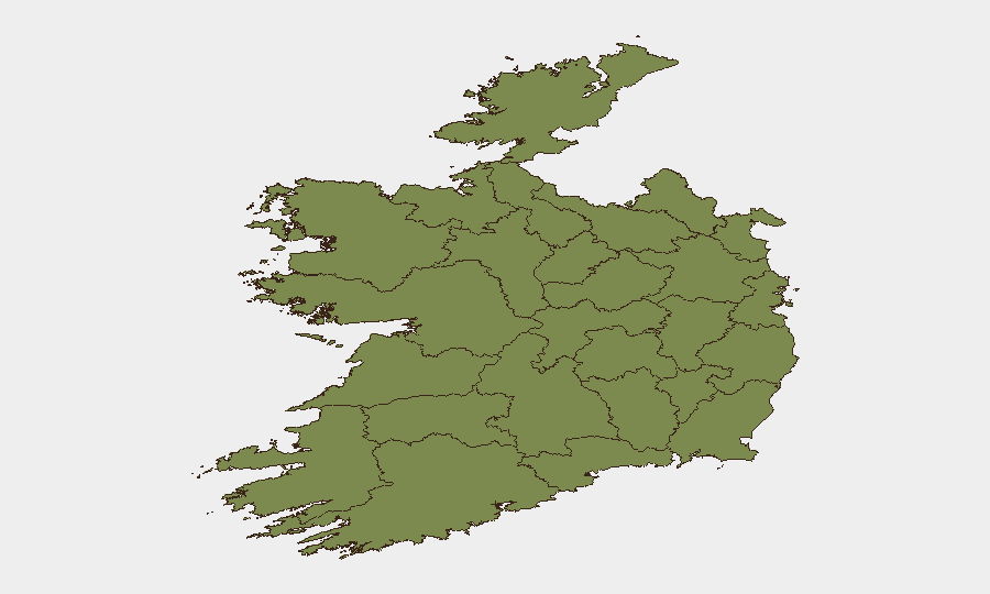
County Kerry dominates the risk ranking (31.5) driven by a serious murder investigation and ongoing criminal activity; County Dublin (26.7) reflects urban violent crime and organised crime enforcement activity centred on the capital. Together, these two counties account for the majority of tracked events and drive the national composite score. County Tipperary (15.6) and County Limerick (9.3) show secondary elevation linked to organised crime networks and industrial–political sensitivities (Aughinish); all other counties remain substantially lower risk. The concentration in Kerry and Dublin should shape asset and personnel focus.
How GeoBit Would Assist
Security teams should deploy AOI Monitoring & Early Warning on high-risk counties (Kerry, Dublin, Limerick) to track organised crime operations and violent incident clusters in near-real time. OSINT fusion and multi-language entity extraction on union demands, ministerial statements, and EU sanctions signals will provide early warning of industrial disruption and supply-chain risk around Aughinish and other strategic assets. Routing & Network Analysis paired with environmental/infrastructure monitoring will help duty-of-care teams navigate water shortages and plan alternative logistics through August.
7-Day Outlook
No major escalation expected; Kerry and Dublin will remain focal points for enforcement and criminal investigation activity. Union actions and ministerial appeals suggest continued low-level political–economic friction through mid-July. Water restrictions and infrastructure stress will persist through early August, affecting operational planning but not triggering acute security events.
Highest-Risk Areas — Ranked
| # | State / Region | Risk |
|---|---|---|
| 1 | County Kerry | 31.5 |
| 2 | County Dublin | 26.7 |
| 3 | County Tipperary | 15.6 |
| 4 | County Limerick | 9.3 |
| 5 | County Carlow | 6.9 |
| 6 | County Galway | 4.9 |
| 7 | County Cork | 4 |
| 8 | County Kildare | 2.5 |
| 9 | County Sligo | 2 |
| 10 | County Mayo | 1.5 |
| 11 | County Clare | 1.5 |
| 12 | County Donegal | 1.5 |
Sources
Previous Daily Briefs
A new Ireland brief is written every day — each with its own risk map and downloadable CSV. Here's the last week; use the calendar to go further back.
📅 Browse every day by calendar →
Highlighted days have a brief. Tap a day for that day's map & analysis, or “csv” for that day's dataset ($5).
Atlas — our AI intelligence desk — emails them this snapshot personally. Nothing else, no list.