Situation Summary
Mauritius maintains a composite threat score of 4 globally (rank #168), with no tracked security incidents in the current reporting window. The national security environment remains stable, with routine diplomatic engagement ongoing and weather monitoring active. Port Louis continues to represent the highest sub-national risk concentration, though absolute threat levels remain low. No trajectory changes are evident from available intelligence.
Key Developments
- Port Louis, 12 Aug 2026 (updated report) — Security assessment covering the 24–48-hour window prior to 12 Aug confirmed no discrete civil unrest, criminal incidents, or infrastructure failures in the capital or surrounding districts.
- Mauritius-wide, 14 Aug 2026 (meteorological) — Mauritius Meteorological Services forecast afternoon and evening showers with high probability and rough marine conditions; potential for localized disruption to port operations and logistics in coastal areas including Port Louis.
- Mauritius maritime, 10–13 Aug 2026 (diplomatic) — Indian Navy Chief Admiral Krishna Swaminathan completed an official visit focused on maritime security cooperation; reflects regional security alignment but constitutes a development event rather than a domestic security incident.
- No corroborated crime, civil-disorder, or infrastructure incidents were identified in live web research covering the last 24–48 hours. Confidence in incident absence is moderate; limited real-time reporting capacity in local media may mask emerging events.
Highest-Risk Areas
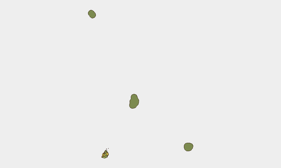
Port Louis (risk score 92) dominates the threat landscape and accounts for the majority of Mauritius's overall risk; this reflects typical urbanization patterns and concentration of commercial, maritime, and administrative functions. Secondary clusters in Plaines Wilhems (68), Black River (65), and Flacq (62) reflect mixed commercial, tourism, and industrial activity corridors. Outer districts and island territories (Rodrigues, Saint Brandon, Agaléga) carry minimal risk. Risk concentration in Port Louis and surrounding urban zones is consistent with infrastructure density and population; absolute threat levels remain low.
How GeoBit Would Assist
Intel Sweep & OSINT Fusion would aggregate local news, social media (X, Telegram), and maritime/port operator reporting to surface emerging incidents before they become widespread; persistent AOI Monitoring & Early Warning configured on Port Louis port facilities, key commercial zones, and transport nodes would provide real-time alerting if civil unrest, labor action, or security incidents develop. Sentiment & Temporal Analysis on social media and local forums would track shifts in public mood ahead of disruptions. Teams managing personnel or supply-chain assets should configure Routing & Network Analysis capabilities to identify alternative transport corridors and port alternatives in the event of Port Louis disruptions.
7-Day Outlook
Weather-driven disruption to port and maritime operations is possible over the next 48–72 hours; operational teams should monitor Mauritius Meteorological Services forecasts and port authority announcements. No escalation in security threats is anticipated in the near term. Routine monitoring of Port Louis commercial and maritime sectors remains advisable to detect labor, civil-order, or criminal developments that may affect duty-of-care obligations.
Highest-Risk Areas — Ranked
| # | State / Region | Risk |
|---|---|---|
| 1 | Port Louis | 92 |
| 2 | Plaines Wilhems | 68 |
| 3 | Black River | 65 |
| 4 | Flacq | 62 |
| 5 | Grand Port | 58 |
| 6 | Moka | 52 |
| 7 | Savanne | 48 |
| 8 | Pamplemousses | 45 |
| 9 | Rivière du Rempart District | 38 |
| 10 | Rodrigues | 22 |
| 11 | Saint Brandon | 8 |
| 12 | Agaléga | 5 |
Sources
Previous Daily Briefs
A new Mauritius brief is written every day — each with its own risk map and downloadable CSV. Here's the last week; use the calendar to go further back.
- August 12, 2026
- August 10, 2026
- August 8, 2026
- August 6, 2026
- August 5, 2026
- August 4, 2026
- August 3, 2026
📅 Browse every day by calendar →
Highlighted days have a brief. Tap a day for that day's map & analysis, or “csv” for that day's dataset ($5).
Atlas — our AI intelligence desk — emails them this snapshot personally. Nothing else, no list.