Situation Summary
Oman faces an unusually tense diplomatic and regional security environment as of late July 2026, driven by a sharp escalation in Iran–Oman relations over the past 72 hours. Multiple bilateral tension signals—including reciprocal relation reductions and public statements—have emerged alongside broader Red Sea and Gulf of Oman instability tied to Houthi maritime attacks and Strait of Hormuz transit concerns. The U.S. Embassy Muscat has suspended non-emergency visa services and relocated non-emergency personnel, signaling official U.S. concern for the operating environment. Current risk trajectory is elevated but not yet reflecting large-scale incidents within Oman's borders.
Key Developments
- Oman–Iran Bilateral Escalation (2026-07-26 to 07-28): Oman and Iran have issued reciprocal relation-reduction statements and public rejections over a 72-hour window, with Tehran explicitly rejecting an Omani position on July 28. Motive and specific dispute remain partially opaque in available reporting; diplomatic signals suggest friction over Red Sea or Strait of Hormuz positioning.
- U.S. Embassy Security Alert (Muscat, 2026-07-24): The U.S. Embassy warned of a "complex regional security environment" with risks of airspace closures, flight cancellations, and escalation; non-emergency personnel relocation and visa-services suspension remain in effect. Alert explicitly referenced wider Gulf instability, not a Muscat-specific incident.
- Oman Call for Red Sea De-escalation (2026-07-24): Oman issued a public statement calling for de-escalation following Houthi attacks on two oil tankers in the Red Sea, indicating Oman's diplomatic concern for regional shipping and potential spillover risk.
- Iran–Oman Strait of Hormuz Diplomacy (2026-07-28): Reuters reported Iran proposed a temporary Strait of Hormuz transit arrangement to Oman, suggesting diplomatic engagement but also underlying concern over shipping chokepoint stability and potential conflict over transit.
- Gulf of Oman Maritime Incident (2026-07-25, approximate): UKMTO reported a tanker incident involving military forces in the Gulf of Oman; precise location and Oman nexus remain unclear, but underscores elevated maritime-transit risk in adjacent waters.
Highest-Risk Areas
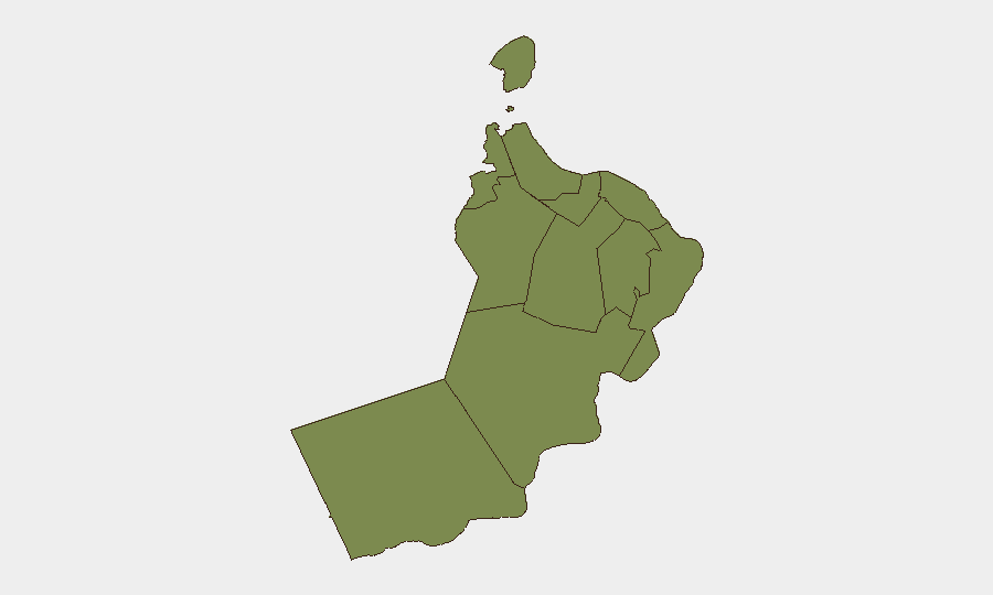
Musandam Governorate is the clear risk driver (31.3 composite score), reflecting its position at the Strait of Hormuz and exposure to maritime incidents, Iran–Oman border dynamics, and transit chokepoint volatility. Muscat (16.3) and Dhofar (16.3) follow at identical risk levels—Muscat as the capital and diplomatic hub now experiencing bilateral tensions and embassy security posture changes, and Dhofar as a key southern port (Salalah) exposed to Red Sea spillover and maritime instability. All other governorates remain below 1.5 composite risk, indicating threat concentration in maritime and northern border zones rather than geographically dispersed domestic instability.
How GeoBit Would Assist
Corporate security teams should deploy AOI Monitoring & Early Warning on Musandam, Muscat port, and Salalah to track Iranian military activity, maritime incidents, and diplomatic movement. Maritime & Aviation tracking, combined with OSINT fusion (X/Telegram diplomatic signals, news feeds, multi-language regional reporting), will enable real-time alerting on shipping disruptions, airspace closures, or escalation. Routing & Network Analysis can identify alternative supply and personnel movement corridors if primary ports or airspace become unstable.
7-Day Outlook
Oman–Iran tensions are likely to remain elevated through early August absent a sudden diplomatic breakthrough, with downside risk of further public statements or military posturing near the Strait. Maritime transit delays and flight cancellations should be anticipated. The trajectory hinges on whether current friction resolves at the diplomatic level or spills into Red Sea/Hormuz incidents that trigger wider regional escalation.
Highest-Risk Areas — Ranked
| # | State / Region | Risk |
|---|---|---|
| 1 | Musandam Governorate | 31.3 |
| 2 | Muscat Governorate | 16.3 |
| 3 | Dhofar Governorate | 16.3 |
| 4 | Al Buraymi Governorate | 1.3 |
| 5 | Ad Dhahirah Governorate | 1.3 |
| 6 | Al Batinah North Governorate | 1.3 |
| 7 | Al Batinah South Governorate | 1.3 |
| 8 | Ad Dakhiliyah Governorate | 1.3 |
| 9 | Ash Sharqiyah North Governorate | 1.3 |
| 10 | Ash Sharqiyah South Governorate | 1.3 |
| 11 | Al Wusta Governorate | 1.3 |
Sources
Previous Daily Briefs
A new Oman brief is written every day — each with its own risk map and downloadable CSV. Here's the last week; use the calendar to go further back.
📅 Browse every day by calendar →
Highlighted days have a brief. Tap a day for that day's map & analysis, or “csv” for that day's dataset ($5).
Atlas — our AI intelligence desk — emails them this snapshot personally. Nothing else, no list.