Situation Summary
Palau remains a low-threat environment with no verified security incidents, civil unrest, or infrastructure disruptions as of 12 August 2026. However, the security landscape is shaped by two concurrent developments: geopolitical tension over Chinese research vessel incursions into Palau's exclusive economic zone and maritime infrastructure, and a localized infrastructure concern following landslides at a U.S. defence project site in Ngaraard. These do not currently pose direct risk to personnel or assets on the ground, but reflect elevated strategic sensitivity as Palau prepares to host the Pacific Islands Forum at month-end.
Key Developments
- Koror / Palau EEZ – Chinese research vessel incursions (reported 13–14 Aug 2026). Palau's government filed a diplomatic complaint with China over repeated intrusions by research vessels into its exclusive economic zone, including one in late May that operated near submarine fibre-optic cable infrastructure for approximately 14 hours. President Whipps characterized the activity as a sovereign and security concern; the latest media reporting and formal diplomatic signalling occurred on 13–14 August.
- Ngaraard State – Landslides at U.S. radar project disrupted construction (reported 12 Aug 2026, work resumed). Heavy rainfall triggered mudslides at a U.S. tactical multi-mission over-the-horizon radar transmitter site; construction was briefly interrupted but has since resumed. Local leaders have formally requested an investigation into preventive measure failures and environmental impact, indicating ongoing political and operational sensitivity at the site.
- Pacific Islands Forum host-country diplomatic tension (reported 11–14 Aug 2026). As Palau prepares to host the Forum at month-end, China has publicly urged the organization to "properly handle Taiwan-related issues" following the Forum's decision to invite Taiwan. This reflects heightened diplomatic friction and informational risk, though no kinetic incidents are reported.
- Nationwide infrastructure and port/airport operations normal (as of 12 Aug 2026). A regional security brief confirmed no emergency alerts, curfews, or travel disruptions across Palau; normal operations at ports and airports continue.
- No verified civil unrest or crime spikes (as of mid-August 2026). Neither regional security reporting nor open-source news identifies protests, riots, or notable crime events in Palau in the current reporting window.
Highest-Risk Areas
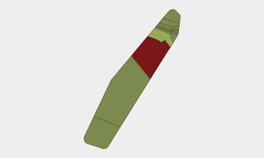
Peleliu (risk 92) and Angaur (risk 88) carry substantially higher sub-national risk scores, likely reflecting historical conflict legacies, limited infrastructure, and remoteness; however, neither has reported active incidents in the current window. Koror (risk 45) and Melekeok (risk 35) face elevated risk primarily due to their concentration of government, port, and strategic infrastructure assets—Koror houses the capital and main commerce hub, while both have proximity to maritime facilities of geopolitical interest. Ngaraard (risk 25) reflects the ongoing infrastructure concern at the radar project site. Overall, no state exhibits acute on-the-ground instability.
How GeoBit Would Assist
Security teams should employ AOI Monitoring & Early Warning on Koror's maritime EEZ and the Ngaraard project site to detect further foreign vessel activity or infrastructure disruptions in near-real time. Maritime & Aviation tracking and OSINT fusion (including X/Twitter, regional news feeds, and diplomatic channels) would provide continuous visibility into Chinese naval and research vessel movements and political signalling ahead of the Forum. Satellite & Imagery analysis could independently assess landslide risk and remediation progress at the radar site.
7-Day Outlook
No escalation in on-the-ground security incidents is anticipated; port, airport, and daily operations should remain stable. Strategic and diplomatic tension over maritime sovereignty and Taiwan representation at the Forum will likely persist and intensify slightly as the late-August summit approaches. Personnel and asset-security risk remains low, contingent on absence of further foreign military incursions or infrastructure failures.
Highest-Risk Areas — Ranked
| # | State / Region | Risk |
|---|---|---|
| 1 | Peleliu | 92 |
| 2 | Angaur | 88 |
| 3 | Koror | 45 |
| 4 | Melekeok | 35 |
| 5 | Airai | 32 |
| 6 | Ngatpang | 28 |
| 7 | Ngeremlengui | 26 |
| 8 | Ngaraard | 25 |
| 9 | Ngardmau | 24 |
| 10 | Aimeliik | 23 |
| 11 | Ngiwal | 22 |
| 12 | Ngchesar | 21 |
Sources
Previous Daily Briefs
A new Palau brief is written every day — each with its own risk map and downloadable CSV. Here's the last week; use the calendar to go further back.
- August 12, 2026
- August 10, 2026
- August 8, 2026
- August 6, 2026
- August 5, 2026
- August 4, 2026
- August 3, 2026
📅 Browse every day by calendar →
Highlighted days have a brief. Tap a day for that day's map & analysis, or “csv” for that day's dataset ($5).
Atlas — our AI intelligence desk — emails them this snapshot personally. Nothing else, no list.