Situation Summary
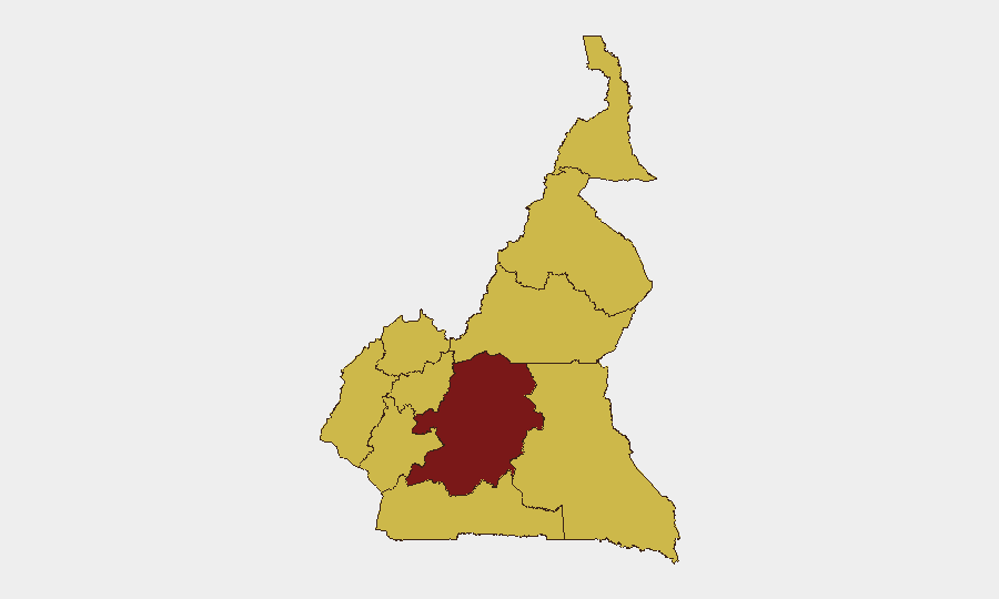
Cameroon remains at elevated risk (#24 globally) with active insurgent and separatist activity concentrated in the Northwest, Southwest, and Far North regions. The last 48 hours have seen kidnappings linked to Ambazonian separatists, mass arrests by security forces, and ongoing Boko Haram operations in the Far North, alongside a significant port disruption in Douala. The Centre region (Yaoundé area) carries disproportionately high composite risk (95.2), though recent event reporting clusters in peripheral conflict zones rather than the capital.
Key Developments
- Northwest Region, Bamenda–Ndop corridor (18–19 July): Seven passengers kidnapped from a commercial vehicle by armed men in Ngoketunjia Division; hostages reportedly moved into forested areas. Classification consistent with separatist-linked abductions.
- Southwest Region, Mutengene, Fako Division (18–19 July): Large-scale security-force sweep conducted, with mass arrests and random detention of residents as part of counter-separatist operations.
- Southwest Region, Ossing village, Manyu Division (18 July): Two Traditional Council officials (secretary-general and technical adviser) kidnapped by men claiming Ambazonian separatist affiliation; incident tied to local chieftaincy dispute and broader separatist intimidation campaign.
- Far North Region, Tourou, Mayo-Tsanaga Division (14–15 July): Boko Haram attack on army forward post killed one civilian woman and wounded four soldiers; attackers looted military equipment. Preceded by Cameroonian Rapid Intervention Battalion ambush (13–14 July) that killed two Boko Haram fighters in the same locality.
- Littoral Region, Douala Port (weekend 18–19 July): Collision between two cargo vessels in main access channel temporarily blocked maritime traffic; partial operations resumed following clearance. Logistics disruption affects supply chains and commercial movement.
- Far North Region, multi-district cholera outbreak (situation current through early July, flagged again in mid-July regional alerts): Over 300 confirmed cases and approximately 12 deaths across Mada, Makary, Fotokol, Kolofata, Kousseri, and Maroua 2 health districts; outbreak exacerbated by insecurity, displacement, and seasonal rains.
Highest-Risk Areas
Centre region dominates the composite risk index (95.2), reflecting governance and regime-stability concerns concentrated in Yaoundé. However, operational threat severity is highest in the Northwest and Southwest, where separatist kidnappings and security-force counter-operations create acute hazard for movement and commercial activity; both regions carry risk scores of 65.2. The Far North (65.2) faces dual threats from Boko Haram and health crisis, compounded by displacement and limited access. Littoral's port disruption signals vulnerability of critical logistics infrastructure.
How GeoBit Would Assist
Security and duty-of-care teams should deploy AOI Monitoring & Early Warning on the Bamenda–Ndop corridor and Southwest Division hotspots to flag further kidnappings or roadblock activity in near-real time. Routing & Network Analysis capabilities enable identification of safer alternative routes for personnel and supply movements around active conflict zones. Multi-language OSINT and Telegram/X intelligence collection in Ambazonian and Boko Haram networks provide early signals of planned abductions or attacks, informing travel advisories and evacuation decisions.
7-Day Outlook
Separatist kidnapping activity in the Northwest and Southwest is likely to persist as a routine threat, with security-force sweeps continuing to generate civilian detention and displacement. Boko Haram operations in the Far North will remain episodic but lethal; cholera outbreak trajectory depends on humanitarian access and weather patterns. Port operations in Douala should stabilize, but residual congestion may extend logistics delays into early next week.
Highest-Risk Areas — Ranked
| # | State / Region | Risk |
|---|---|---|
| 1 | Centre | 95.2 |
| 2 | Northwest | 65.2 |
| 3 | Southwest | 65.2 |
| 4 | West | 65.2 |
| 5 | Littoral | 65.2 |
| 6 | Adamawa | 65.2 |
| 7 | South | 65.2 |
| 8 | Far-North | 65.2 |
| 9 | North | 65.2 |
| 10 | East | 65.2 |
Sources
Previous Daily Briefs
A new Cameroon brief is written every day — each with its own risk map and downloadable CSV. Here's the last week; use the calendar to go further back.
📅 Browse every day by calendar →
Highlighted days have a brief. Tap a day for that day's map & analysis, or “csv” for that day's dataset ($5).
Atlas — our AI intelligence desk — emails them this snapshot personally. Nothing else, no list.