Situation Summary
Ireland remains a low-threat environment globally (rank #155) but exhibits concentrated regional volatility, particularly in County Kerry and Dublin. The security picture is dominated by organised crime disruption operations, routine law-enforcement activity, and isolated incidents of serious violence rather than systemic instability. The trajectory over the past 48 hours shows sustained Garda enforcement momentum against drug-trafficking and weapons networks, with no indicators of coordinated civil unrest or cross-border destabilisation.
Key Developments
- Counties Laois and Kildare (24–48h): Gardaí executed a significant organised crime operation resulting in seizure of machine guns, pistols, and drug quantities; Assistant Commissioner Angela Willis characterised the action as a "significant disruption of organised criminal activity" in the region.
- Killarney, County Kerry (48h window): A person of interest in the murder investigation of an American mother was arrested in Jordan after returning there; the arrest follows Garda investigation and represents a major development in an active homicide case.
- Belfast, Roosevelt Street/Iverna Street, Northern Ireland (~00:10 BST, 16 July): Police executed a security operation with evacuations following arrest on drugs offences; property search yielded items requiring examination; residents were temporarily relocated and two individuals (both 37) taken into custody.
- Ballyclare, County Antrim, Northern Ireland (incident on 12 July, reported in last 48h): A man suffered serious injuries in an assault by a masked gang armed with bats; police investigation ongoing with no assessment of wider public risk.
- Motorway, Republic of Ireland (24–48h disclosure): Gardaí seized a vehicle after a 17-year-old learner driver was recorded travelling at 174 km/h; registered owner must apply to District Court for vehicle recovery.
- General activity: Public statements from barristers, landlord-tenant court proceedings, ministerial administrative sanctions, and union demands have generated administrative and policy-level friction, though no direct security impact is evident.
Highest-Risk Areas
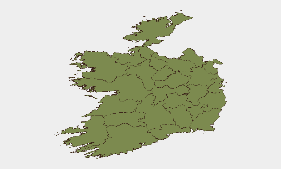
County Kerry (31.9) and County Dublin (28.8) drive the composite risk ranking and account for the majority of tracked threat events. Kerry's position reflects the active murder investigation and associated criminal networks; Dublin reflects the concentration of organised crime activity, government/judicial proceedings, and urban crime density typical of capital regions. County Tipperary (21.5) and Westmeath (13.5) show elevated scores, likely linked to organised crime supply routes and enforcement operations in the midlands corridor. The concentration of risk in Kerry and Dublin should inform duty-of-care prioritisation for corporate assets and personnel in those jurisdictions.
How GeoBit Would Assist
Security teams should employ AOI (Area-of-Interest) Monitoring & Early Warning on Kerry and Dublin to detect emerging organised crime activity, violence trends, and enforcement operations before escalation. Intelligence & OSINT capabilities—including entity extraction, sentiment analysis, and multi-source corroboration—would track court proceedings, Garda press releases, and criminal network developments in near-real time. Routing & Network Analysis can support duty-of-care travel planning for personnel in high-risk counties by identifying alternative routes and temporal risk windows around known crime hotspots and enforcement corridors.
7-Day Outlook
Organised crime enforcement operations are likely to continue with similar intensity, particularly in the midlands and southern regions; no significant escalation or systemic threat is forecast. Low-level violence, drug-trafficking disruption, and routine criminal proceedings should be expected as baseline activity. The trajectory remains consistent with Ireland's global threat ranking and poses no material shift in the security environment over the next seven days.
Highest-Risk Areas — Ranked
| # | State / Region | Risk |
|---|---|---|
| 1 | County Kerry | 31.9 |
| 2 | County Dublin | 28.8 |
| 3 | County Tipperary | 21.5 |
| 4 | County Westmeath | 13.5 |
| 5 | County Limerick | 11.7 |
| 6 | County Carlow | 8.6 |
| 7 | County Laois | 7.4 |
| 8 | County Galway | 6.2 |
| 9 | County Cork | 5 |
| 10 | County Kildare | 3.1 |
| 11 | County Sligo | 2.5 |
| 12 | County Mayo | 1.9 |
Sources
Previous Daily Briefs
A new Ireland brief is written every day — each with its own risk map and downloadable CSV. Here's the last week; use the calendar to go further back.
📅 Browse every day by calendar →
Highlighted days have a brief. Tap a day for that day's map & analysis, or “csv” for that day's dataset ($5).
Atlas — our AI intelligence desk — emails them this snapshot personally. Nothing else, no list.