Situation Summary
Oman remains exposed to significant regional volatility stemming from U.S.–Iran tensions and ongoing military activity in the Gulf of Oman and Strait of Hormuz. The U.S. Embassy Muscat issued a security alert on 24 July citing a complex threat environment, with particular concern over potential airspace closures and flight disruptions. No specific new incidents targeting Oman territory or nationals have been confirmed in the last 48 hours; current risk reflects spillover from maritime enforcement actions and diplomatic friction rather than domestic instability.
Key Developments
- Oman–Iran diplomatic tensions (27–29 July). Multiple "reduce relations" signals and investigative statements between Oman and Iran, as well as public statements from Oman directed at Islamic actors, suggest diplomatic friction or messaging adjustments. Context and specific causes remain unclear from available open sources.
- Gulf of Oman maritime activity (~24–25 July, ongoing significance). U.S. CENTCOM disabled the Mozambique-flagged tanker *Lavine* in the Gulf of Oman after it allegedly attempted to breach a U.S. blockade on Iranian ports. This incident, ~100 nm east of Duqm, exemplifies enforcement risk in waters Oman controls and through which major shipping transits.
- U.S. Embassy Muscat alert (24 July, status sustained). The U.S. Embassy issued a security alert warning of potential airspace closures, flight cancellations, and continued suspension of non-emergency visa services. The alert reflects institutional assessment of escalation risk, even absent daily attack reports.
- Oman–Iran Strait of Hormuz negotiations (24–25+ July). Ongoing talks between Oman and Iran on managing Strait of Hormuz navigation and potential reopening coincide with a temporary pause in U.S. strikes on Iran. Outcome could materially alter shipping lanes, fees, or joint control mechanisms affecting corporate routing and compliance.
Highest-Risk Areas
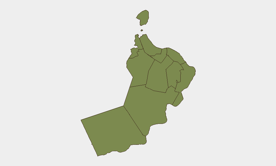
Musandam Governorate (risk score 31.3) dominates the sub-national ranking, driven by its geographic position commanding the Strait of Hormuz chokepoint and its proximity to Iranian territory. Muscat Governorate (16.3) follows, reflecting exposure to maritime incidents in the Gulf of Oman and diplomatic/consular activity during regional tension. All remaining governorates carry minimal baseline risk (1.3), indicating threat concentration in the north and maritime zones rather than widespread inland instability. The disparity suggests that corporate and travel risk in Oman is primarily anchored to Gulf shipping corridors and the capital's diplomatic environment, not territorial insurgency or civil unrest.
How GeoBit Would Assist
Security teams should deploy AOI (Area-of-Interest) Monitoring & Early Warning on Musandam and the Gulf of Oman approaches to detect new military activity, maritime incidents, or airspace restrictions before they cascade into travel disruptions or supply-chain delays. Maritime & Aviation Tracking combined with multi-language OSINT and X/Twitter intelligence enables real-time detection of vessel movements, enforcement actions, and official announcements affecting Oman-based operations. Routing & Network Analysis allows pre-planning of alternative logistics corridors should Hormuz transit or Muscat airspace become restricted.
7-Day Outlook
Oman's security posture will likely remain contingent on U.S.–Iran escalation dynamics rather than domestic events. If Oman–Iran Strait negotiations progress or a formal ceasefire framework emerges, maritime risk may ease; conversely, any resumption of U.S. strikes or Iranian retaliation could trigger rapid airspace closures or shipping diversions. Diplomatic messaging signals suggest Oman is repositioning its stance, warranting close watch on official statements and visa/travel policy changes over the next week.
Highest-Risk Areas — Ranked
| # | State / Region | Risk |
|---|---|---|
| 1 | Musandam Governorate | 31.3 |
| 2 | Muscat Governorate | 16.3 |
| 3 | Al Buraymi Governorate | 1.3 |
| 4 | Ad Dhahirah Governorate | 1.3 |
| 5 | Al Batinah North Governorate | 1.3 |
| 6 | Al Batinah South Governorate | 1.3 |
| 7 | Ad Dakhiliyah Governorate | 1.3 |
| 8 | Ash Sharqiyah North Governorate | 1.3 |
| 9 | Ash Sharqiyah South Governorate | 1.3 |
| 10 | Dhofar Governorate | 1.3 |
| 11 | Al Wusta Governorate | 1.3 |
Sources
Previous Daily Briefs
A new Oman brief is written every day — each with its own risk map and downloadable CSV. Here's the last week; use the calendar to go further back.
📅 Browse every day by calendar →
Highlighted days have a brief. Tap a day for that day's map & analysis, or “csv” for that day's dataset ($5).
Atlas — our AI intelligence desk — emails them this snapshot personally. Nothing else, no list.