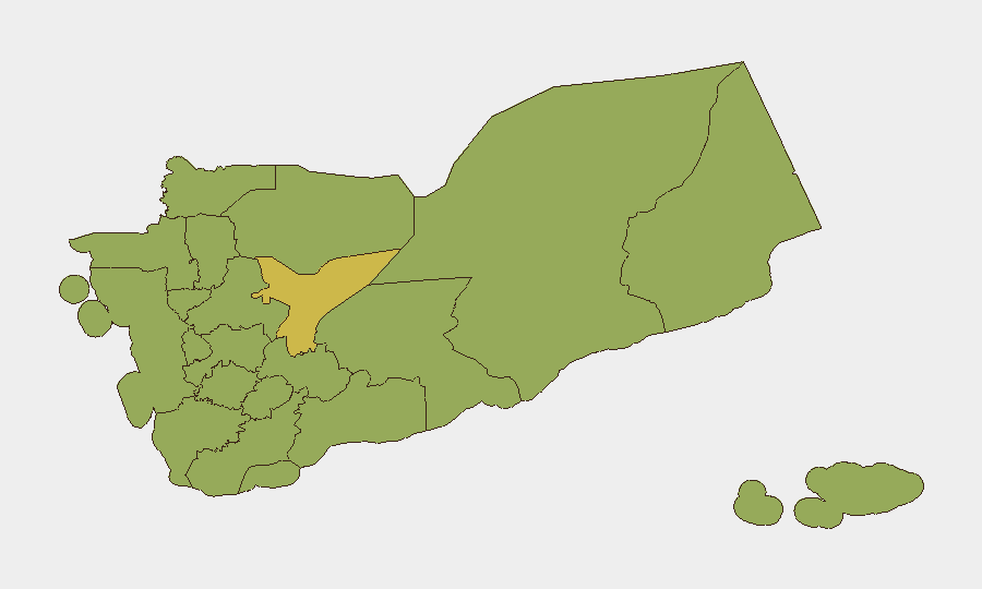
Situation Summary
Yemen remains in active civil war, with Houthi forces, Saudi-led coalition air operations, and competing government factions driving sustained violence across multiple governorates. As of late July 2026, Red Sea maritime threats and cross-border drone/missile activity continue at elevated levels, with civilian shipping and regional infrastructure repeatedly targeted. The conflict shows no signs of de-escalation, and the involvement of Iranian-backed actors and external state forces perpetuates the cycle of asymmetric warfare and humanitarian disruption.
Key Developments
- Red Sea / Bab el-Mandeb (July 27, 2026): Commercial tanker reported a splash from an unknown projectile while transiting the southern Red Sea; UK Maritime Trade Operations confirmed the vessel and crew safe but advised heightened caution for all shipping in the corridor.
- Al-Jawf Province, Northern Yemen (July 27, 2026): Houthi sources claimed successful air-defense engagement of a Turkish-made Bayraktar AKINCI armed reconnaissance drone, alleged to be Saudi-operated and conducting hostile reconnaissance.
- Red Sea Shipping (July 24–27, 2026): Multiple tanker incidents reported over this 72-hour period, including claims of three separate vessel targeting events; precise timestamps for individual incidents within the final 24–48 hours remain unclear in available open sources.
- Hodeidah & Kamaran Island (July 24–25, 2026): Saudi-led coalition conducted airstrikes on port facilities and island positions; Houthi forces responded with claims of missile and drone launches toward Yanbu and Jizan in Saudi Arabia.
- Cross-Border Threats (July 29, 2026): Event signals indicate ongoing small arms combat and artillery operations between Saudi and Yemeni forces, alongside unconventional violence claims involving Iran and regional actors.
- Political/Diplomatic Activity (July 28–30, 2026): Public statements from Sanaa authorities, Yemen-based actors, and Iraqi entities underscore ongoing regional diplomatic tensions and rhetorical escalation tied to the conflict.
Note: Open-source data availability constraints mean events dated July 29–30 are represented in aggregate event signals rather than specific incident reports. Real-time maritime and conflict monitoring feeds are essential for operational decision-making.
Highest-Risk Areas
Amanat Al Asimah (Sana'a capital region, risk 89.5) dominates the risk landscape as the seat of Houthi control and a hub of political/military command authority. Marib Governorate (61.7) remains a contested frontline with ongoing militia activity, while Aden Governorate (59.8) and the northern corridor provinces—Sa'dah, Hajjah, Al Hudaydah, and 'Amran—all register at 59.5, reflecting sustained combat, tribal instability, and irregular-force activity. The concentration of risk in the northwest and the capital region reflects both Houthi territorial consolidation and the continued presence of Saudi-led coalition assets and ground-force allies.
How GeoBit Would Assist
GeoBit's AOI Monitoring & Early Warning capability enables persistent watch on high-risk governorates with alert triggers for new attack patterns or force movements. Maritime tracking combined with conflict event feeds and X/Twitter OSINT provide real-time visibility into Red Sea incidents and cross-border weapons activity. Battle mapping and force-structure analysis support scenario planning and casualty estimation for corporate teams assessing supply-chain and personnel risk in contested areas.
7-Day Outlook
Houthi maritime harassment and drone operations in the Red Sea are expected to persist, with further commercial-vessel incidents likely if current targeting patterns hold. Saudi-led coalition responses and small arms clashes will continue across northern and central Yemen, particularly in Marib and along supply corridors. De-escalation remains unlikely absent major diplomatic intervention or shift in regional actor posture.
Highest-Risk Areas — Ranked
| # | State / Region | Risk |
|---|---|---|
| 1 | Amanat Al Asimah | 89.5 |
| 2 | Marib Governorate | 61.7 |
| 3 | Aden Governorate | 59.8 |
| 4 | Sa'dah Governorate | 59.5 |
| 5 | Hajjah Governorate | 59.5 |
| 6 | Al Mahwit Governorate | 59.5 |
| 7 | Al Hudaydah Governorate | 59.5 |
| 8 | 'Amran Governorate | 59.5 |
| 9 | Sana'a Governorate | 59.5 |
| 10 | Raymah Governorate | 59.5 |
| 11 | Dhamar Governorate | 59.5 |
| 12 | Ibb Governorate | 59.5 |
Sources
Previous Daily Briefs
A new Yemen brief is written every day — each with its own risk map and downloadable CSV. Here's the last week; use the calendar to go further back.
📅 Browse every day by calendar →
Highlighted days have a brief. Tap a day for that day's map & analysis, or “csv” for that day's dataset ($5).
Atlas — our AI intelligence desk — emails them this snapshot personally. Nothing else, no list.