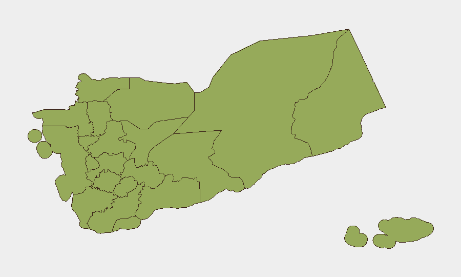
Situation Summary
Yemen remains fractured between Houthi-controlled northern territory and the internationally recognised government in the south, with civil conflict as the primary driver of the composite threat score (67/100, #23 globally). The past 48 hours have seen sharp escalation in maritime aggression by Houthi forces against Saudi-linked shipping in the Red Sea, coupled with reinforced government naval deployments and large-scale military redeployment to northeastern governorates. Ground-level tensions remain in a posture of military readiness rather than active large-scale combat, but concurrent public unrest over infrastructure failures in southern cities and heightened rhetoric toward multiple regional actors signal elevated risk of spillover.
Key Developments
- Red Sea, west of Yemen – 1 Aug 2026: Houthi forces have maintained a self-declared naval blockade on Saudi-linked tankers transiting Bab al-Mandab and the southern Red Sea, with multiple diversions and delayed transits recorded by maritime trackers in the past 24–48 hours.
- Bab al-Mandab approaches and western coast – 1 Aug 2026: The internationally recognised Yemeni government has reinforced coastguard and naval units along Red Sea and Indian Ocean approaches, moved heavy weapons to strategic coastal positions, and raised combat readiness in response to Houthi naval activity.
- Marib and Al-Jawf governorates (northeast) – 1 Aug 2026: Yemeni government sources report large-scale redeployment of military reinforcements and heavy equipment to these governorates over the past 24 hours, signalling heightened readiness against potential Houthi ground advances.
- Presidential Leadership Council – 1 Aug 2026: Senior military commanders have been banned from overseas travel without top-level approval, indicating sustained tension and a move to ensure command continuity.
- Aden and southern governorates – 31 Jul–1 Aug 2026: Renewed nighttime street protests and roadblocks have been reported in multiple southern cities, tied to prolonged electricity shortages amid summer heat; social media references suggest continuity of unrest into the latest 24-hour cycle.
- Red Sea shipping lanes off Yemen – 31 Jul–1 Aug 2026: Maritime security advisories continue to warn of risk of ballistic missile and drone attacks on Saudi-linked shipping, following recent strikes on tankers NCC GHAZAL, Encelia, and Layla.
- Internal front lines (nationwide) – 1 Aug 2026: Despite sharp rhetoric and force repositioning, no major new ground clashes have been publicly confirmed in the past 24 hours; both Houthi and government forces are assessed to be in a posture of deterrence rather than active offensive operations.
Highest-Risk Areas
Amanat Al Asimah (risk 76.8), which encompasses the capital Sana'a and surrounding areas, remains the single highest-risk subnational zone, reflecting the concentration of Houthi administrative control, military command structures, and historical flashpoints. The northwestern corridor—Sa'dah, Hajjah, Al Mahwit, and Al Hudaydah governorates (all 46.8)—represents the second-tier cluster of persistent civil-war risk, encompassing Houthi strongholds and contested border regions with Saudi Arabia. The northeastern governorates (Marib, Al-Jawf) are currently experiencing acute military redeployment and represent a secondary theatre of escalation risk. Southern governorates including Aden, Ta'izz, and Ad Dali' carry compounded risk from both residual conflict dynamics and infrastructure-driven civil unrest.
How GeoBit Would Assist
Teams managing staff or assets in Yemen should employ AOI Monitoring & Early Warning to track persistent threats across Amanat Al Asimah, maritime corridors, and northeastern military zones, with real-time alerting on force movements and protest activity. Maritime & Aviation tracking combined with Intel Sweep and OSINT fusion would provide continuous situational awareness of Red Sea shipping threats, blockade enforcement, and naval deployments. Conflict mapping and force-structure analysis would enable rapid assessment of government and Houthi redeployment patterns and readiness postures to anticipate further escalation.
7-Day Outlook
The maritime blockade by Houthi forces is likely to persist or intensify over the next week absent diplomatic intervention, sustaining disruption to regional shipping and keeping Saudi-Yemen tensions elevated. Government military reinforcements in the northeast suggest contingency planning for possible renewed ground conflict, though no imminent large-scale offensive is indicated. Electricity-driven unrest in southern cities may continue to degrade stability in government-held areas and create secondary security incidents around critical infrastructure.
Highest-Risk Areas — Ranked
| # | State / Region | Risk |
|---|---|---|
| 1 | Amanat Al Asimah | 76.8 |
| 2 | Sa'dah Governorate | 46.8 |
| 3 | Hajjah Governorate | 46.8 |
| 4 | Al Mahwit Governorate | 46.8 |
| 5 | Al Hudaydah Governorate | 46.8 |
| 6 | 'Amran Governorate | 46.8 |
| 7 | Sana'a Governorate | 46.8 |
| 8 | Raymah Governorate | 46.8 |
| 9 | Dhamar Governorate | 46.8 |
| 10 | Ibb Governorate | 46.8 |
| 11 | Ta'izz Governorate | 46.8 |
| 12 | Ad Dali' Governorate | 46.8 |
Sources
Previous Daily Briefs
A new Yemen brief is written every day — each with its own risk map and downloadable CSV. Here's the last week; use the calendar to go further back.
📅 Browse every day by calendar →
Highlighted days have a brief. Tap a day for that day's map & analysis, or “csv” for that day's dataset ($5).
Atlas — our AI intelligence desk — emails them this snapshot personally. Nothing else, no list.