Situation Summary
Canada remains a low-threat environment globally (rank #67, composite score 2.3), with security risk heavily concentrated in British Columbia and the northern territories rather than distributed across population centers. The last 24–48 hours have yielded limited confirmed security incidents; a minor earthquake in Alberta and unverified social-media claims regarding water-infrastructure cyber access in Quebec constitute the primary signals. Overall trajectory remains stable with no indicators of imminent escalation in civil order, terrorism, or large-scale organized crime.
Key Developments
- Grande Prairie region, Alberta – 9 July 2026, 18:30 MDT. A magnitude 3.8 earthquake centered 35 km south of Grande Prairie was recorded and felt locally. While minor, such events typically trigger brief infrastructure and safety reviews by local authorities and utilities.
- Quebec – Cyber access claim (date unconfirmed). A social-media post circulating in political/security discussion groups alleges unauthorized access to a Quebec town's water treatment systems by a pro-Russian hacktivist group. The underlying incident date cannot be confirmed from publicly indexed sources; treat as an emerging narrative regarding critical-infrastructure vulnerability rather than a verified 24–48h event.
- Federal and provincial public statements – 8–10 July. Multiple government-level public statements and investigative activity were recorded across Ontario and federal channels, though specific substance and classification remain unclear from event metadata alone.
- Labour and media incidents – 8–10 July. Worker-related public statements and a media-versus-employee threat incident were logged on 10 July; localized scope and involvement of unconventional violence and police response suggest low systemic scale but warrant monitoring for escalation narratives.
No major civil unrest, mass-casualty events, significant organized-crime incidents, or travel-safety alerts were confirmed in open-source indexed reporting for the last 24–48 hours.
Highest-Risk Areas
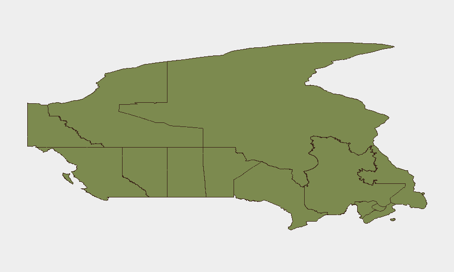
British Columbia's composite risk score of 31.6 places it as Canada's highest-risk jurisdiction by a significant margin, likely reflecting ongoing gang violence, organized-crime activity, and cross-border trafficking dynamics. Nunavut (24.7) and Ontario (21.4) follow; Arctic territorial risk is heavily influenced by governance fragility, infrastructure isolation, and transnational crime, while Ontario reflects major-population-center density and Toronto's role as a money-laundering and trafficking hub. The Prairie provinces and Atlantic Canada show markedly lower risk, with Quebec (4.5) and Atlantic jurisdictions all below 5.0, indicating concentrated risk in the west and north rather than a pan-Canadian trend.
How GeoBit Would Assist
Teams managing Canadian operations would leverage AOI Monitoring & Early Warning to track elevated-risk zones in BC and the territories with persistent alerting on crime, trafficking, and critical-infrastructure threats; Intel Sweep and multi-language OSINT to corroborate fragmentary social-media claims (e.g., water-system cyber incidents) before they escalate; and Cyber and critical-infrastructure search to assess exposure of Canadian utilities and SCADA systems to known threat groups. Conflict & Military capabilities would support tracking of cross-border organized-crime networks and supply-chain security for assets in transit.
7-Day Outlook
No imminent escalation is expected. Continued monitoring of British Columbia gang-violence patterns and Arctic governance instability is prudent; the Quebec cyber narrative should be tracked for confirmation and scope before operational response. Routine duty-of-care vigilance in major urban centers and resource-extraction regions remains standard practice.
Highest-Risk Areas — Ranked
| # | State / Region | Risk |
|---|---|---|
| 1 | British Columbia | 31.6 |
| 2 | Nunavut | 24.7 |
| 3 | Ontario | 21.4 |
| 4 | Northwest Territories | 13.1 |
| 5 | Saskatchewan | 7.3 |
| 6 | Manitoba | 5.7 |
| 7 | Alberta | 5 |
| 8 | Quebec | 4.5 |
| 9 | Newfoundland and Labrador | 2.3 |
| 10 | New Brunswick | 2 |
| 11 | Yukon | 1.7 |
| 12 | Prince Edward Island | 1.7 |
Sources
Previous Daily Briefs
A new Canada brief is written every day — each with its own risk map and downloadable CSV. Here's the last week; use the calendar to go further back.
📅 Browse every day by calendar →
Highlighted days have a brief. Tap a day for that day's map & analysis, or “csv” for that day's dataset ($5).
Atlas — our AI intelligence desk — emails them this snapshot personally. Nothing else, no list.