Situation Summary
DR Congo remains at elevated overall threat (rank #35 globally, composite score 59) with acute volatility concentrated in the eastern provinces, particularly North Kivu and Ituri. The past 48 hours have seen renewed combat between FARDC and M23 near Goma, intensified ADF-linked attacks around Beni, and continued CODECO militia activity in Ituri, driving displacement and restricting movement across key travel corridors. Kinshasa is experiencing localized police activity linked to economic grievances but has not yet escalated to widespread unrest. The trajectory over the coming week will depend on whether current frontline clashes stabilize or expand.
Key Developments
- North Kivu, Kibumba–Rutshuru axis (June 29): Heavy sustained fire reported overnight between FARDC and M23 positions north of Goma, with civilians evacuating toward camps and the Goma–Rutshuru road closed to non-essential traffic.
- North Kivu, Sake–Masisi territory (June 29): Intensified clashes and shelling reported around Sake, with new displacement toward Sake and Minova; travel on the Goma–Sake–Minova corridor flagged as high-risk.
- North Kivu, Beni outskirts (night of June 28–29): Suspected ADF (ISIS-linked) attack on villages along the Beni–Oicha road, with civilian casualties and houses burned; FARDC response underway.
- Ituri, Djugu territory (June 29): CODECO militia attacks reported near Bule and surrounding villages, with civilian casualties and displacement; Bunia–Djugu routes marked unsafe due to ambush risk.
- South Kivu, Kalehe territory (June 29): Armed groups reported blocking roads and extorting travelers in the Buhavu chiefdom; insecurity affecting Bukavu–Goma lake corridor and feeder roads.
- North Kivu, Goma urban (June 29): Heightened security posture with additional patrols and checkpoints; access delays and advisory against northern/western approaches after dark.
- Kinshasa, central areas (June 29): Increased police deployments and checkpoints on Boulevard du 30 Juin and around government buildings in response to calls for protests; no large-scale unrest to date.
- Ituri, Bunia city (June 29): Security forces conducting sweeps, arrests of suspected militia collaborators, and tightened night controls in certain quarters.
Highest-Risk Areas
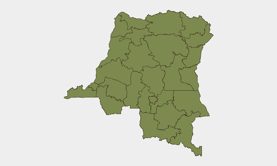
Nord-Ubangi and Ituri lead the sub-national ranking (both 34.5), driven by active militia presence and cross-border instability; North Kivu (included in the broader Kinshasa/South Kivu tier at 5.6 but demonstrably more volatile in real time) is experiencing sustained M23–FARDC combat and ADF activity. Kinshasa and South Kivu at 5.6 reflect lower-frequency but still material urban and rural threats; South Kivu's Kalehe territory is showing renewed banditry and armed group activity. The remaining provinces (Maniema, Sud-Ubangi, Équateur, Mongala, Lower Uele, Tshopo, Tshuapa, Upper Uele) at 4.5 represent baseline instability with sporadic militia and criminality, but are not currently witnessing the intensity of clashes seen in the eastern corridor.
How GeoBit Would Assist
Security teams should deploy AOI Monitoring & Early Warning on Nord-Ubangi, Ituri, and North Kivu to track militia and combat movements in near-real time. Conflict & Military battle mapping and force-structure analysis would clarify FARDC positioning and M23/ADF operational capability, informing movement decisions and asset protection. Routing & Network Analysis capabilities enable real-time alternative-route planning around closed corridors (Goma–Rutshuru, Bunia–Djugu, Bukavu–Goma lake), and OSINT fusion of X/Twitter, local media, and regional monitors provides rapid ground-truth corroboration for operational decisions.
7-Day Outlook
The North Kivu frontline is likely to remain volatile through early July as M23 and FARDC maneuver; ADF activity around Beni may persist. Kinshasa police presence could remain elevated if economic protests gain momentum, though sustained large-scale unrest is not yet indicated. Ituri militia activity will continue; humanitarian access and civilian movement in the eastern provinces should be assumed constrained for the near term.
Highest-Risk Areas — Ranked
| # | State / Region | Risk |
|---|---|---|
| 1 | Nord-Ubangi | 34.5 |
| 2 | Ituri | 34.5 |
| 3 | Kinshasa | 5.6 |
| 4 | South Kivu | 5.6 |
| 5 | Maniema | 4.5 |
| 6 | Sud-Ubangi | 4.5 |
| 7 | Équateur | 4.5 |
| 8 | Mongala | 4.5 |
| 9 | Lower Uele | 4.5 |
| 10 | Tshopo | 4.5 |
| 11 | Tshuapa | 4.5 |
| 12 | Upper Uele | 4.5 |
Sources
Previous Daily Briefs
A new DR Congo brief is written every day — each with its own risk map and downloadable CSV. Here's the last week; use the calendar to go further back.
📅 Browse every day by calendar →
Highlighted days have a brief. Tap a day for that day's map & analysis, or “csv” for that day's dataset ($5).